National Weather Service United States Department of Commerce

Severe Thunderstorms in the Southeast and Mid-Atlantic and Dangerous Heat in the West on Friday

Severe thunderstorms will bring a threat of damaging winds, large hail, and a couple of tornadoes to portions of the Southeast and Mid-Atlantic on Friday, and heavy rain may lead to instances of flash flooding from eastern Kentucky to southern New York. Meanwhile, dangerous heat will develop in the West, with potentially record-breaking temperatures. Read More >

Click a location below for detailed forecast.

Last Map Update: Fri, May 30, 2025 at 5:46:34 am CDT
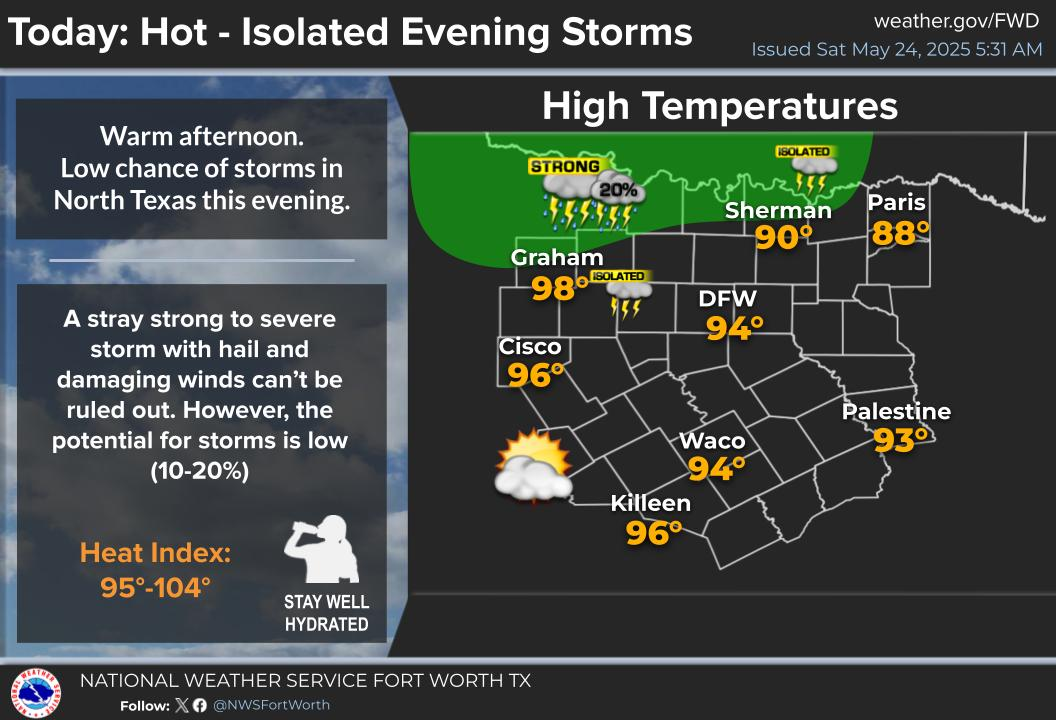
Nice weather is in store today and Saturday behind a departing cold front, with clearing skies and highs in the 70s and 80s expected.
A weakening storm complex may survive long enough to bring rain chances Saturday night-Sunday. Current storm chances have increased to 20-30% as model guidance becomes more confident. If storms do make it, they will likely be sub-severe, but may still be strong.
Daily storm chances are expected next week associated with a incoming front and dryline. Some storms may be severe, with the highest chances on Tuesday and Wednesday. We will know more details on timing, locations, and threats for each day as higher resolution model guidance is received in the coming days.

Text Product Selector (Selected product opens in current window)
Latest Text Products Issued (Experimental)
Safe Rooms Icon Cooperatirve Rainfall (CoCoRaHs) icon Storm Ready Icon AirNow Icon