Gusty winds are expected from portions of the Mid-Atlantic into the Northeast through the night following the system that brought rain to the area. An atmospheric river will move into the Northwest late today into Saturday bringing moderate to heavy rainfall, mountain snow, windy conditions, and high surf to the area over the weekend. Read More >
Hastings, NE
Weather Forecast Office
Smoke Plume Easily Visible on Satellite
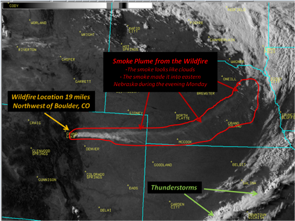
This Monday evening sky looked no different than many other evenings across Central Plains, with the exception of a smoke plume snaking its way across much of Nebraska. The gray and brownish plume was from a wildfire which developed quickly on Monday afternoon, September 6th about 20 miles northwest of Boulder, Colorado. The fire began in Four Mile Canyon and quickly spread with relative humidities less than 10% and wind gusts up to 45 mph. The fire was responsible for destroying some homes triggering evacuations in its path. The plume quickly lifted high in the atmosphere, and was picked up in strong upper level winds near 100 mph. The plume spread in an arcing pattern from southwest to northeast Nebraska. Often times, smoke plume particles will result in a more vivid, red or orange color at sunset. Admittedly, this plume didn't seem to add much color to the sunset Monday evening.
The first image below is a visible satellite image of the smoke plume, and was taken early Monday evening. The image clearly depicts the origin of the wildfire northwest of Denver. The plume area has been outlined in red. Thunderstorms are also visible in the image along a cold front in southeast Kansas.
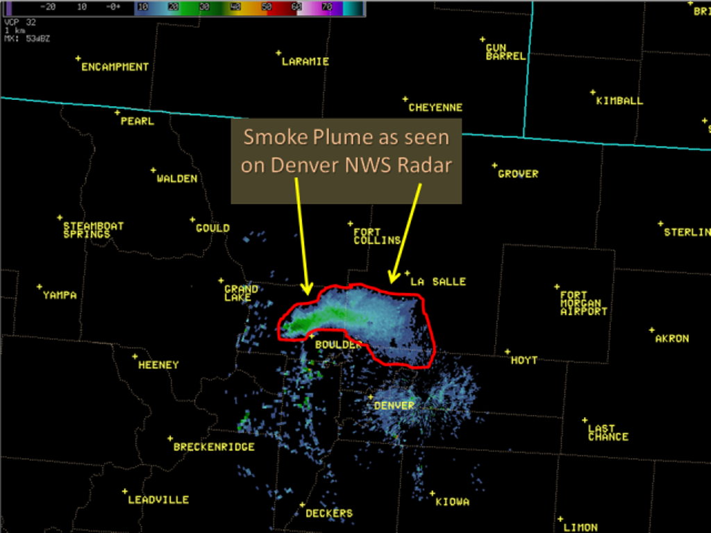
The second image below depicts doppler radar reflectivity of the smoke plume, and was also taken early Monday evening. The WSR-88D radar site is located at Front Range Airport, roughly 50 miles southeast of the fire.
 |
|
|
Hazardous Weather
Submit A Storm Report
Storm Prediction Center
Local Storm Reports
Experimental Graphical Hazardous Weather Outlook
Forecasts
Area Forecast Discussion
Fire Weather
Aviation Weather Center
Winter Weather
Activity Planner
Winter Storm Severity Index
Experimental Winter Storm Outlook
Wet Bulb Globe Temp
Current Conditions
Current Area Observations
Text Products
Satellite
Rivers and Lakes
Local 24 Hour Precip Maps
Local Archived Precip Maps
NWPS Precipitation Analysis
Local Snowfall Maps
Snowfall Analysis
Snow Cover
Climate
Local Database (NOWData)
Local Climate Webpage
Hastings/G. Island Records
Local Historical Tornado Info
U.S. Drought Monitor
Grand Island - Daily
Grand Island - Monthly
Hastings - Daily
Hastings - Monthly
Kearney - Daily
Kearney - Monthly
Ord - Daily
Ord - Monthly
US Dept of Commerce
National Oceanic and Atmospheric Administration
National Weather Service
Hastings, NE
6365 North Osborne Drive West
Hastings, NE 68901-9163
402-462-4287
Comments? Questions? Please Contact Us.