
Heavy to excessive rainfall across parts of central Texas into southern New Mexico may bring areas of flooding into this evening. Excessive runoff may result in flooding of rivers, creeks, streams, and other low-lying and flood-prone locations. Hot temperatures are forecast for the far southwest U.S., parts of California, and the interior northwest U.S. this week. Read More >
Overview
|
A large upper level storm system developed over the Dakotas on Sunday, November 27th. Abnormally warm and moist air (by November standards) streamed north through Kansas and Nebraska out ahead of the storm system. As the overall upper level system strengthened, there was a broad area of favorable lift within the moist warm sector across central Nebraska, which supported thunderstorm development as clouds cleared and the atmosphere became unstable. Low level wind shear values were very high and there was just enough instability by afternoon to allow the thunderstorms to develop, strengthen, and even spin up a few tornadoes in the 4-5 p.m. CST time frame. With the shorter days of later fall, there was a limited window for these severe thunderstorms, and they quickly began to die off with the early onset of evening. Severe weather had largely ended by 5:30 p.m. CST Sunday evening. Tornadoes were confirmed in Franklin County near Upland, Webster County near Red Cloud, and Nuckolls County near Lawrence. There were also a few nickel-quarter size hail reports in St. Paul, Red Cloud and near Lexington. This event on November 27th marked the second-latest day of the calendar year that tornadoes occurred in the state of Nebraska, with the latest occurring on December 13, 1975, when tornadoes touched down in Thayer and Pawnee Counties. This was the 4th time since 2000 that a tornado occurred in the month of November in Nebraska. Below is more information about the confirmed tornadoes that struck the area. Additional information may be added as it becomes available. |
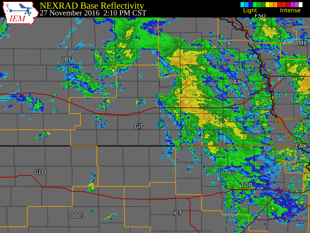 NWS Hastings radar loop from 2:10-7:00 p.m. CST on November 27th. The NWS Hastings coverage area is outlined in orange and labled "GID". Interstates are in red. |
|
|
||||||||||
|
||||||||||
|
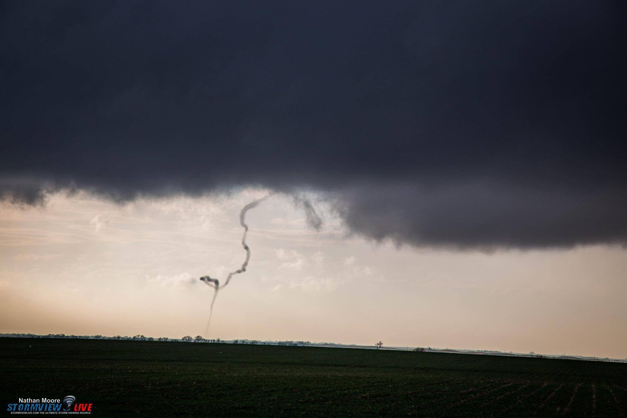
Tornado #1 - Southwest of Upland, NE
Track Map 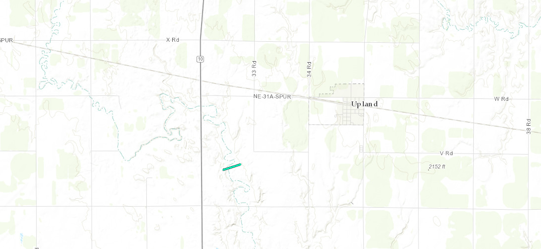 
Downloadable KMZ File |
||||||||||||||||
The Enhanced Fujita (EF) Scale classifies tornadoes into the following categories:
| EF0 Weak 65-85 mph |
EF1 Moderate 86-110 mph |
EF2 Significant 111-135 mph |
EF3 Severe 136-165 mph |
EF4 Extreme 166-200 mph |
EF5 Catastrophic 200+ mph |
 |
|||||
 |
 |
 |
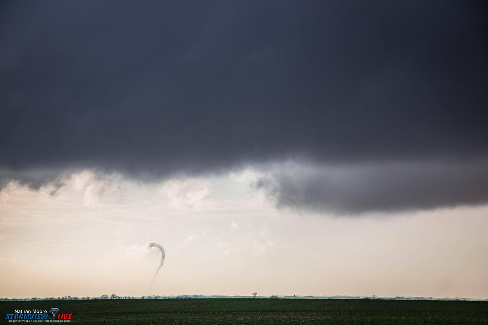 |
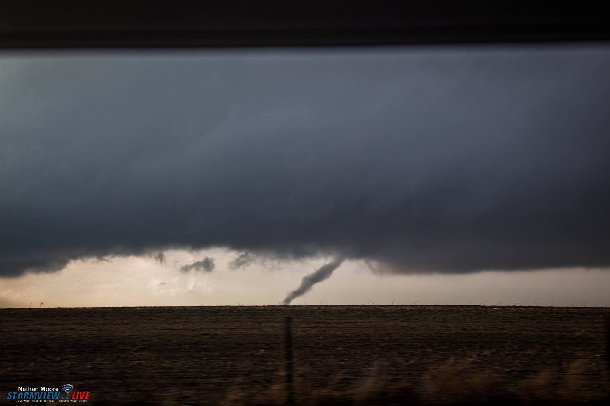
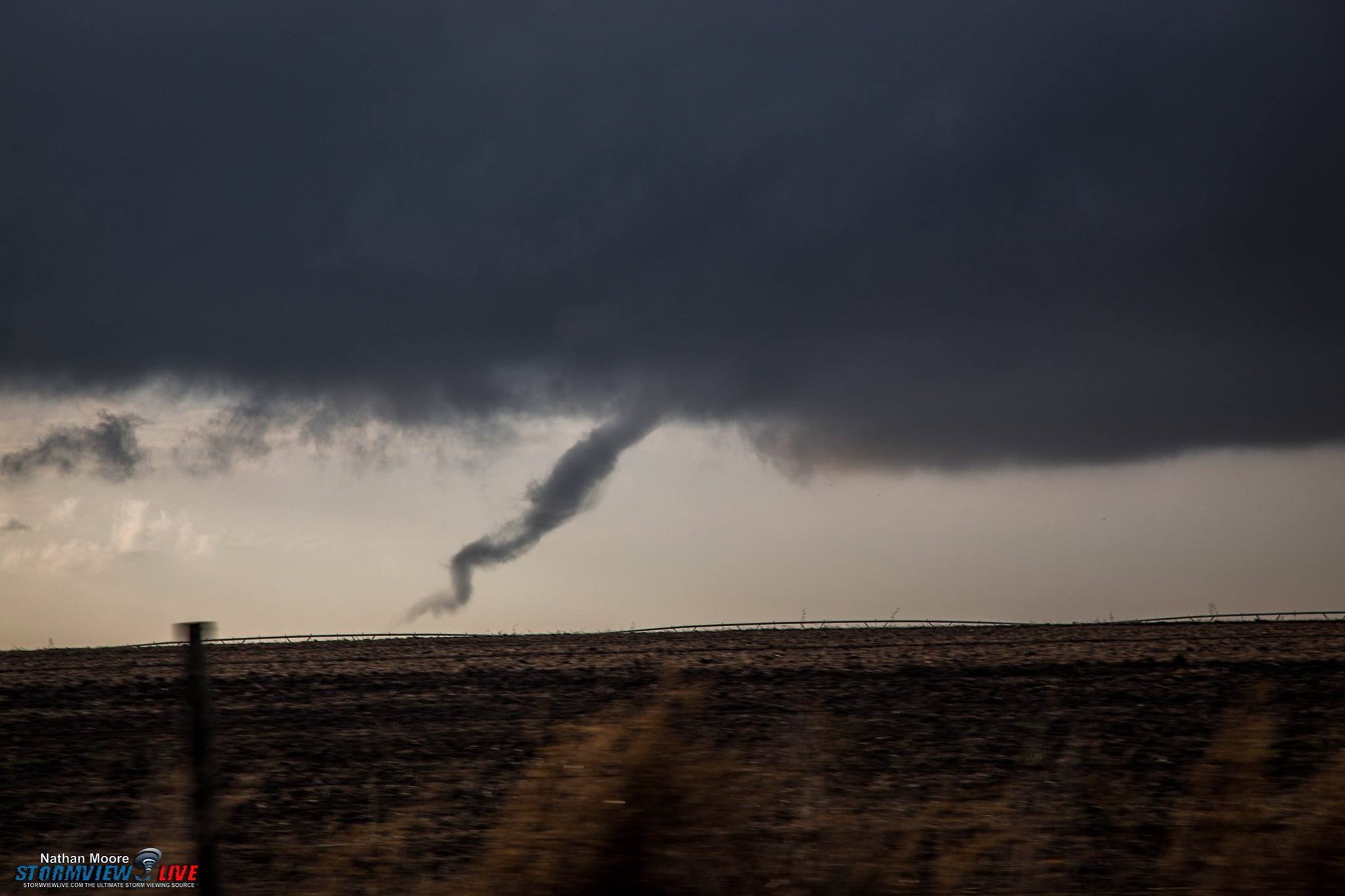
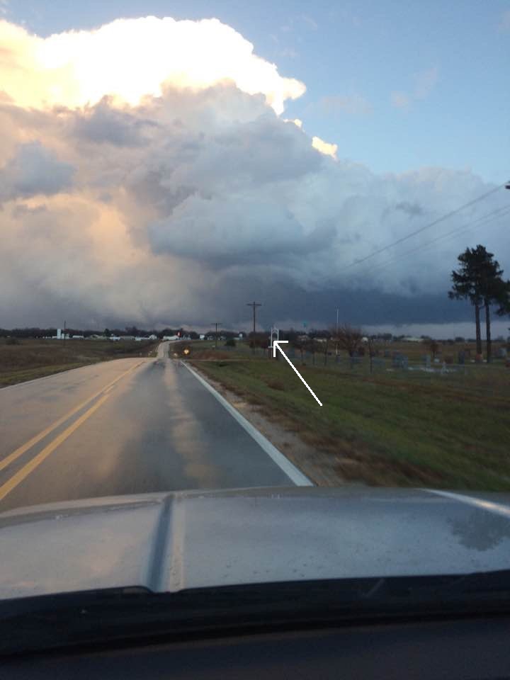
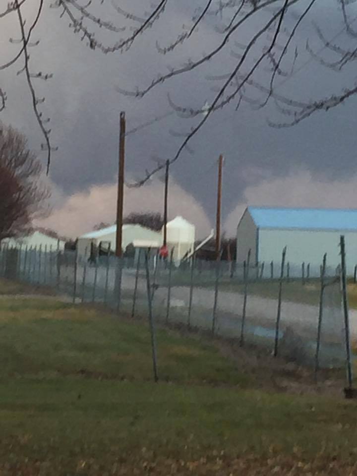
| Photos of the tornado near Upland, NE. Courtesy of Nathan Moore. | |||
|
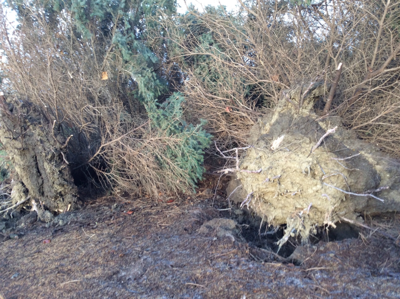
Tornado #2 - East of Red Cloud
Track Map 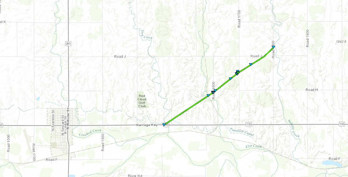
Downloadable KMZ File |
||||||||||||||||
The Enhanced Fujita (EF) Scale classifies tornadoes into the following categories:
| EF0 Weak 65-85 mph |
EF1 Moderate 86-110 mph |
EF2 Significant 111-135 mph |
EF3 Severe 136-165 mph |
EF4 Extreme 166-200 mph |
EF5 Catastrophic 200+ mph |
|
|||||
 |
 |
 |
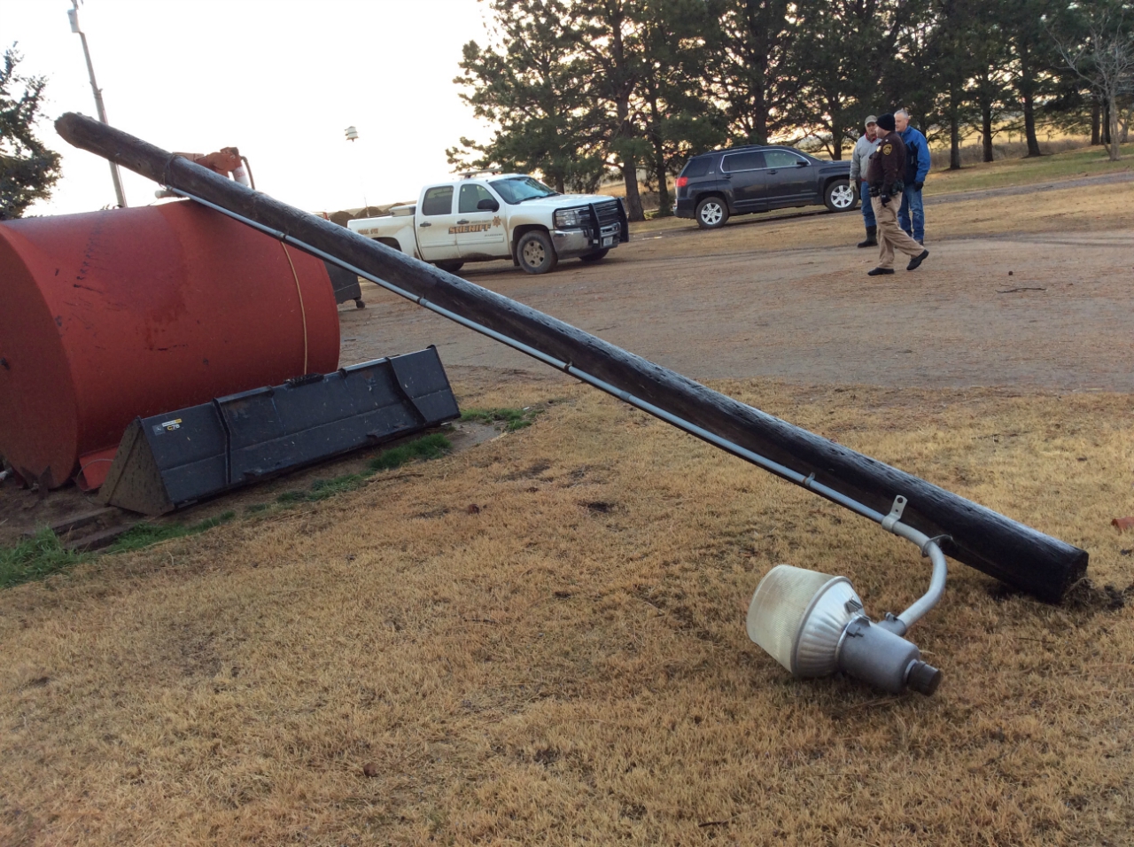 |
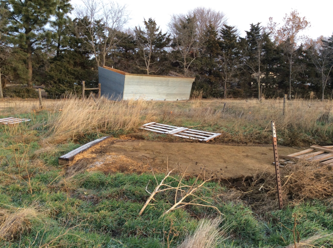
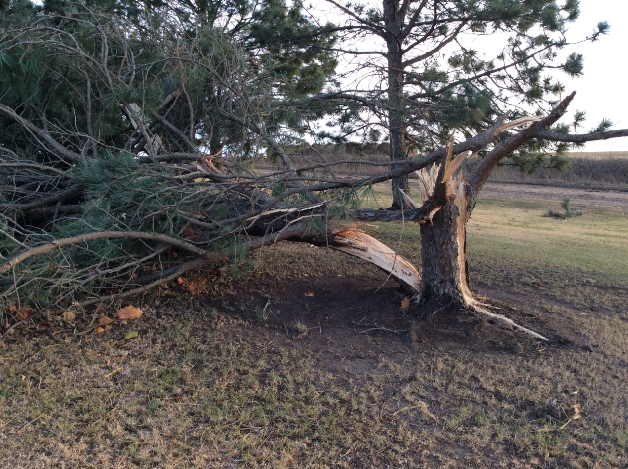
| Photos of damage along the path of the tornado. Taken by NWS Hastings Damage Survey Team. | |||
 |
 |
 |
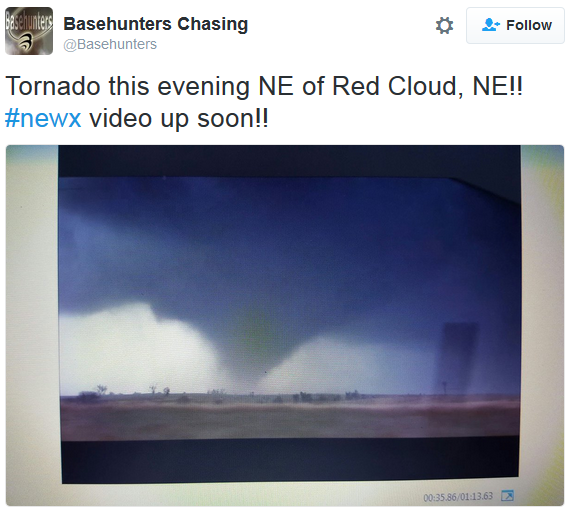
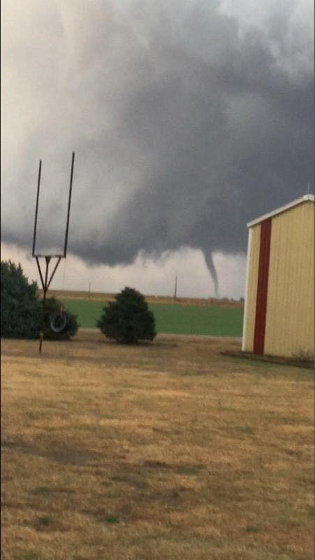
| Tornado east of Red Cloud. Photo courtesy of the Red Cloud/Guide Rock Fire Department. | Tornado east of Red Cloud. Photo courtesy of Basehunters Chasing. | Hail in Red Cloud. Photo courtesy of Katie Ord. |
|
Tornado #3 - East of Lawrence
Track Map 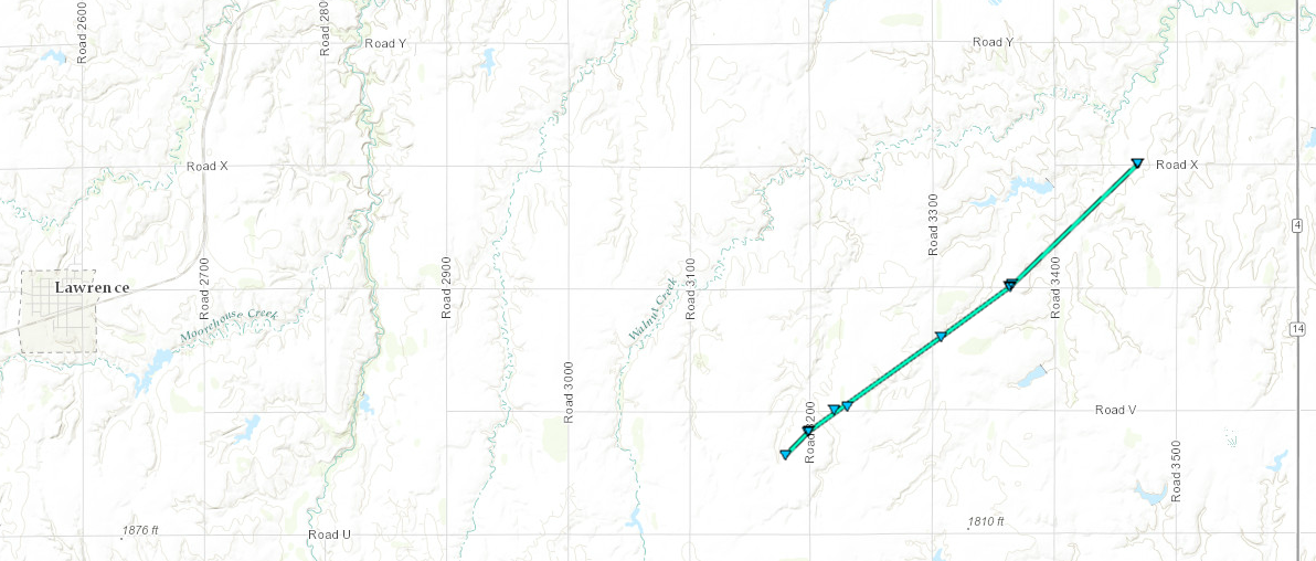
Downloadable KMZ File |
||||||||||||||||
The Enhanced Fujita (EF) Scale classifies tornadoes into the following categories:
| EF0 Weak 65-85 mph |
EF1 Moderate 86-110 mph |
EF2 Significant 111-135 mph |
EF3 Severe 136-165 mph |
EF4 Extreme 166-200 mph |
EF5 Catastrophic 200+ mph |
|
|||||
 |
 |
 |
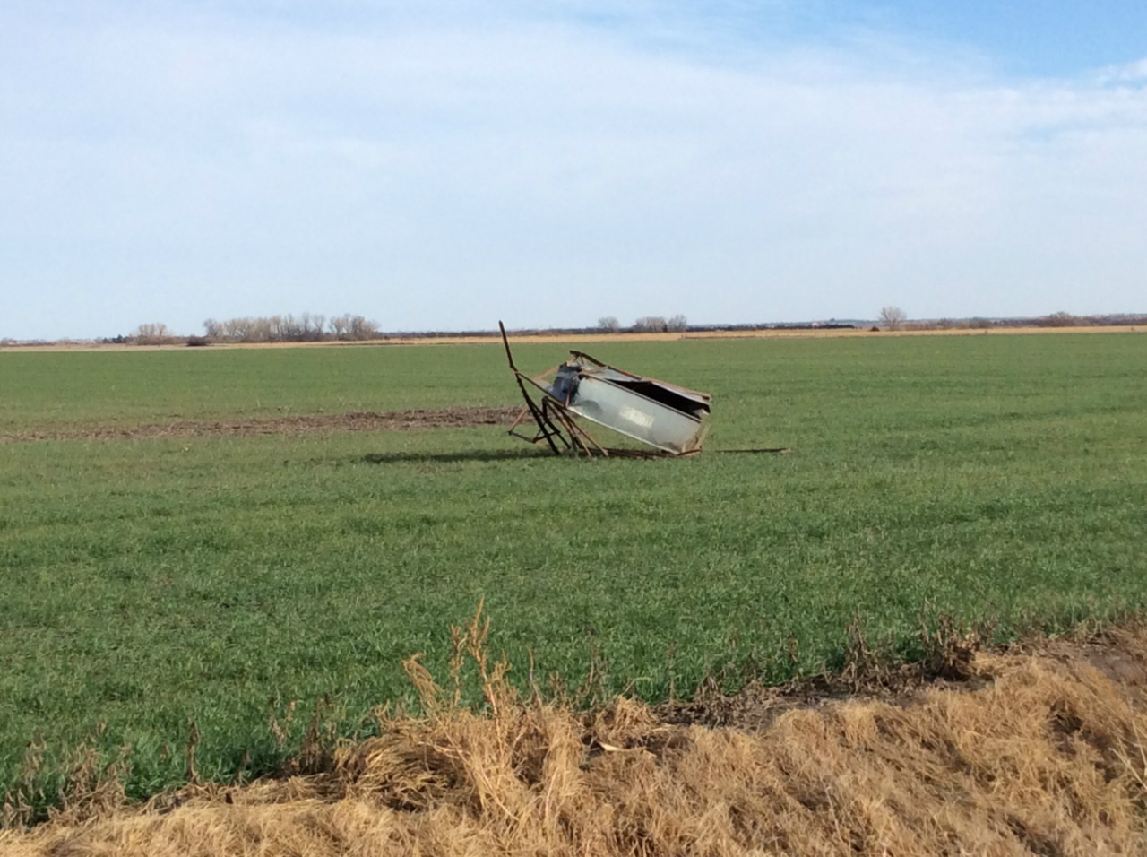
| Feeder thrown into a field. Photo from NWS Damage Survey Team. |
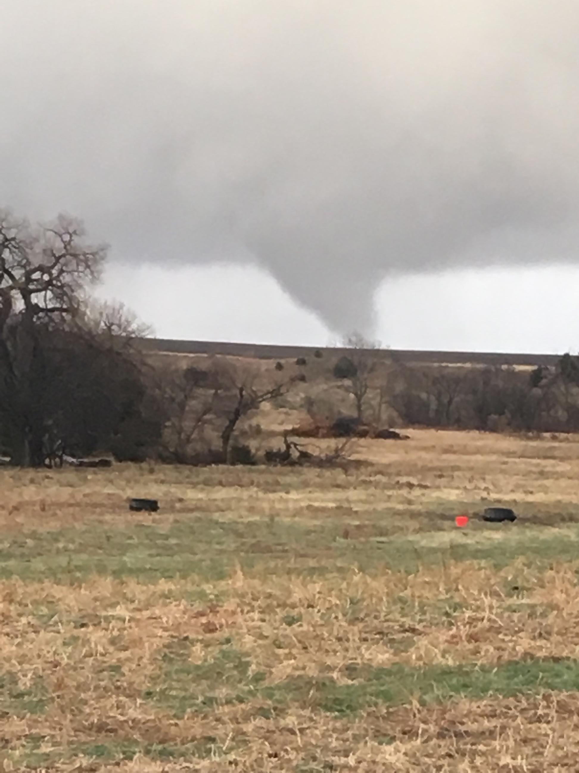
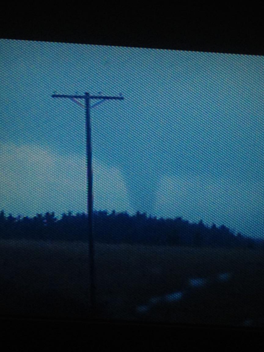
Video capture of the tornado near Lawrence. Photo courtesy of Jeremy Wesely. |
Tornado east of Lawrence. Photo courtesy of Judson Buescher. |
 |
 |
 |
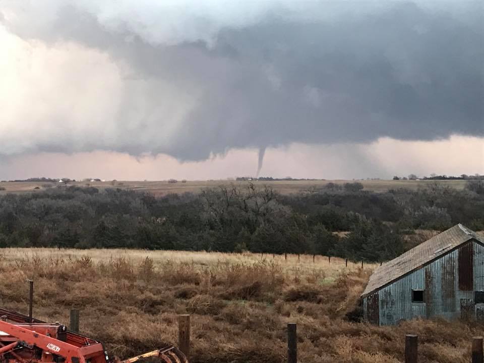
| Tornado east of Lawrence. Photo courtesy of Geoff Jamieson. |
Tornado east of Lawrence. Photo courtesy of Nick Kliewer. |
Tornado east of Lawrence. Photo courtesy of Lauren Jasch. |
 |
Media use of NWS Web News Stories is encouraged! Please acknowledge the NWS as the source of any news information accessed from this site. |
|

