Overview
|
|
|
Ingredients for Major to Record Flooding
 |
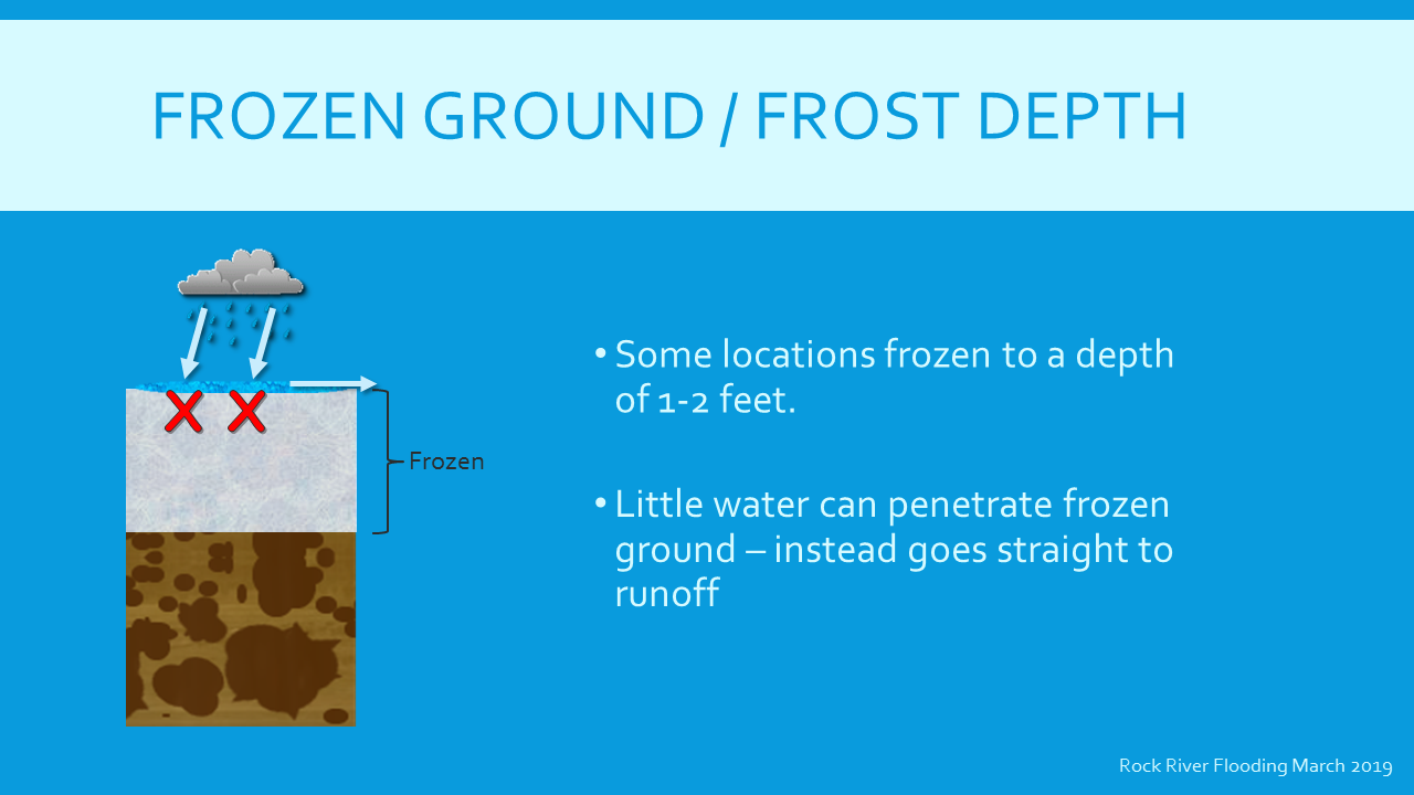 |
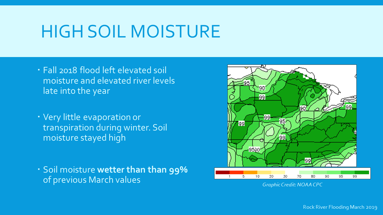
| High Soil Moisture | Frozen Ground / Frost Depth |
 |
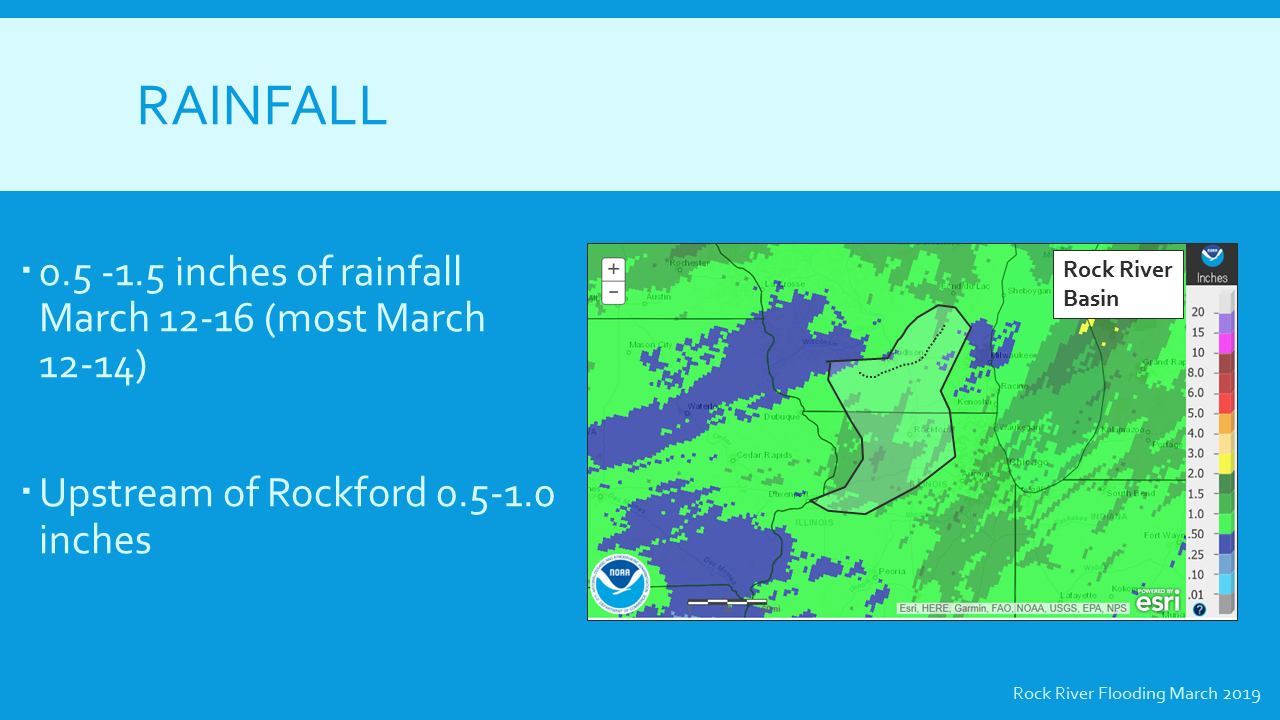 |
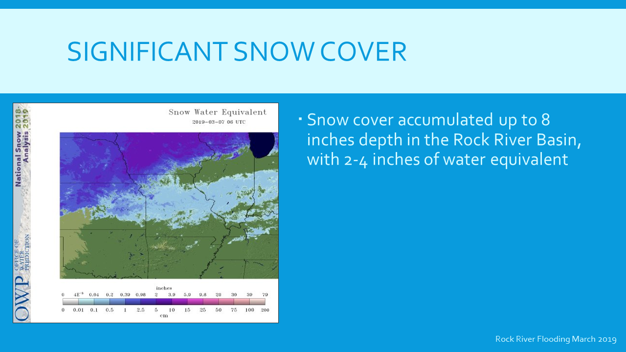
| Significant Snow Cover | Rainfall |
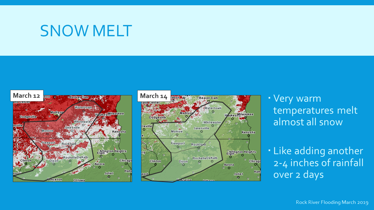 |
| Snow Melt |
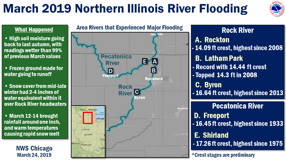
Rivers
NOTE: These are static images of the crests. For the latest river stages and forecasts, please see our AHPS Page.
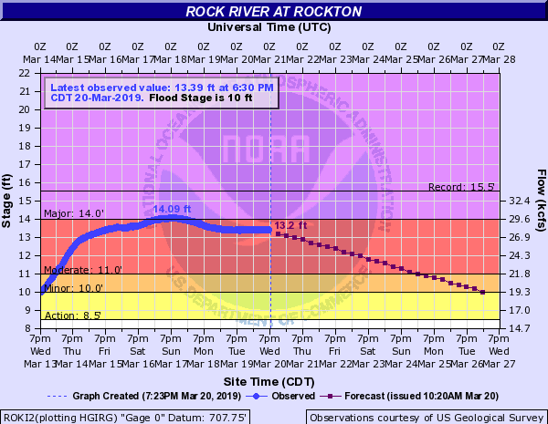
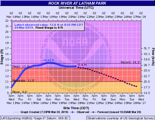
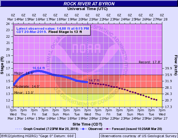
| Observed Stages (in blue) on the Rock River | ||
 |
 |
|
| Rockton Hydrograph | Latham Park Hydrograph | Rockford Hydrograph |
 |
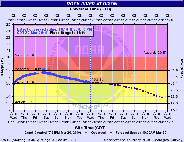 |
| Byron Hydrograph | Dixon Hydrograph |
| Observed Stages (in blue) on the Pecatonica River |
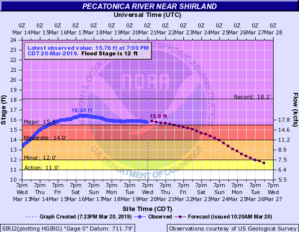 |
| Shirland Hydrograph |
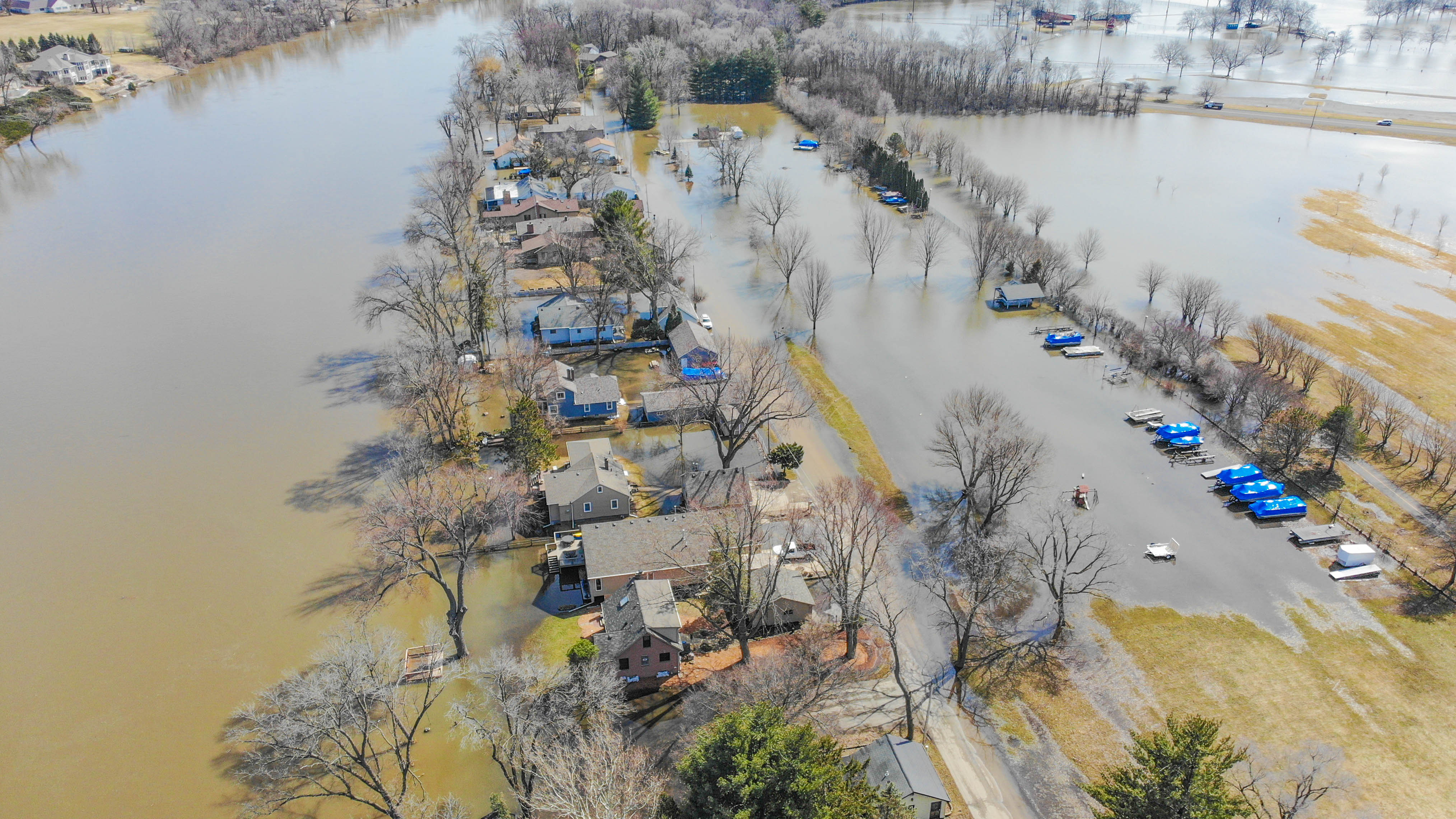
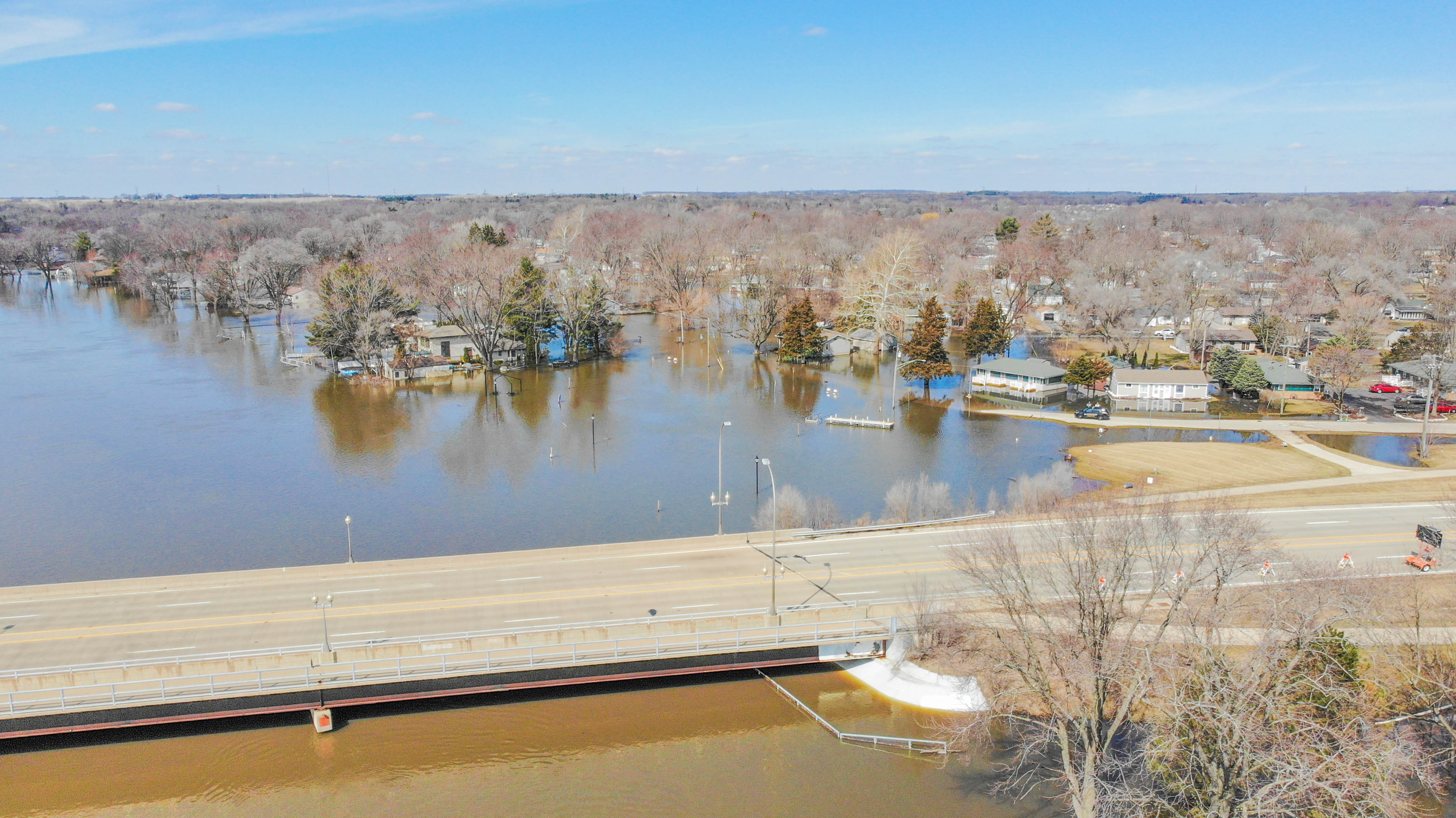
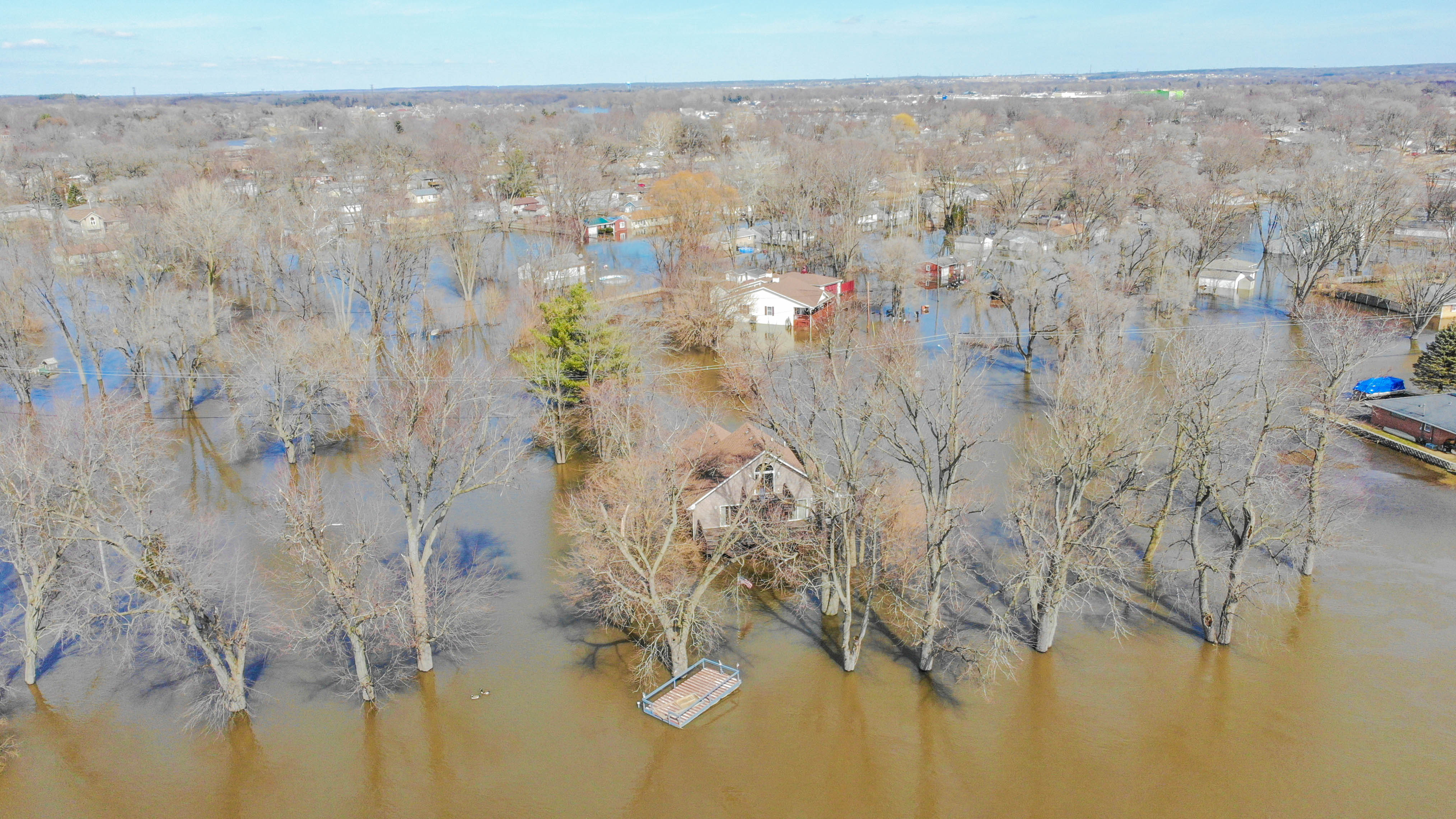
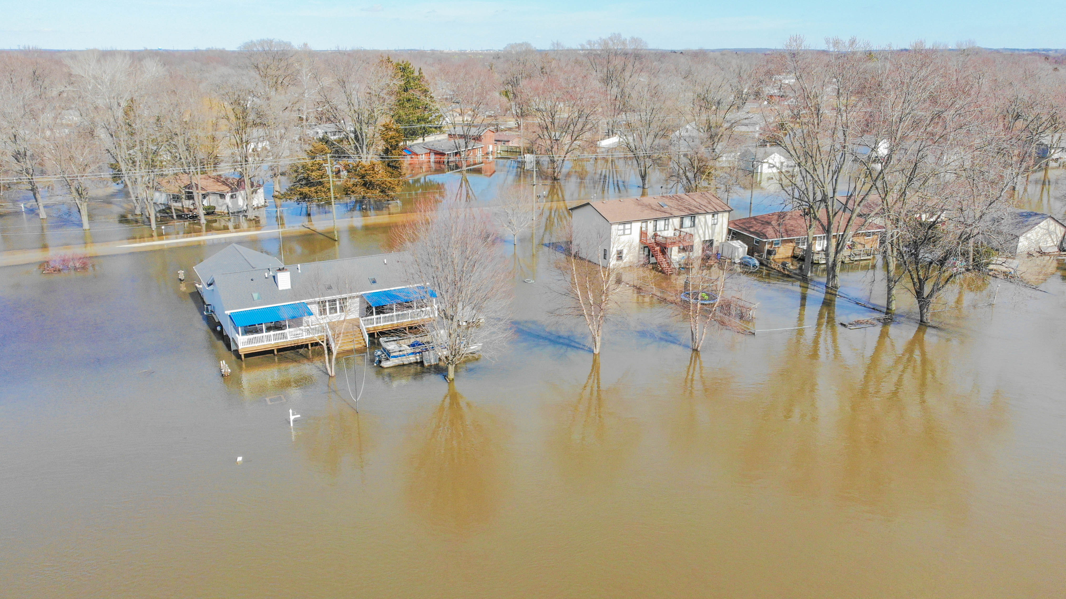
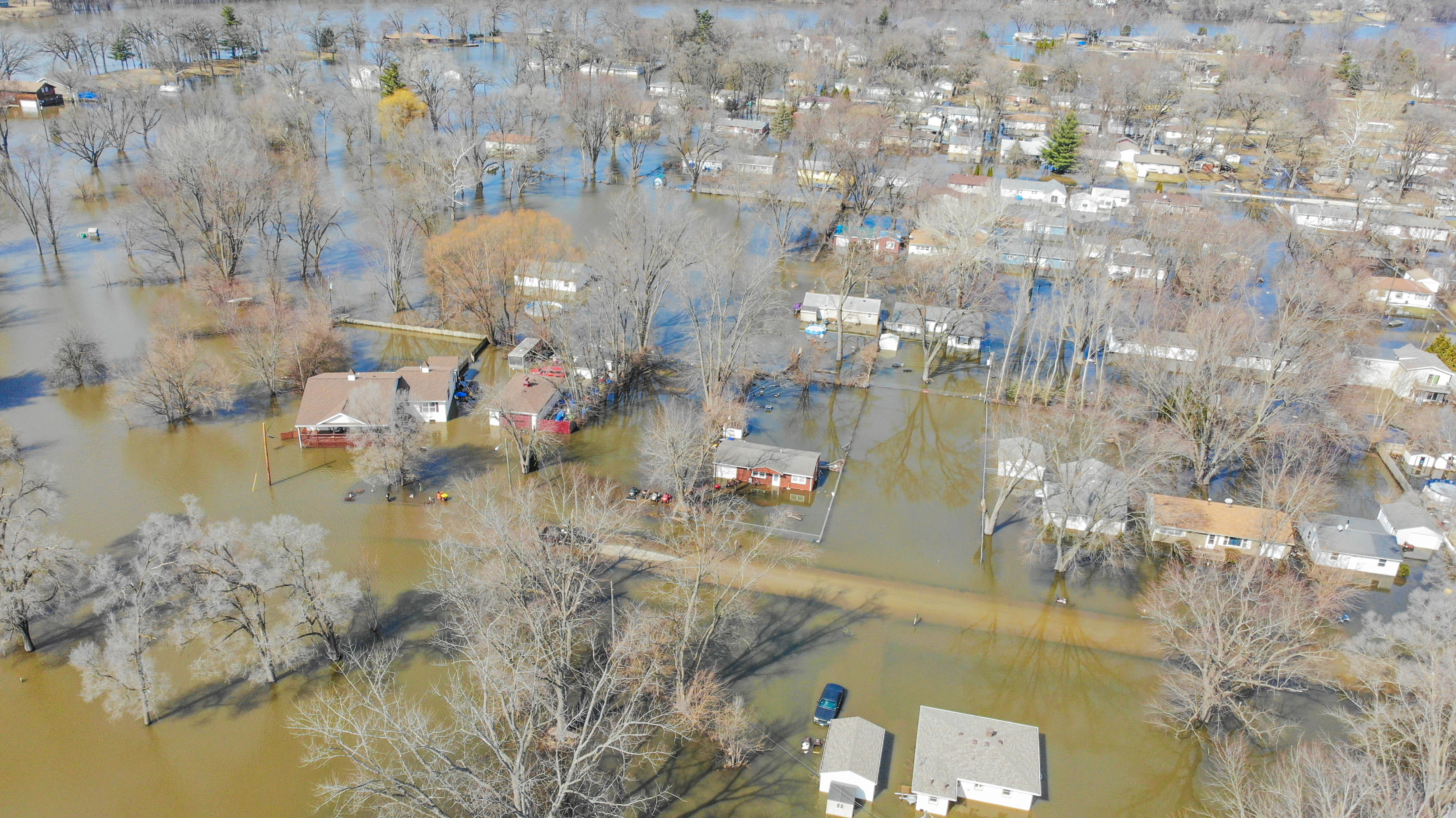
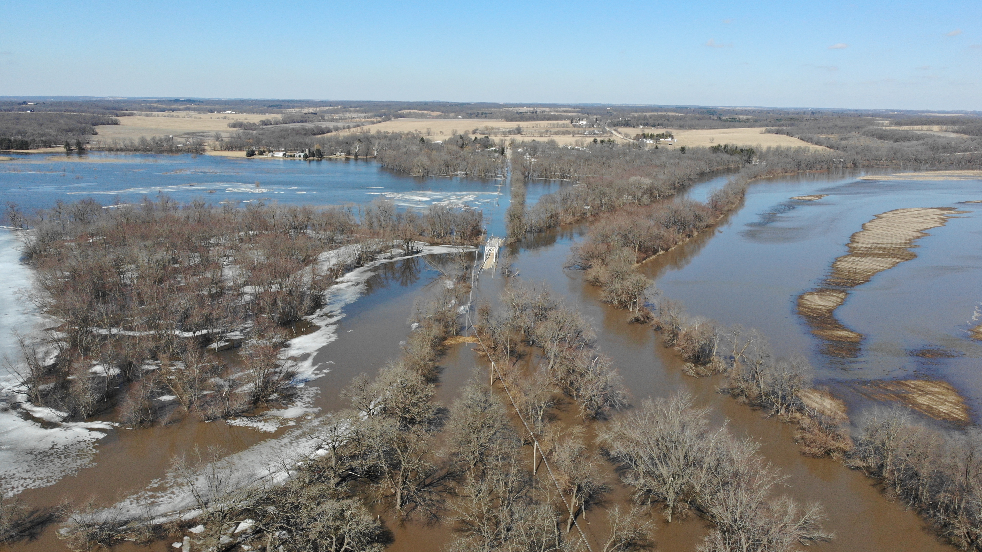
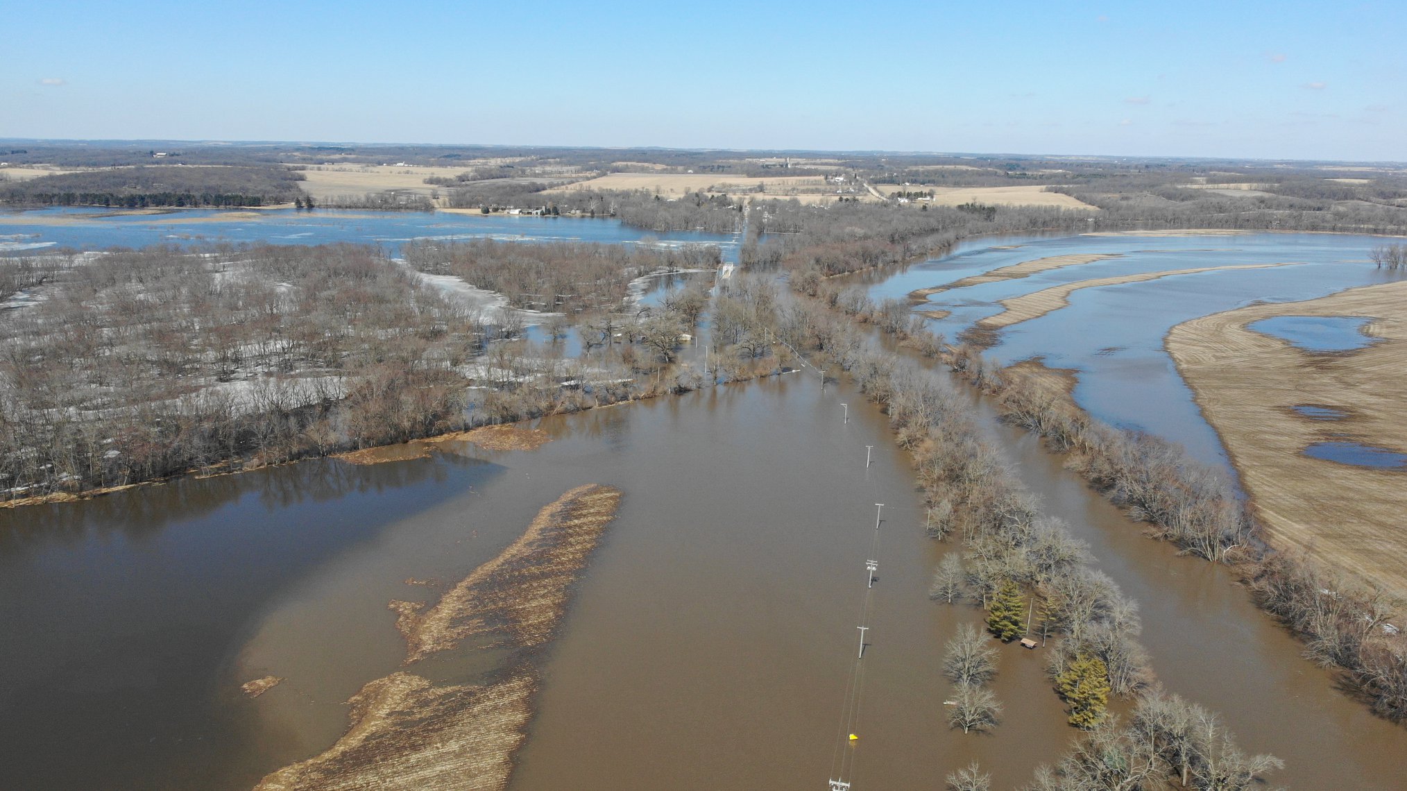
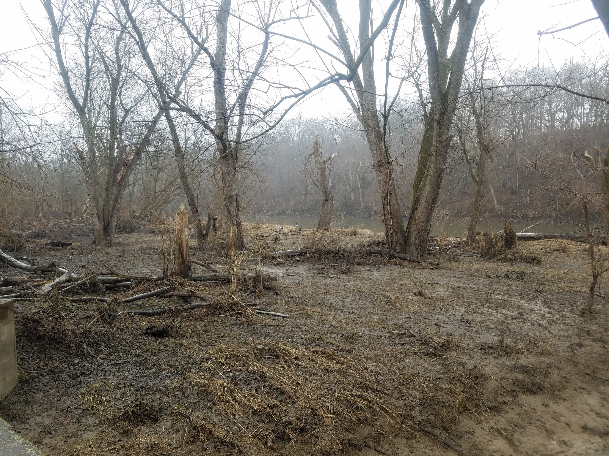
Photos
 |
 |
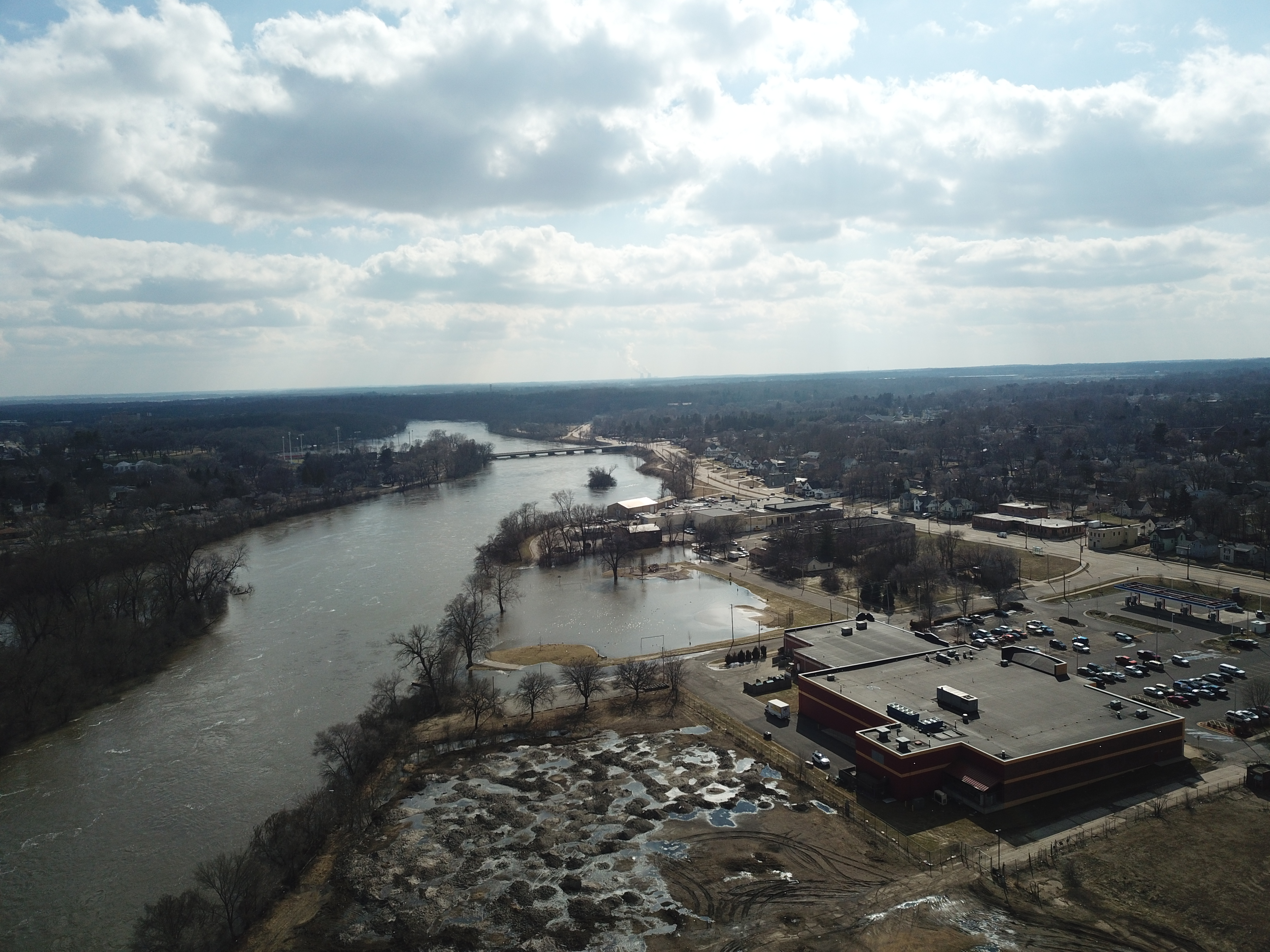 |
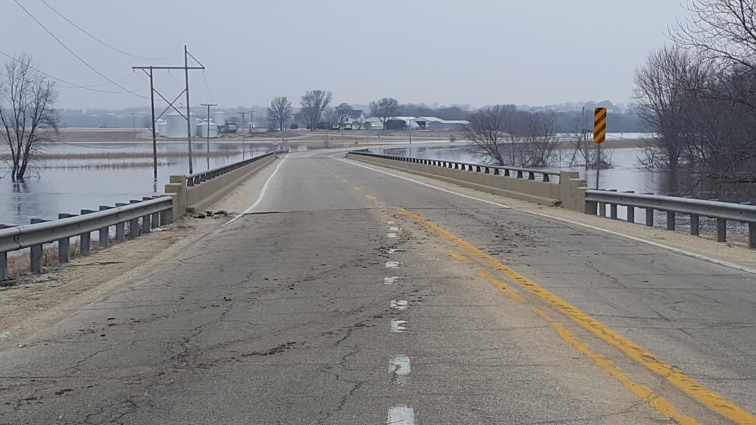
| Rock River - Roscoe Road Looking West | Rock River - Country Club Beach Road, courtesy of Chief Pankow | Rock River - Industrial areas south of downtown Rockford, courtesy of Chief Pankow |
 |
 |
 |
| Courtesy of Winnebago County, IL Sheriff | Courtesy of Winnebago County, IL Sheriff | Courtesy of Winnebago County, IL Sheriff |
 |
 |
 |
| Courtesy of Winnebago County, IL Sheriff | Courtesy of Winnebago County, IL Sheriff | Courtesy of Winnebago County, IL Sheriff |
 |
 |
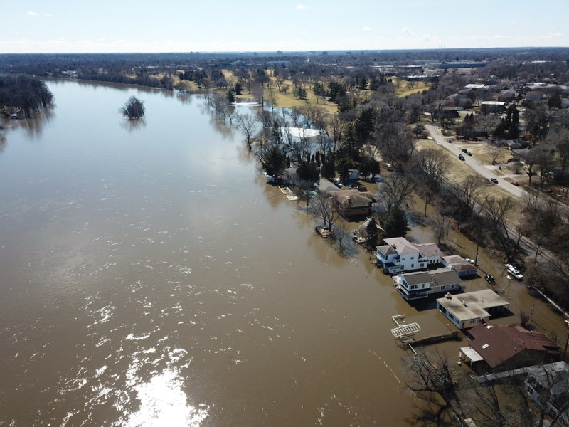
| Shirland, IL on the Pecatonica River. Courtesy of Winnebago County, IL Sheriff | Kishwaukee River flood impacts in Kishwaukee State Park. Courtesy of Joey Marino. |
Service
The potential for flooding in these northern Illinois basins, as well as into Wisconsin and other Midwest basins, increased during the late winter. As this potential grew, NWS offices coordinated to issue outlooks, statements, and other messages of increasing flooding risk. Some of this is provided below.
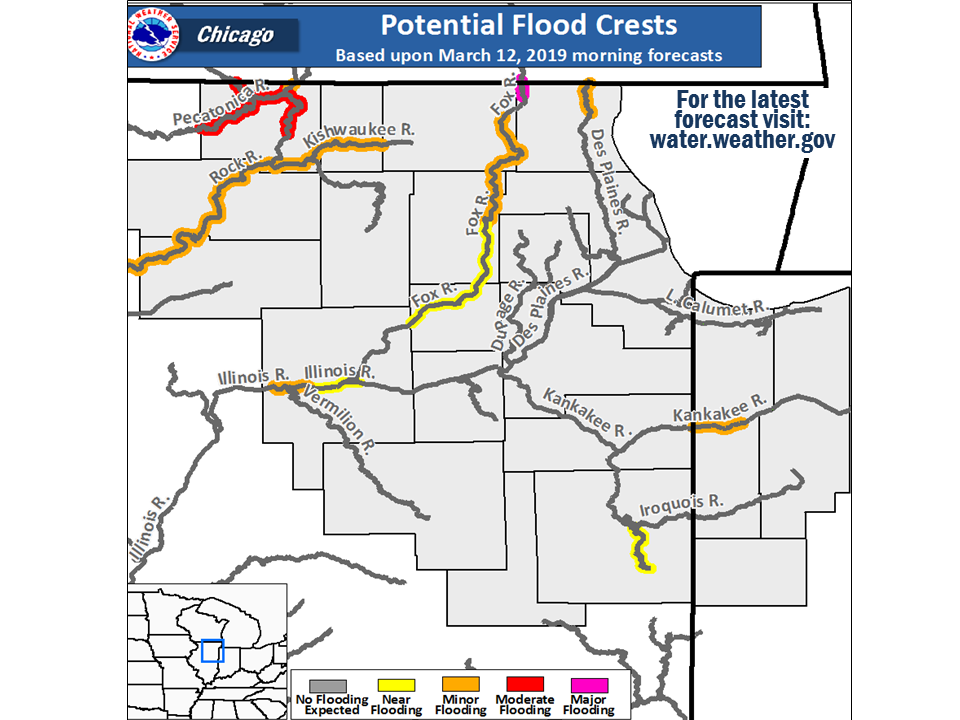
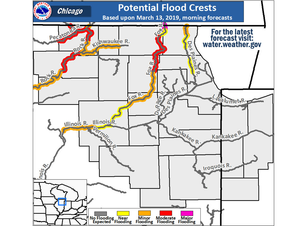
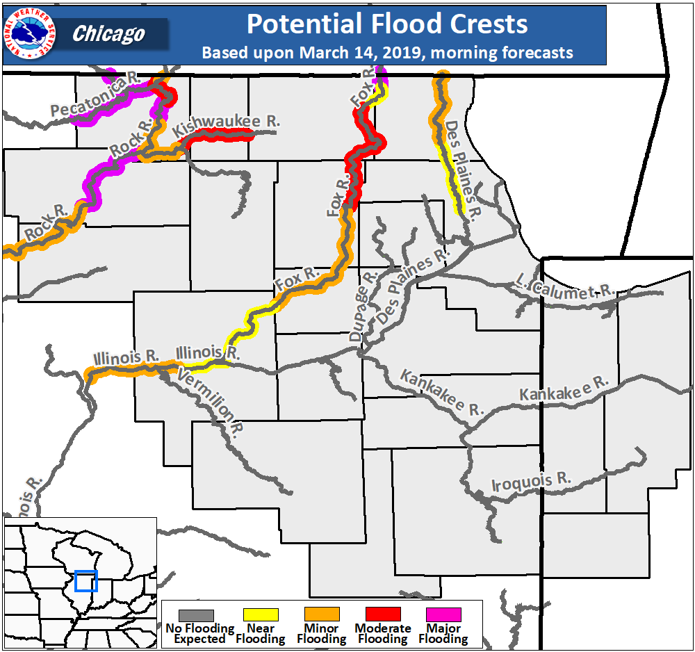
Timeline:
| Weather Story Graphics Issued in Advance of Flooding | |||
 |
 |
 |
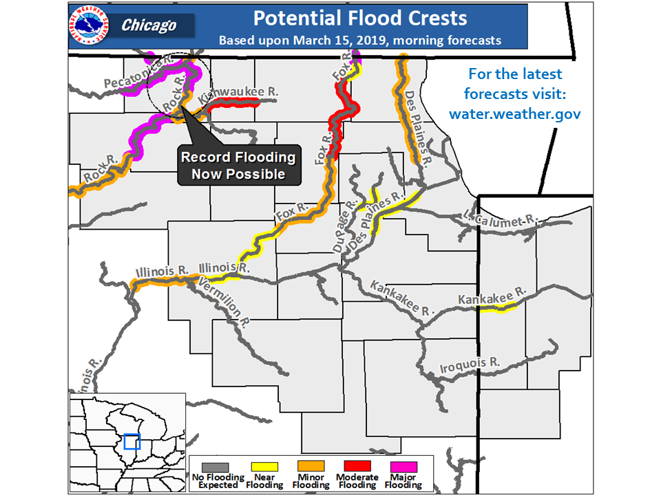 |
| March 12 | March 13 | March 14 | March 15 |
Additional
| Satellite View Showing Swollen River |
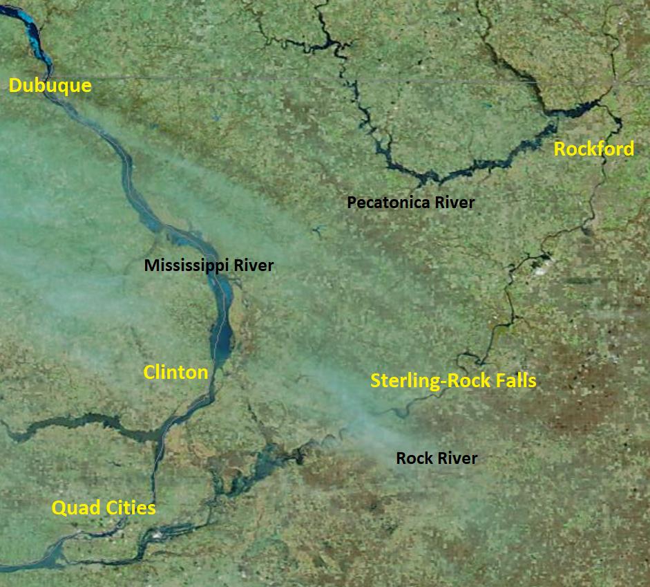 |
| Image from MODIS taken March 19 |
 |
Media use of NWS Web News Stories is encouraged! Please acknowledge the NWS as the source of any news information accessed from this site. Additional recaps can be found on the NWS Chicago Past Events Page |
|


 Follow us on YouTube