Nashville, TN
Weather Forecast Office
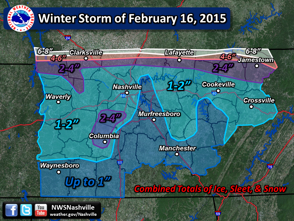
A major winter storm affected Middle Tennessee on Monday, February 16, 2015, bringing heavy snow to areas near the Kentucky border with a mix of freezing rain, sleet, and snow to areas further south. Snow totals ranged from 2 to 8 inches for locations along and north of a Dover to Jamestown line, while a combined 1 to 3 inches of ice, sleet, and snow fell across much of the rest of Middle Tennessee, including the Nashville metro area.
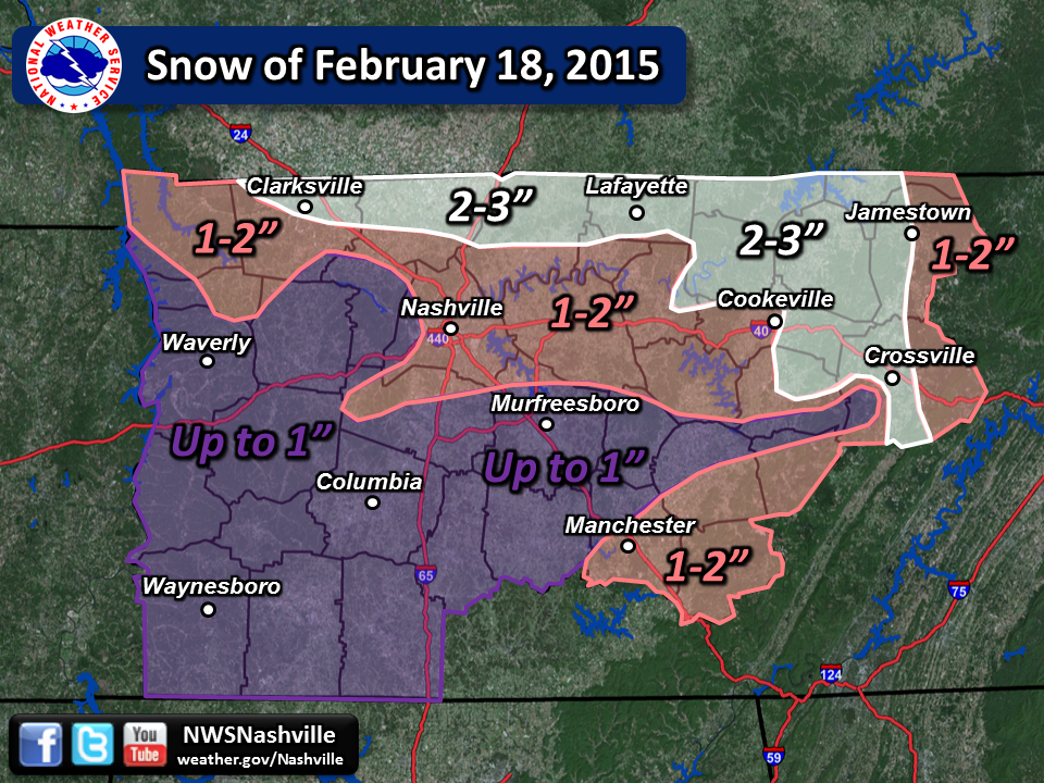
Right on the heels of that storm, another low pressure area swept through early on the morning of Wednesday, February 18, 2015, bringing an additional dusting to 3 inches of snow. The effects were cumulative since temperatures had remained below freezing since the February 16th winter storm, and most of the previous ice, sleet and snow had not melted. Untreated roads remained a mess over most, if not all, of the area. In addition, as a result of the freezing rain on the 16th, trees and tree branches were still on the ground over a wide swath of the Mid-State, and up to a half inch of ice still hung on trees and power lines. The Nashville Metro area was one of the places to experience the most extreme impacts from the ice.
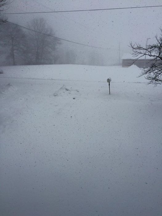
Snow falling on Jamestown (Fentress Co.), 2/18/15 [Photo Credit: Ethan Davis]
Snow falling on Portland (Sumner Co.), 2/16/15 [Photo Credit: Jordan Emert]
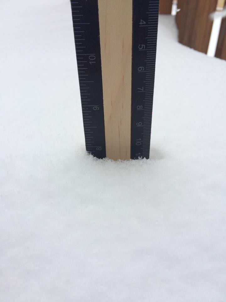
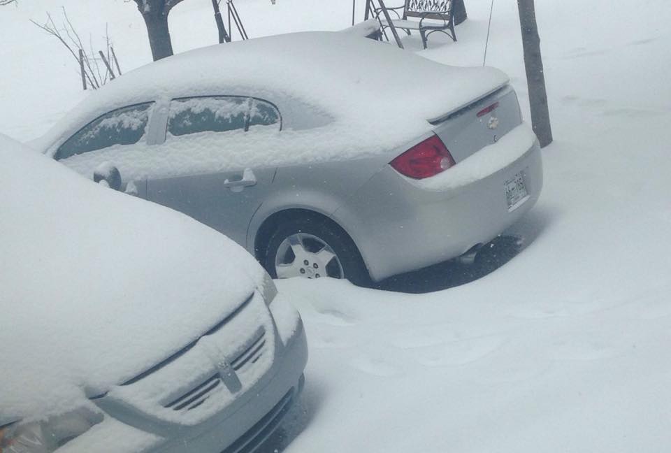
Nearly 8" of snow measured in Clarksville (Montgomery Co.), 2/18/15 [Photo Credit: Erica Barber]
We are always happy to receive your weather pictures, and will often post them in articles on our website. All we ask is that you provide your name, as well as the date and location of the photo(s).
You can send them to us on Facebook, or at: sr-ohx.webmaster@noaa.gov
US Dept of Commerce
National Oceanic and Atmospheric Administration
National Weather Service
Nashville, TN
500 Weather Station Road
Old Hickory, TN 37138
615-754-8500
Comments? Questions? Please Contact Us.

