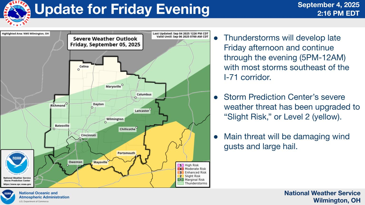
National Weather Service United States Department of Commerce

Warm and humid conditions will continue through much of the week with a chance of showers and thunderstorms each day until the weekend. Locally heavy rainfall is possible into Wednesday. Then, it will get very warm with heat indices near 90 Wednesday and Thursday.
Showers and some thunderstorms will develop once again this afternoon and continue into the early evening before diminishing. These showers and storms will be very efficient, leading to locally heavy rainfall which could lead to isolated flooding. A corridor from the Miami Valley to the eastern part of the Tri-State is an area that early morning data indicate may be of particular concern.