| Rainfall Summary: September 10-18, 2013 |
The table below is a comprehensive list of the more significant precipitation reports that were received for the 9-day event period.
Back to Historic Rainfall Feature
|
Location (source)
|
Precipitation Total (in)
|
|
Brushy Mountain (RAWS)
|
4.05
|
|
Cubero (COOP)
|
3.17
|
|
El Malpais Natl Monument (COOP)
|
2.86
|
|
Bluewater Ridge (RAWS)
|
2.15
|
|
Grants (RAWS)
|
2.00
|
|
El Morro Natl Monument (HCN)
|
1.83
|
|
Ramah (RAWS)
|
1.71
|
|
Grants/Milan Airport (AWOS)
|
1.58
|
|
Grants 2 S (HCN)
|
1.34
|
|
Laguna 1 N (RAWS)
|
1.33
|
|
| Impact Summary |

| Location |
Date |
Summary |
|
Tohajiilee
|
09/12/2013
|
Heavy rainfall produced flooding around many areas of Tohajiilee, including a school, homes, roads, and the fire department. One lane of Interstate 40 was closed due to a sink hole at the Tohajiilee exit. An ICP was set up to assist with flooding situation. |
|
Grants-Milan
|
09/13-09/14/2013
|
Areal flooding developed after flash flooding with continued heavy rainfall. 25 to 30 homes partially under water around Bluewater Village. Milan endangered by flooding with 4 residents displaced to shelter. The "Grants West" Centurlink box was flooded and cell phone services lost in the area. CR 23A closed due to high water. A total of 50 structures were damaged from this multi-day event. |
|
|
Hydrologic Summary
|
There are no reporting locations in the Advanced Hydrologic Prediction Service database within Cibola County therefore no hydrographs are available for review.
|
|
Photos
|
|
|
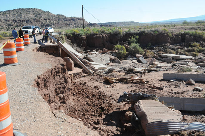
| Bridge and road damage on State Road 29 in Bluewater Village. Photo taken September 19, 2013. |
| |
|
|
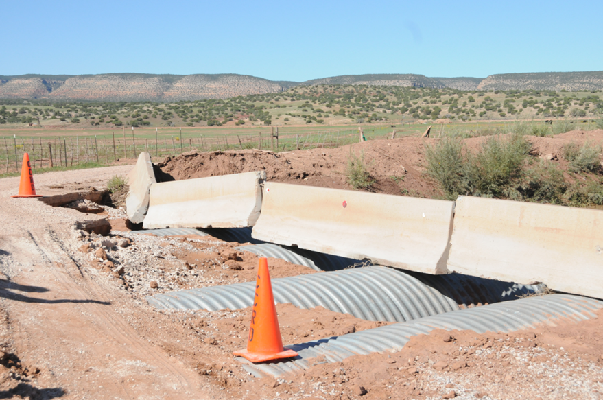
| Photo of damaged culverts over Bluewater Lake Rd. Photo taken September 19, 2013. |
| |
|
|
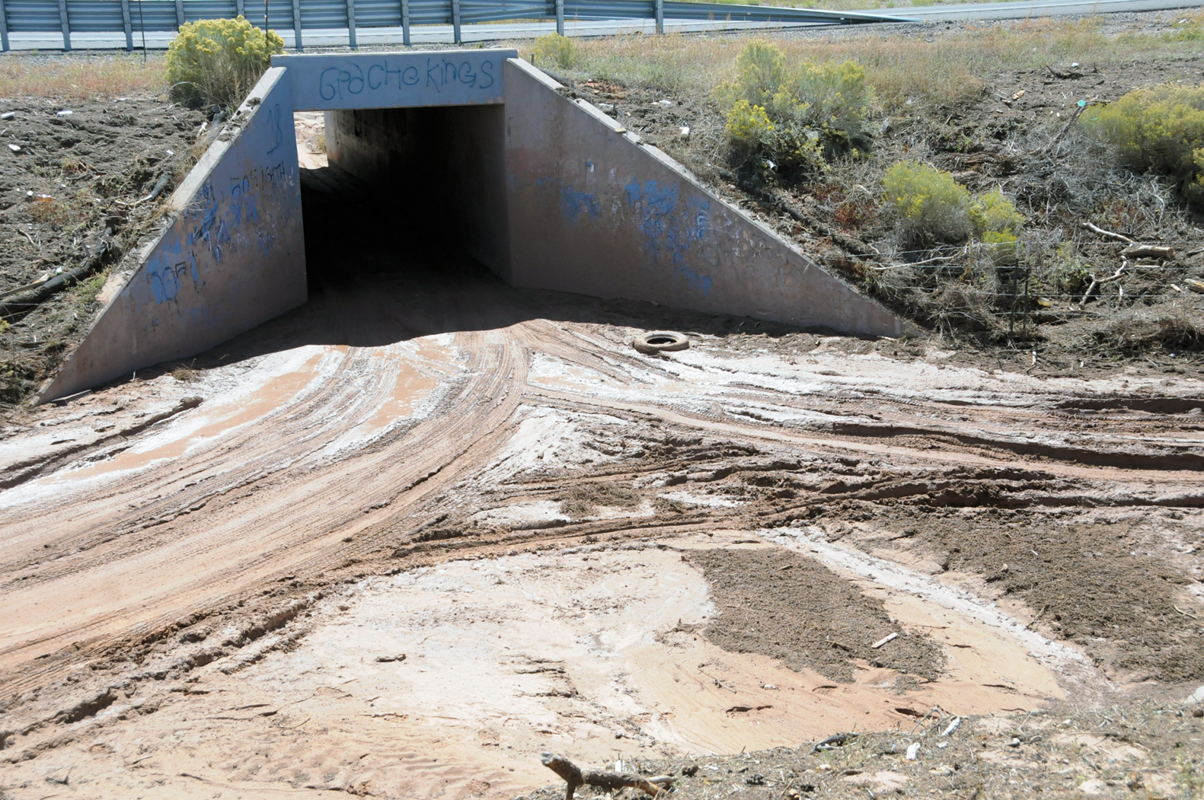
| Many drainages like this one south of NM Highway 122 (and under Interstate 40) were at capacity from excessive flooding and runoff upstream in McKinley County. Note height of debris on either side of bridge. Photo taken September 19, 2013. |
| |