| Rainfall Summary: September 10-18, 2013 | ||||||||||||||||||||||||||
|
The table below is a comprehensive list of the more significant precipitation reports that were received for the 9-day event period.
|
||||||||||||||||||||||||||
| Impact Summary | ||||||||||||||||||||||||||

|
||||||||||||||||||||||||||
|
Hydrologic Summary
|
||||||||||||||||||||||||||
|
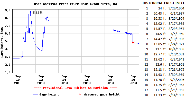
The Pecos River near Anton Chico crested at 8.85 feet (4,770 cfs) at 115pm MDT September 11, 2013. This event does not fall within the top 18 record events at this location. The record crest is 24 feet set back on September 29, 1904. No significant flooding was observed immediately along the Pecos River near Anton Chico however numerous tributaries leading into this area flooded. Action stage is 12 feet, minor flood stage 15 feet, moderate flood stage 20 feet, and major flood stage 24 feet.
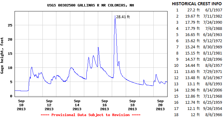
The Gallinas River near Colonias crested at 28.41 feet (29,507 cfs) at 545am MDT September 17, 2013. This is now the highest crest ever observed at this location breaking the previous record crest of 27.2 feet on June 1, 1937. Significant flooding was observed along the Gallinas River however no impacts were reported to residential and transportation infrastructure. Action stage is 12 feet and minor flood stage 16 feet. There has been no determination of moderate and major flood stages.
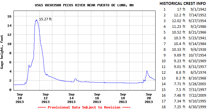
The Pecos River near Puerto de Luna crested at 15.27 feet (36,200 cfs) at 1245pm MDT September 11, 2013. This is now the 2nd highest crest for this location and compares to the record crest of 17 feet set back on September 1, 1942. Significant flooding was observed within this area. Action stage is 10 feet and minor flood stage 11 feet. There has been no determination of moderate and major flood stages.
|
||||||||||||||||||||||||||
|
Photos
|
||||||||||||||||||||||||||
|
|
||||||||||||||||||||||||||
|
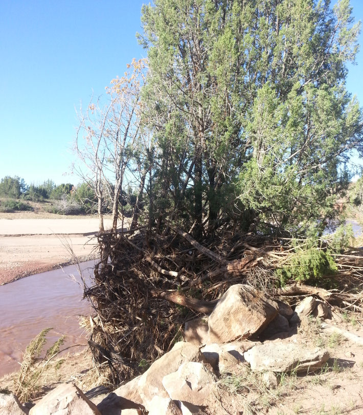
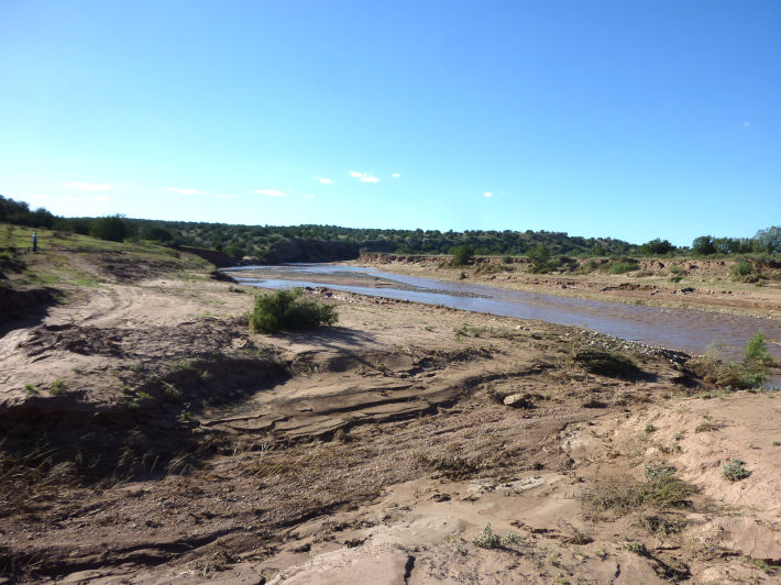
Debris well-above the bank of the Pecos River near Colonias. |
||||||||||||||||||||||||||
 |
||||||||||||||||||||||||||
| The effect of the 28.4 foot stage on the Pecos near Colonias (see hydrograph above) is apparent in the photos by the width of the mud flow on both sides of the Pecos River. | ||||||||||||||||||||||||||