| Rainfall Summary: September 10-18, 2013 | |||||||||||||||||||||||||||||||||
|
The table below is a comprehensive list of the more significant precipitation reports that were received for the 9-day event period.
|
|||||||||||||||||||||||||||||||||
| Impact Summary | |||||||||||||||||||||||||||||||||
|
|||||||||||||||||||||||||||||||||
|
Hydrologic Summary
|
|||||||||||||||||||||||||||||||||
|
The Rio Puerco at Bernardo crested at 21.22 feet (7,120 cfs) at 1030pm MDT September 16, 2013. This is the 2nd highest crest ever observed at this location and compares to a previous crest of 19.52 feet on August 10, 2006. The record crest is 27.9 feet set back on September 23, 1941. Significant flooding was observed along the Rio Puerco around the San Francisco community where a levee breach flooded several homes. Action stage is 18 feet, minor flood stage 19.5 feet, moderate flood stage 23 feet, and major flood stage 27 feet.
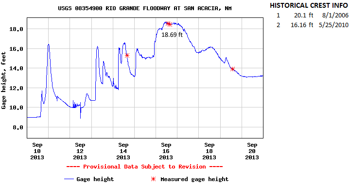
The Rio Grande at San Acacia crested at 18.69 feet (8,780 cfs) at 1130am MDT September 16, 2013. This crest is the second highest on record for this location and compares to a previous crest of 16.16 feet on May 25, 2010. The record crest is 20.1 feet set back on August 1, 2006. Action stage is 21 feet , minor flood stage 23 feet, and moderate 25 feet. There has been no determination of major flood stage.
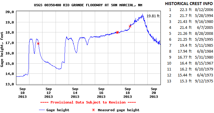
The Rio Grande at San Marcial crested at 19.81 feet (4,250 cfs) at 245pm MDT September 19, 2013. This is now the 7th highest crest for this location and compares to a previous crest of 19.4 feet set back on May 11, 1985. Action stage is 24.5 feet, minor flood stage 24.5 feet, and moderate flood stage 26 feet. There has been no determination of major flood stage.
|
|||||||||||||||||||||||||||||||||
|
Photos
|
|||||||||||||||||||||||||||||||||
|
|
|||||||||||||||||||||||||||||||||
|
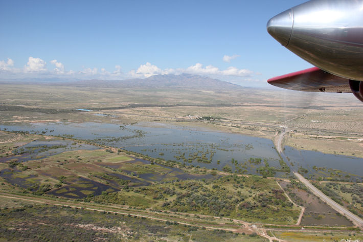
Aerial view of Rio Puerco near Bernardo looking west and south from U.S. Highway 60. Photo taken September 17, 2013. |
|||||||||||||||||||||||||||||||||
|
|
|||||||||||||||||||||||||||||||||
|
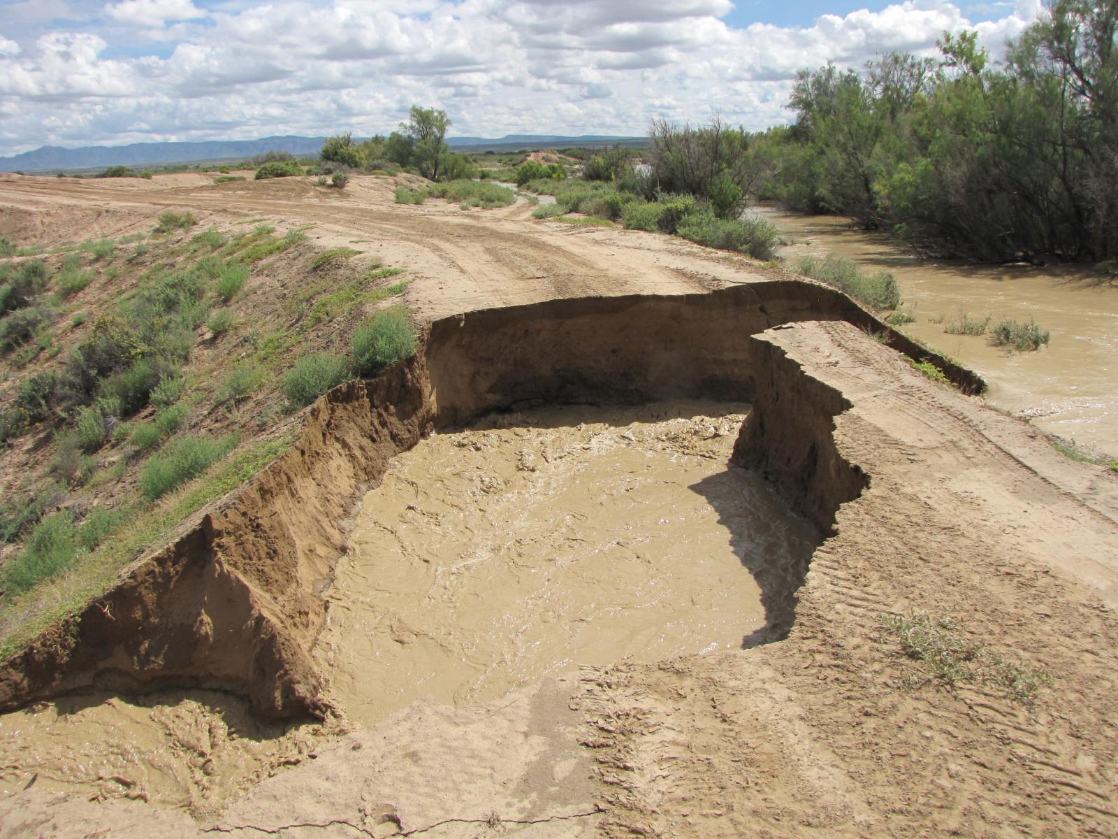
The Rio Puerco breaches its banks near the small community of San Francisico, causing damage to a road. Image taken on September 16, 2013. |
|||||||||||||||||||||||||||||||||
|
|
|||||||||||||||||||||||||||||||||
|
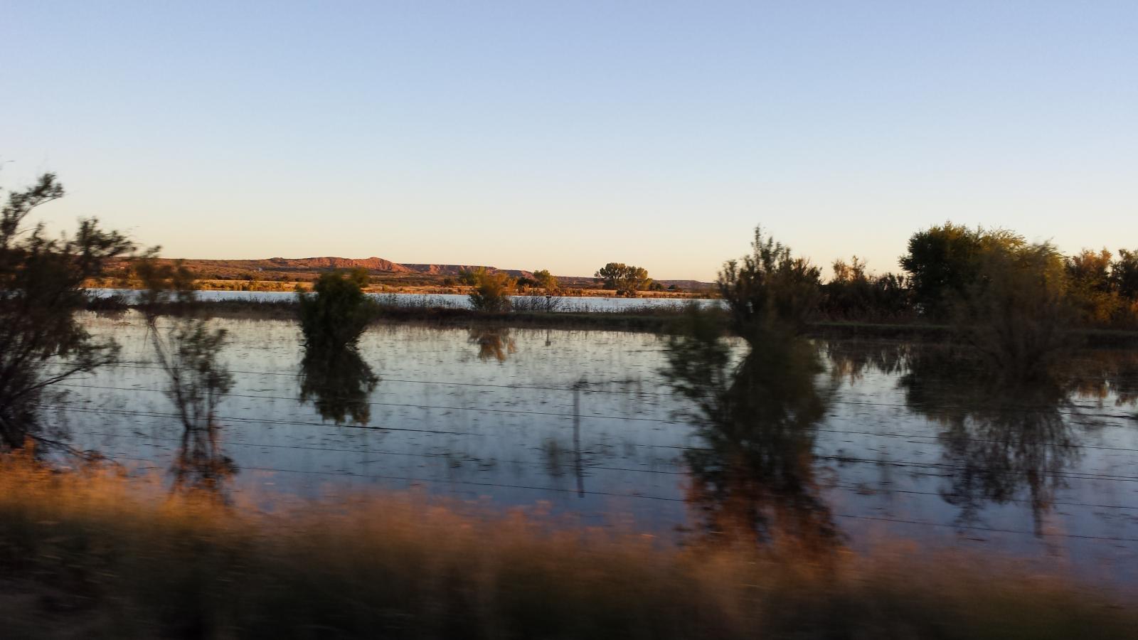
Standing water can be seen several days after flooding inundated the Rio Puerco. Image taken near Bernardo at U.S. Highway 60 on September 23, 2013. |
|||||||||||||||||||||||||||||||||