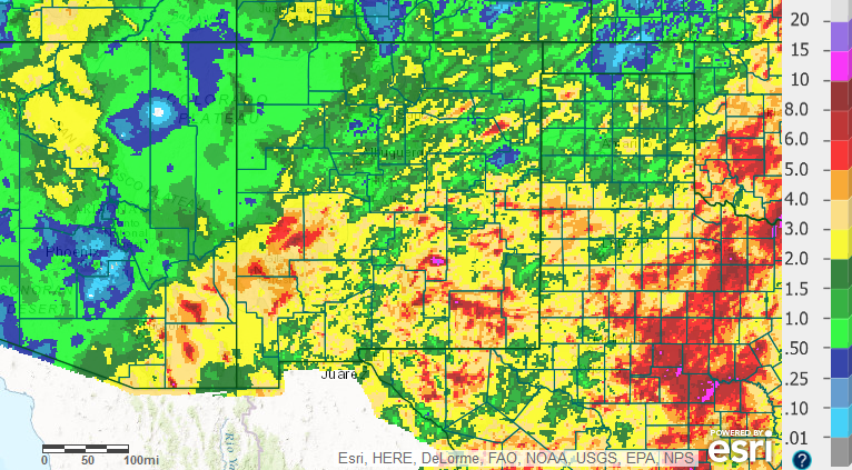
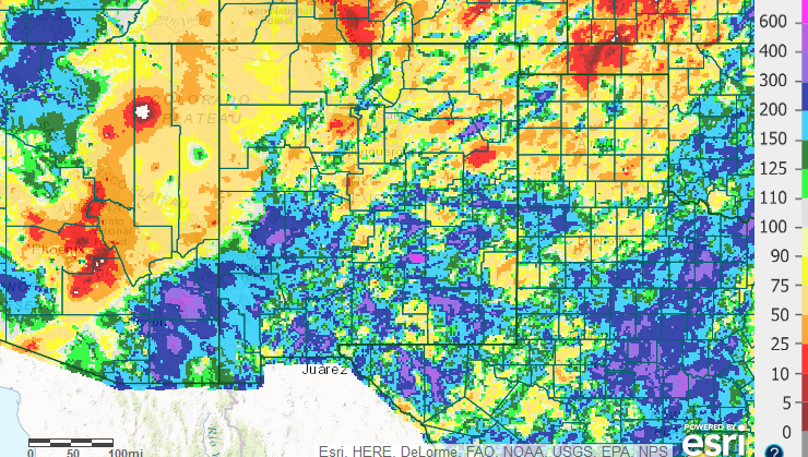
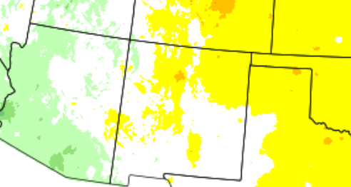
September 2016 was mostly warmer and wetter than normal. The one exception was below normal precipitation in the northwest portion of the state.
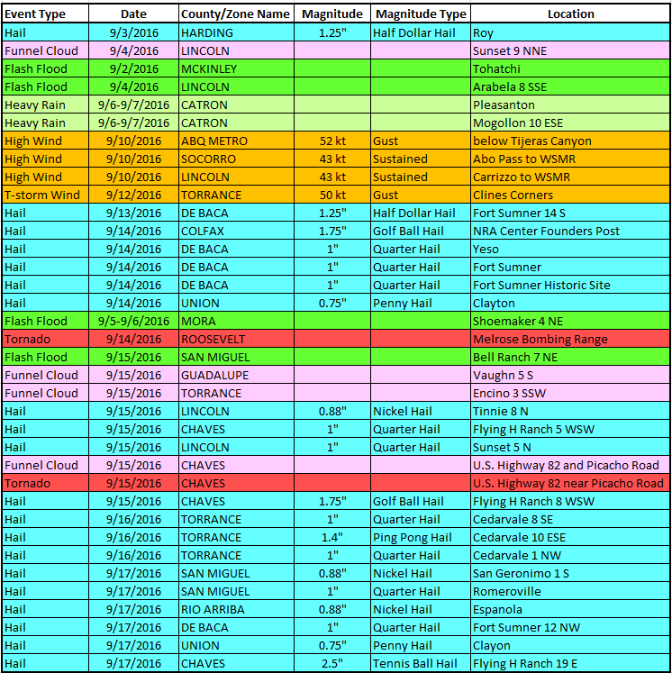
Plenty of moisture remained over New Mexico through most of the month. The fourth was especially active with flash flooding at a few locations. Unfortunately, two people were killed near Tohatchi in a flooded arroyo. Severe weather struck on the 14th through 17th with many reports of large hail and even a tornado. Golfball size hail struck near Raton on the 14th, and near Dunken on the 15th, while a tornado was confirmed near the Chaves/Eddy County line on the 16th. Baseball size hail fell west of lake Arthur on the 17th. The last two weeks of the month were rather mundane.
Statewide Precipitation and Temperatures
Climate Cities Temperatures and Precipitation
| Albuquerque |
| |
|
There was 1.04 inches of precipitation measured at the Sunport in September 2016, compared to the normal of 1.08 inches, or 0.04 inches below normal.
The average temperature for Albuquerque in September 2016 was 70.8°, which was 1.5 degrees above the normal of 69.3°.
The average maximum temperature for the month was 83.2°. This was 2.5 degrees above the normal average maximum temperature of 80.7°.
The average minimum temperature for the month was 58.4°. This was 0.5 degrees above the normal average minimum temperature of 57.9 degrees.
Records: none.
|
| |
| Clayton |
| |
|
There was 2.63 inches of precipitation measured at Clayton in September 2016, or 0.96 inches above the average of 1.67 inches.
The average temperature for Clayton in September 2016 was 67.8°, which was 2.0 above the normal of 65.8 °.
The average maximum temperature for the month was 81.8°. This was 2.5 degrees above the normal average maximum temperature of 79.3 degrees.
The average minimum temperature for the month was 53.8°. This was 1.5 degrees above the normal average minimum temperature of 52.3°.
Records:none.
|
| |
| Roswell |
| |
|
There was 1.21 inches of precipitation reported at Roswell during September of 2016, which is 0.32 inches below the normal of 1.53 inches.
The average temperature in Roswell for September 2016 was 72.4°, which is 0.4 degrees above the normal of 72.0 degrees.
The average maximum temperature for the month was 85.1°. This was 0.5 degrees below the average maximum temperature of 85.6 degrees.
The average minimum temperature for the month was 59.7°. This was 1.2 degrees above the normal average minimum temperature of 58.5°
Records: none.
|