|
Major Late Season Winter Storm: April 28-29 |
||
|
|
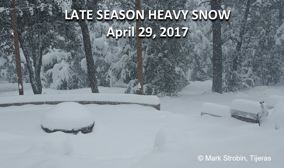
A potent, slow-moving low pressure system combined with a strong backdoor cold front to produce heavy late season snowfall from the high terrain of central into much of northern New Mexico. Ten to 18 inches of snow were reported along the Sandia Mountains into the Santa Fe Metro area and over the Sangre de Cristo Mountains. Widespread snowfall accumulations of 3 to 6 inches were reported across the east central and northeast plains. Numerous long-term daily snowfall records were smashed across the region, including 11 inches at Gascon, 8 inches at Mosquero and Pasamonte, 6 inches at Cimarron, and 5.5 inches at Tucumcari. The 7.5 inches of snowfall at Clayton established a new daily record for April 29th and was the greatest 24-hour snowfall amount of the entire 2016-17 winter season. |
|
|
Historic Severe Weather Outbreak: May 8-9 |
||
|
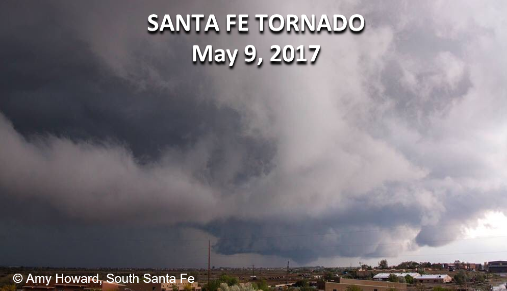
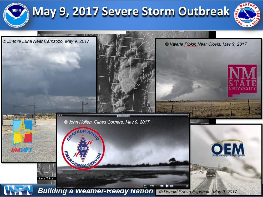
Less than two weeks after heavy snow impacted much of the area, one of the most widespread and significant severe weather outbreaks of the Doppler radar-era occurred in early May. An unusually strong, nearly stationary upper-level storm over the Desert Southwest combined with plentiful moisture and extreme instability on May 9th. Isolated severe thunderstorms erupted shortly after midnight in the area from Santa Fe to Farmington and produced quarter size hail with heavy rain and strong wind. A large area of strong to severe thunderstorms developed shortly after sunrise over central New Mexico and moved north across the Albuquerque and Santa Fe Metro areas through the early afternoon. A brief tornado developed near the Santa Fe airport shortly after noon with minor damage reported. A major hailstorm struck the Interstate 25 corridor near Kewa Pueblo, resulting in damage to homes and vehicles. The next wave of storms that developed over central New Mexico produced tornadoes near Carrizozo, Clines Corners, and Wagon Mound. Large hail up to the size of golf balls was also reported with these storms. More storms firing up around the Albuquerque metro area produced nickel to quarter size hail from Rio Rancho north into the Jemez Mountains. Severe thunderstorms continued to pound eastern New Mexico well into the evening hours with golf ball to hen egg size hail producing damage in areas around Roswell and Tucumcari. |
|
|
|
Portales Flooding and Las Vegas Hailstorm: August 3-9 |
||
|
|
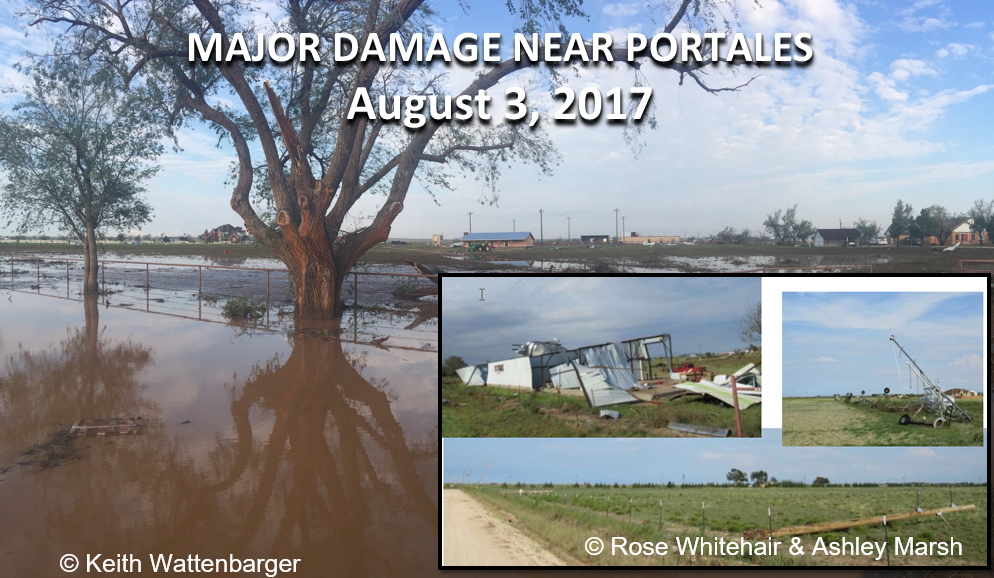
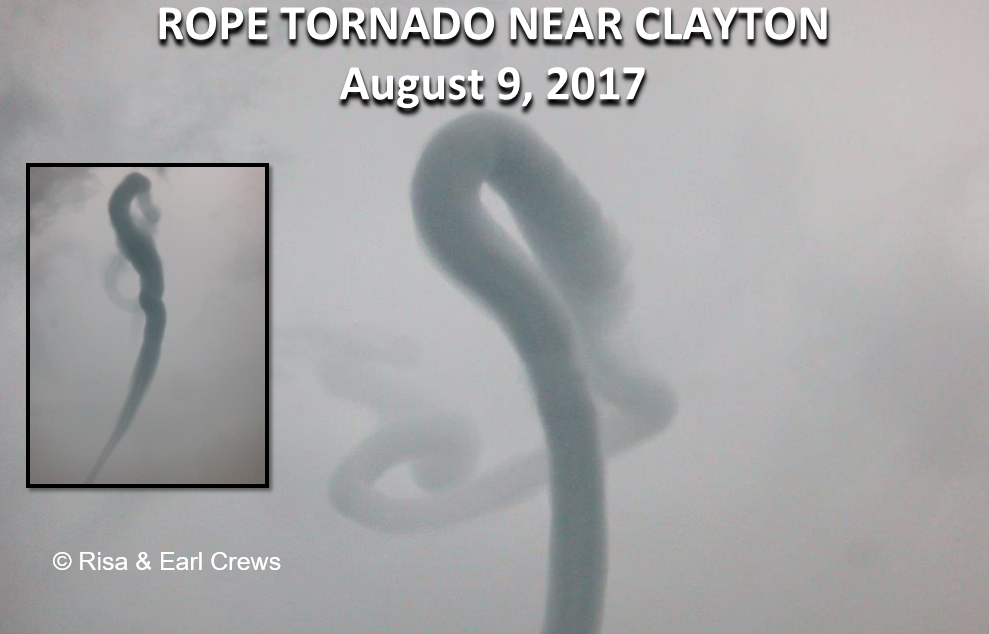
Deep moisture and strong instability along and east of the central mountain chain combined with an unseasonably strong northwest flow aloft to produce a favorable, multi-day environment for severe thunderstorms over the east-central and northeast portions of the state in early August. During the early evening of Thursday, August 3, 2017, a line of strong to severe thunderstorms slowly advanced toward the southeast at 15 to 20 mph across far east-central New Mexico to include central and northern Roosevelt County. A peak wind gust of 60 mph was recorded at the K4MR AWOS (Melrose Range) at 6:45 p.m., which is about 40 miles northwest of Portales, and was associated with the leading edge of the rain-cooled air or gust front. In addition to the high winds, torrential rain accompanied the storms resulting in widespread flood damage. A few days later, on August 9th, another severe storm that developed over Las Vegas produced damaging baseball size hail mainly over the southeastern quadrant of town. Severe damage was reported to many vehicles. Several other storms that moved across Harding, Mora, and San Miguel counties produced golf ball to baseball size hail. Funnel clouds and a brief tornado also accompanied the severe storms in Las Vegas and near Grenville and Clayton. Heavy rainfall amounts up to nearly three inches were reported with several storms. |
|
|
Destructive Flash Floods and Tornadoes: September 28 - October 5 |
||
|
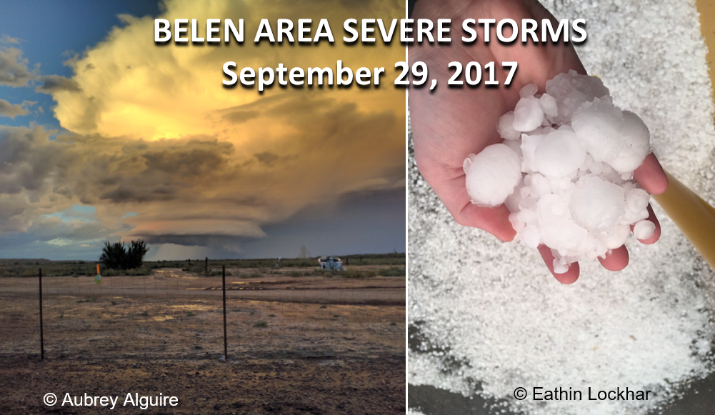
An upper level low pressure system developed over the Great Basin during the final days of September into first week of October and delivered multiple rounds of widespread showers and thunderstorms. Saturated soils over much of central and eastern New Mexico from late September exacerbated the flash flood potential. Flash flooding and severe storms developed in the Rio Grande Valley September 28-30. Numerous roads were washed out within Santa Fe County. Destructive flash flooding, large hail, and high winds were reported in and around Belen. Meanwhile, eastern New Mexico continued to experience deluges of rainfall with flash flooding reported around Logan, Fort Sumner, Portales, and Elk. Three-day total rainfall amounts of 3 to 8 inches were reported across eastern New Mexico with another 1 to 3 inches around the Rio Grande Valley. |
|
|
|
Record-Shattering Warm November |
||
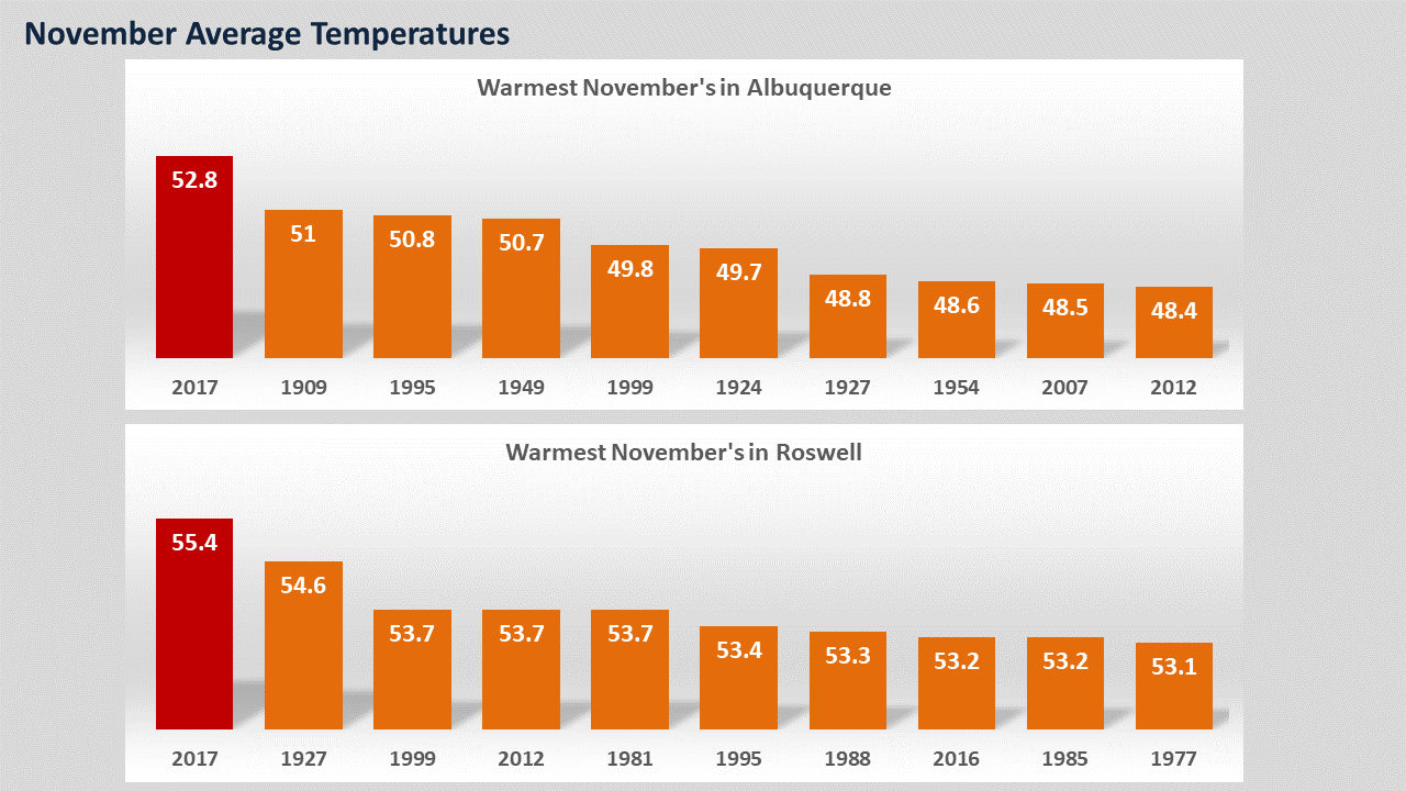 |
Albuquerque experienced the warmest November on record with an average temperature of 52.8 degrees. This shattered the previous record of 51.0 degrees set back in 1909. The normal average November temperatures is 44.9 degrees. Roswell also experienced the warmest November on record with an average temperature of 55.4 degrees. This beat the previous record of 54.6 degrees set back in 1927. The normal average November temperature is 49.3 degrees. |
|