
Wildfires and poor air quality continue for the Pacific Northwest, Rockies and extended into the Plains. Severe thunderstorms possible for the northern Plains and upper Midwest on Monday along a frontal boundary. Another boundary will focus showers and thunderstorms for the eastern seaboard with localized heavy rainfall possible. For Alaska, a strong Bering Sea storm will bring winds and rainfall. Read More >
Albuquerque, NM
Weather Forecast Office
DAMAGING WINDS AND EXTREME FIRE WEATHER!!
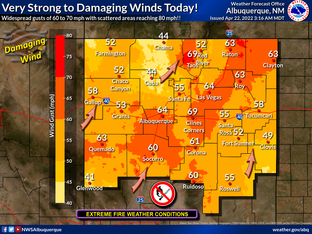
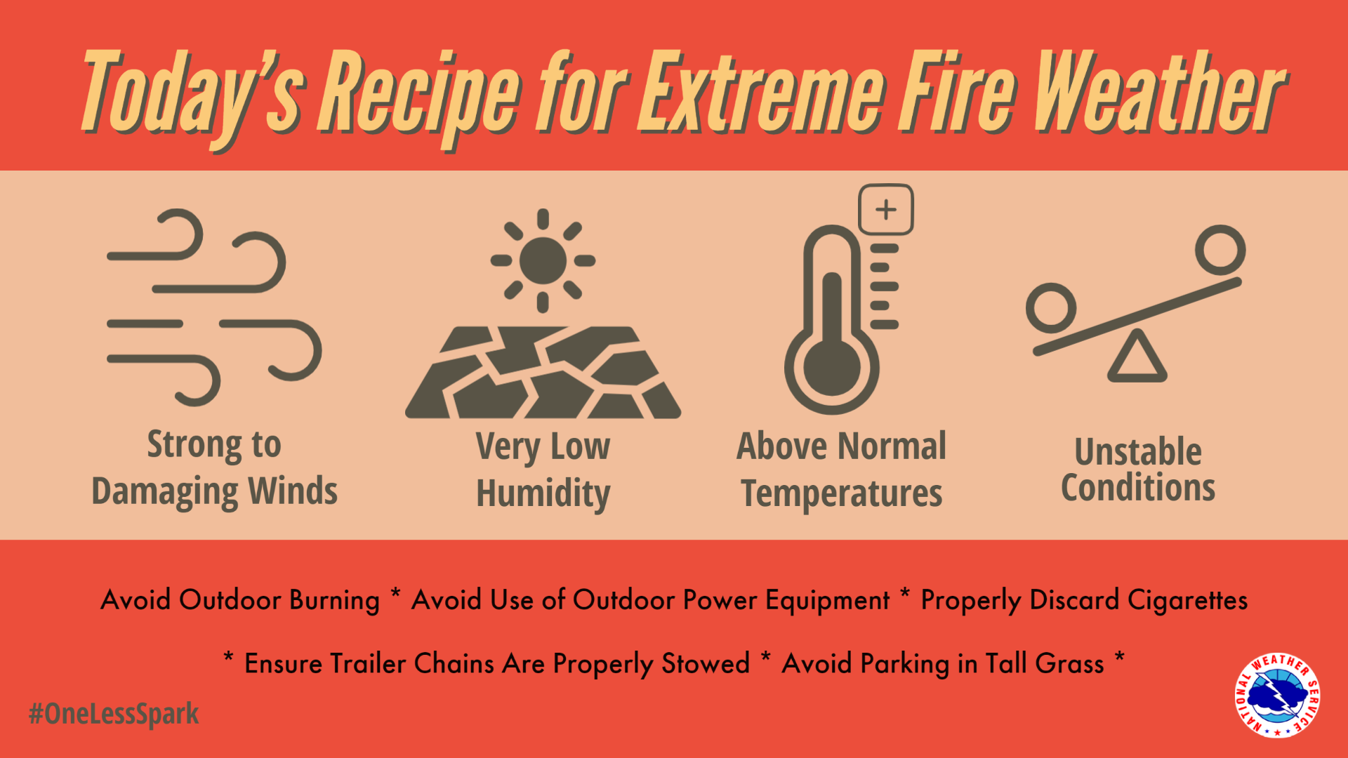
Damaging winds and extreme fire weather will occur today, April 22. Widespread wind gusts of 60 to 70 mph and scattered areas reaching 80 mph could knock down large tree limbs, utility poles and other structures while threatening to topple high profile vehicles! Damage to roof tops and other structures is possible along with widespread blowing dust. These winds could potentially be catastrophic for ongoing wildfires or any new fire ignitions, as rapid fire growth and extreme fire behavior is expected.
Key Impacts:
Current Hazards
Outlooks
Submit A Storm Report
Severe and Hazardous Weather Info
Current Conditions
Surface Observations
Observed Precipitation
Satellite
Local Satellite Page
Local Observations Page
Map of Latest Wind and Precipitation Reports
Radar
National Radar
ABX Albuquerque Radar
FDX Cannon Air Force Base Radar
Forecasts
Fire Weather Forecasts
Area Forecast Discussion
Hourly View Forecast
Activity Planner
Aviation Forecasts
Local Forecast Page
Graphical Forecasts
Hydrology
Local Hydrology Products
Advanced Hydrologic Prediction Services
Climate and Past Weather
NOAA Climate Center
Climate Prediction Center
Climate Graphs
Drought
Severe T-Storm Climatology for NM
Local Data
Winter Climatology for NM
Local Programs
About Our Office
SKYWARN
NOAA Weather Radio
Local Studies and Features
Winter Weather Info, Safety Tips, and Climo
Severe Weather Info, Safety Tips, and Climo
Center Weather Service Unit
US Dept of Commerce
National Oceanic and Atmospheric Administration
National Weather Service
Albuquerque, NM
2341 Clark Carr Loop SE
Albuquerque, NM 87106-5633
(505) 243-0702
Comments? Questions? Please Contact Us.

