
New Mexico's Winter Cloud
|
||||||||||||
|
You have no doubt seen them in the sky this winter, perhaps snapped a photo or two and used terms like "flying saucer" or "stack of pancakes" to describe them. So what exactly are those mysterious looking clouds and why do they form? |
||||||||||||
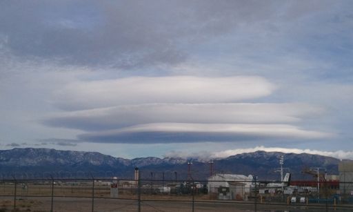 Picture taken December 21, 2010 by Ethan Nelson |
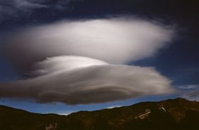 Picture taken February 11, 2008 by Todd Shoemake |
|||||||||||
|
Known as Altocumulus Standing Lenticular (ACSL) or Altocumulus Standing Lenticularis clouds, they are associated with waves in the atmosphere that develop when relatively stable, fast moving air is forced up and over a topographic barrier that is oriented more or less perpendicular to the direction from which the upper-level wind is blowing. This deflection creates a gravity wave downwind of the topographic barrier not unlike a wave you might generate by throwing a pebble into a pond. When sufficient moisture is present above mountain-top level, ACSL clouds develop within the crest of these mountain waves where the air is rising. ACSL clouds are continually developing and dissipating in the vicinity of the wave's crest and immediately downwind of the crest, respectively. That is why they appear to remain stationary (hence the name) even though winds are swiftly (sometimes very swiftly) moving through the entire cloud. They are most often seen in the winter or spring when winds aloft are typically the strongest. A more thorough discussion of mountain waves is available here. When aircraft encounter a mountain wave, severe turbulence is often the result. The most telling clue that a mountain wave exists is the presence of ACSL clouds. But when the air is too dry to support cloud development, pilots and others may be unaware that a mountain wave and potentially severe turbulence exists. So while visually striking and appealing to photographers, ACSL may not be a welcome sight to those in the aviation community. Additionally, strong and gusty surface winds may be encountered particularly in the lee of the mountain barrier. |
||||||||||||
|
Dominated by periods of strong, mostly dry northwest winds aloft, the upper-air pattern during the winter of 2005-06 has been down right dismal for precipitation across New Mexico. It has favored among all things mountain wave development and increased windiness. The image to the right (click to enlarge) depicts the Albuquerque upper-air sounding valid at 5am MST February 1, 2006. Note the shallow layer of stable air ~2km above the surface or just above 700 mb. Northwest winds of 30-40 knots are also present through a deep layer of the lower troposphere. This sounding was taken the day that an impressive ACSL cloud was captured on film (below) just north of Gallup and is typical of days when ACSL clouds are present. |
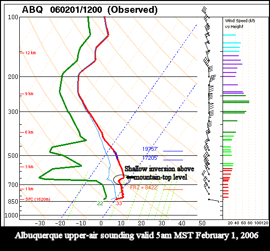 |
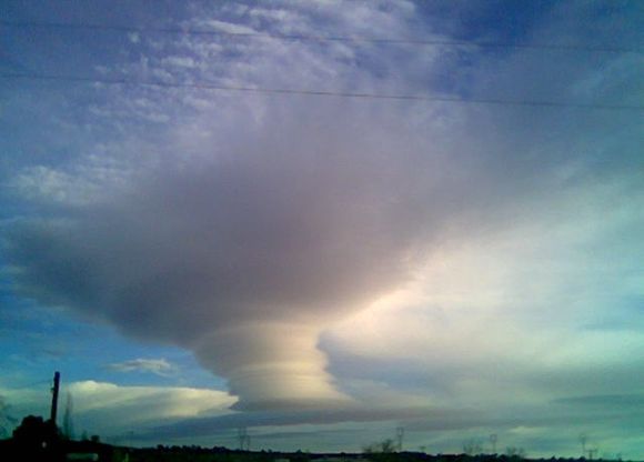 Photo taken by Laura Haven-Daniels in the community of Yah-Tah-Hey |
|

