National Weather Service United States Department of Commerce

Cuba EF-0 Tornado (Sumter Co)

 
EF-0
Estimated Maximum Wind:
80 mph
Injuries/Fatalities:
None
Damage Path Length:
0.67 miles
Maximum Path Width:
100 yards
Approximate Start Point/Time:
32.4312/-88.3707 at 406 pm 
Approximate End Point/Time:
32.4370/-88.3615 at 408 pm
 

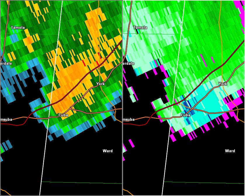
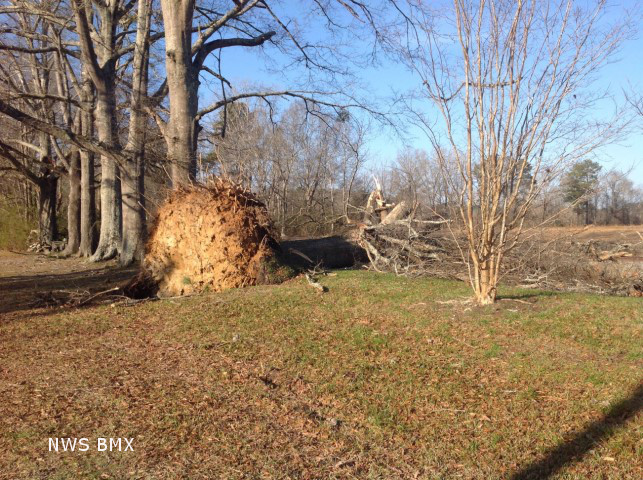
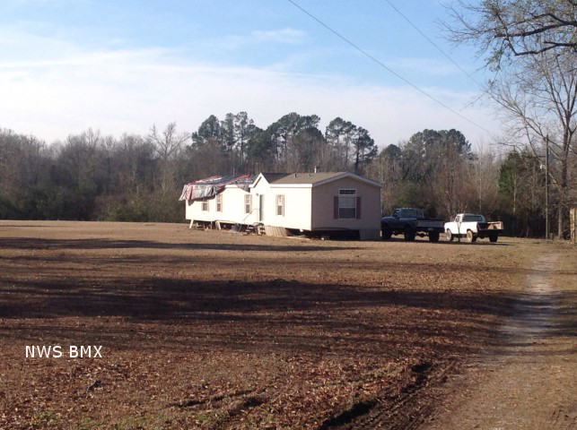
National Weather Service Meteorologists surveyed damage in Sumter County and confirmed a weak tornado. The tornado touched down just west of Pretty Branch Road along the Norfolk Southern Railroad, about 0.5 miles east of Cuba. The tornado tracked northeast downing several large hardwoods and caused damage to the roof and anchoring system of a manufactured home as it crossed Pretty Branch Road and the railroad track. The tornado moved parallel to the railroad track downing approximately a dozen trees. The tornado lifted just west of Old Livingston Road.

Special thanks to the Munoz family for assisting with the survey.


Damage Point legend
  Download in KML         Shapefile Information
 
 
Radar Data 

Radar Image
This is an image of the 0.5 degree reflectivity (left) and velocity (right) data from KBMX at 406 pm as the weak tornado touched down in Cuba.
Click to enlarge.


Storm Damage Images - Click to Enlarge

Storm Damage Image
  Uprooted Tree

Storm Damage Image
Mobile Home Damage