NWS Birmingham, Alabama
Weather Forecast Office
Gordo Tornado - January 10, 2008
|
Rating:
(Click for EF Scale) |
EF-1
|
|
Estimated Maximum Wind:
|
90-100 mph
|
|
Injuries/Fatalities:
|
None
|
|
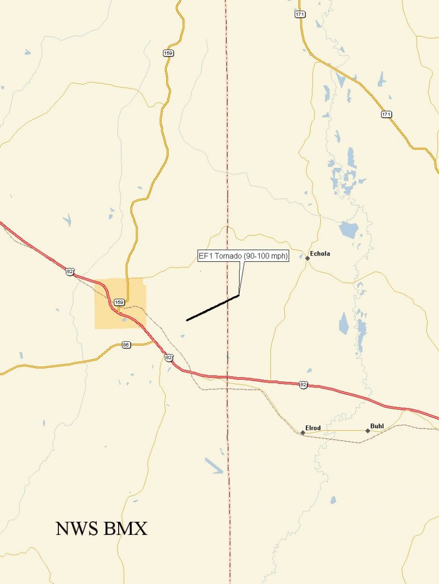
Damage Path Length:
|
1.53 miles
|
|
Maximum Path Width:
|
100 yards
|
|
Approximate Start Point:
|
33.31/-87.86 at 343 PM
|
|
Approximate End Point:
|
33.32/-87.84 at 345 PM
|
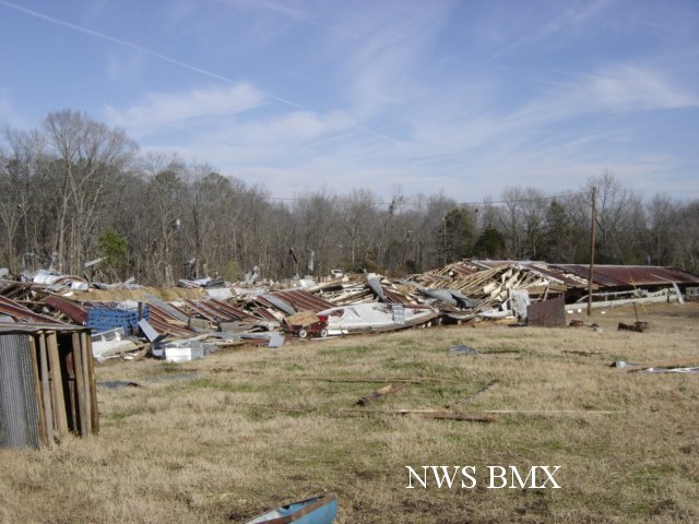
National Weather Service meteorologists surveyed storm damage in far eastern Pickens County, near the city of Gordo, and determined that the damage was the result of a tornado. The tornado has been rated an EF-1 on the Enhanced Fujita Scale with estimated maximum winds 90-100 mph.
The tornado touched down around 343 PM, between Gordo and the Tuscaloosa County line. It then travelled east-northeast for just under two miles, crossing into Tuscaloosa County just before lifting at 345 PM. Several old chicken houses east of Gordo sustained heavy damage.
A Tornado Warning was in effect for this area from 331 PM until 401 PM. A Tornado Watch was in effect from 1134 AM until 622 PM.
Click on the images below for larger picture.
|
|
||||||||||
Current Hazards
National Outlooks
Tropical
Local Storm Reports
Public Information Statement
Graphical Hazardous Weather Outlook
Current Conditions
Regional Weather Roundup
Rivers and Lakes
Drought Monitor
Forecasts
Air Quality
Fire Weather
Aviation Weather
Graphical Forecasts
Forecast Discussion
Climate and Past Weather
Past Events
Storm Data
Tornado Database
Daily Rainfall Plots
Tropical Cyclone Reports
Monthly Climate
Annual Climate
Warnings and Other Products
Tornado Warnings
Severe Thunderstorm Warnings
Flash Flood Warnings
Winter Weather Warnings
Special Weather Statements
Non-Precipitation Warnings
Flood/River Flood Warnings
Productos en Español
Conciencia y Preparación
Previsión de 7 Días
Weather Safety
NOAA Weather Radio
Severe Weather Preparedness
Severe Safety Rules
Tornado Safety Rules
Severe Safety w/ ASL
Awareness Weeks
Severe Weather
Hurricane Preparedness
Summer Safety Campaign
Winter Weather
US Dept of Commerce
National Oceanic and Atmospheric Administration
National Weather Service
NWS Birmingham, Alabama
465 Weathervane Road
Calera, AL 35040
205-664-3010
Comments? Questions? Please Contact Us.