|
Event Summary
|
|
EF-1
|
|
Estimated Maximum Wind:
|
90 mph
|
|
Injuries/Fatalities:
|
2 Injuries |
|
Damage Path Length:
|
9.29 miles
|
|
Maximum Path Width:
|
400 yards
|
|
Approximate Start Point/Time:
|
6.5 NW Autaugaville
32.4847/-86.7275
at 204 pm
|
|
Approximate End Point/Time:
|
4.9 NNW Booth
32.5467/-86.5900
at 217 pm
|
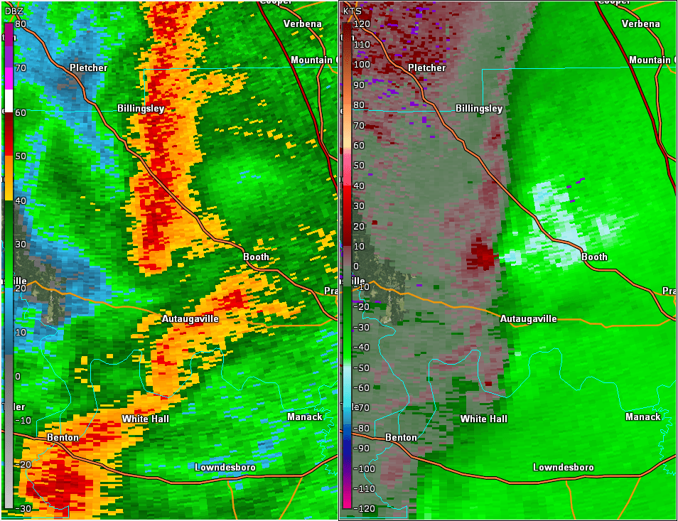
National Weather Service meteorologists surveyed the damage in central Autauga County near the town of Booth and determined it was the result of a tornado with maximum sustained winds of 90 mph.
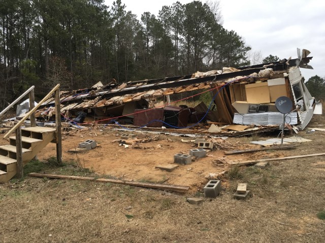
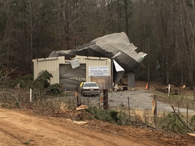
The tornado touched down at Shiloh Circle, just west of County Road 45. The tornado caused minor roof damage to one home and also produced minor tree damage. The tornado continued due east to County Road 19, where one home suffered roof damage and numerous trees were snapped and uprooted. At this point, the tornado turned toward the northeast and traveled through a forested and swampy area. As it reached Seaside Road, the tornado destroyed a small business garage, damaged a few outbuildings, and produced tree damage. The tornado turned toward the east traveling through a large wooded area and uprooted numerous trees. At County Road 46, two homes suffered minor roof and siding damage along with more tree damage. The tornado continued producing tree damage as it crossed Highway 82, County Road 69, and County Road 21. Between County Road 21 and Goodson Howser Road, a couple of homes received minor roof damage, a few outbuildings were damaged, and trees were uprooted. One unsecured mobile home was rolled over and destroyed. Two occupants of the mobile home suffered minor injuries. The tornado lifted before reaching Goodson Howser Road.
|