|
Event Summary
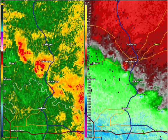
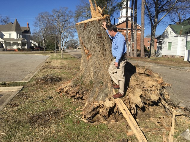
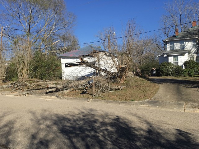
National Weather Service meteorologists surveyed damage in central Elmore County in Wetumpka and determined that the damage was consistent with an EF-1 tornado.
The tornado touched down on the north side of the Coosa River, south of South Boundary Street. The tornado tracked north northeast right into Wetumpka. Just after crossing South Boundary Street, the tornado began snapping and uprooting trees. The strongest winds appeared to be between West Bridge Street and West Tuskeena Street where several large trees were down and a church was damaged. The tornado continued north northeast where several more trees were downed and several structures received minor roof damage. The tornado lifted near Wetumpka City Park and North Bridge Street. The tornado was 1.53 miles long and was 450 yards wide at its widest point. The tornado was rated an EF-1 with maximum winds around 100 mph.
Thanks to Elmore County EMA for their assistance with this survey.
|