National Weather Service United States Department of Commerce

Sulligent (Lamar Co.) EF-1 Tornado
January 30th, 2013

 
EF-1
Estimated Maximum Wind:
90 mph
Injuries/Fatalities:
None
Damage Path Length:
3.8 miles
Maximum Path Width:
300 yards
Approximate Start Point/Time:
33.8723/-88.2275 at 433 am
Approximate End Point/Time:
33.8855/-88.1674 at 436 am
 

The tornado entered Alabama from Mississippi near the intersection of Pleasant Hills and State Line Roads. The tornado was at its widest point here of 300 yards with a maximum speed of 90 mph. Several softwood and hardwood trees were uprooted or snapped at this location. The tornado continued northeast and crossed Shake Rag Road where two buildings sustained minor shingle damage. The tornado then continued northeast towards U.S. Highway (HWY) 278 and then lifted near the intersection of Glass Road and U.S. HWY 278.

Many thanks to the Lamar County Emergency Management Agency for their assistance while the survey was conducted in Lamar County.


Radar Data 

Radar Image
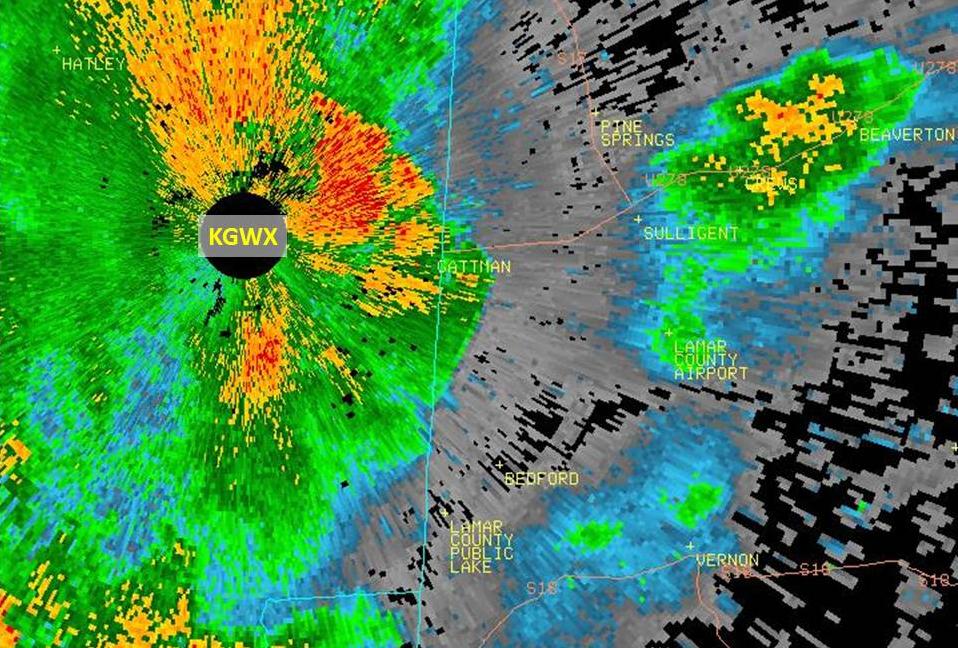
This is an image of the 0.5 degree reflectivity data from KGWX at 434 am. Notice the radar cone of silence just to the west in Mississippi.  The tornado was on the ground at this time. Click to enlarge.

Radar Image
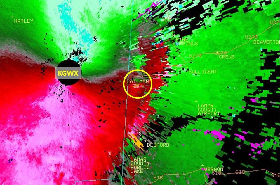
This is an image of the 0.5 degree SRM data from KGWX. Notice velocity couplet in the yellow circle. The data closest to the radar however, is noisy in appearance. Click to enlarge.

 
Damage Pictures 

Debris from outbuilding thrown across field
Debris from outbuilding thrown across a field