EF-2 Newtonville - Oakman Tornado - February 6, 2008
|
Rating:
(Click for EF Scale) |
|
|
Maximum Wind:
|
130 mph
|
|
Injuries/Fatalities:
|
4 minor injuries
|
|
Path Length:
|
25.1 miles
|
|
Maximum Path Width:
|
One Half Mile
|
|
Start:
|
33.53/-87.77 at 251 AM
|
|
End:
|
33.74/-87.41 at 319 AM
|
This supercell developed near Decatur, Mississippi in Newton County. As the storm moved into Noxubee, it produced an EF-0 tornado near the town of Paulette. The storm continued northeastward and crossed into Central Alabama near the Memphis community in Pickens County. A few trees were reported down in Pickens County as the storm moved just north of Carrollton and near Reform.
A tornado then touched down approximately 1 mile southeast of Newtonville near the Tuscaloosa and Fayette County line. As the tornado tracked northeastward across the three counties, it produced extensive damage to at least 15 structures...including 10 homes. At least eight of the structures were completely destroyed. Approximately 500 trees were either snapped off or uprooted along the path. The greatest damage associated with this tornado occured on Patton Hill Road...just west of Oakman in Walker County. The tornado damage path was 25.1 miles long and was one half mile wide at its widest point.
This supercell moved into the Tennessee Valley and produced a weak EF-0 tornado near Dodge City in Cullman County. The storm then produced another tornado northeast of Guntersville which was rated an EF-1. The supercell then strengthened and dropped a violent EF-4 tornado in Jackson County near Pisgah and Rosalie. The supercell eventually merged with the broken squall line in Tennessee.
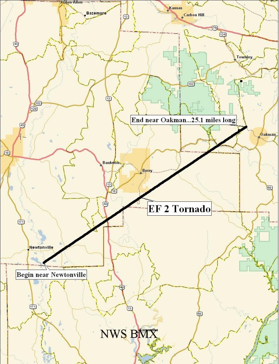 Tornado Damage Path |
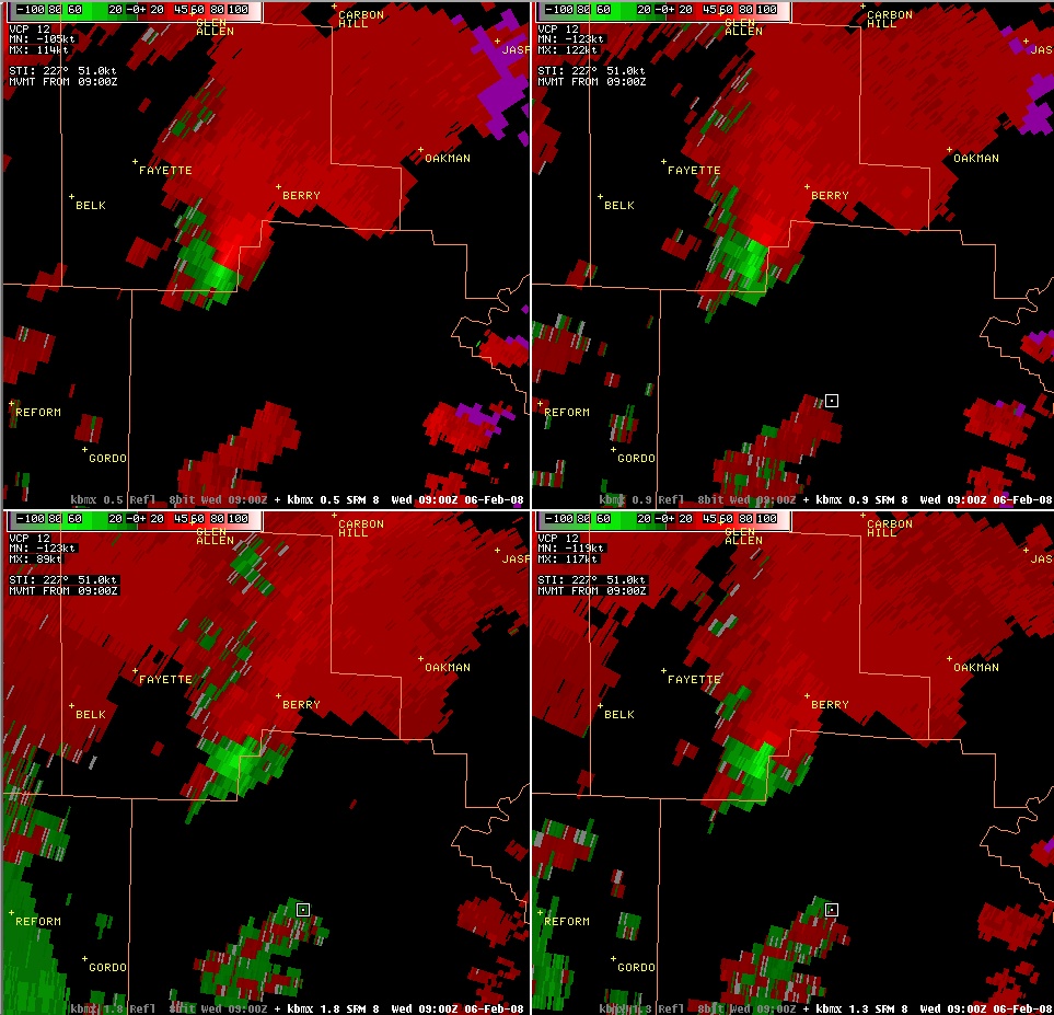 4-PanelStorm Relative Velocity Image During the Tornado |
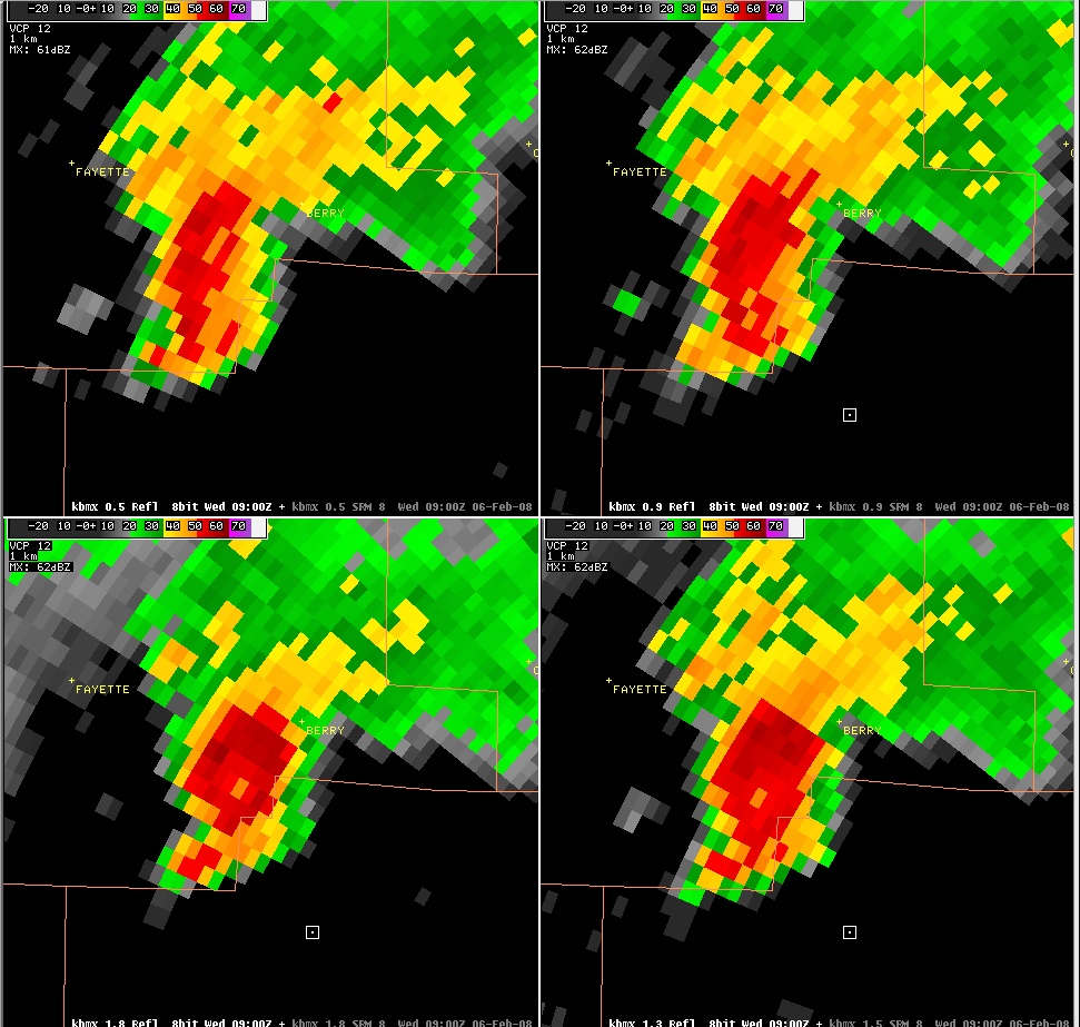 4-Panel Reflectivity Image During the Tornado |

