|
Event Summary
|
|
EF-1
|
|
Estimated Maximum Wind:
|
105-110 mph
|
|
Injuries/Fatalities:
|
1 Injury / 1 Fatality |
|
Damage Path Length:
|
1.29 miles
|
|
Maximum Path Width:
|
400 yards
|
|
Approximate Start Point/Time:
|
4 SE Demopolis
32.4617/-87.8012
at 213 am
|
|
Approximate End Point/Time:
|
4 SE Demopolis
32.4725/-87.7834
at 215 am
|
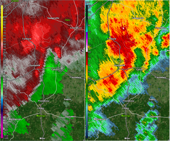
NWS Meteorologists surveyed damage in northern Marengo County just southeast of Demopolis and determined it was the result of a tornado.
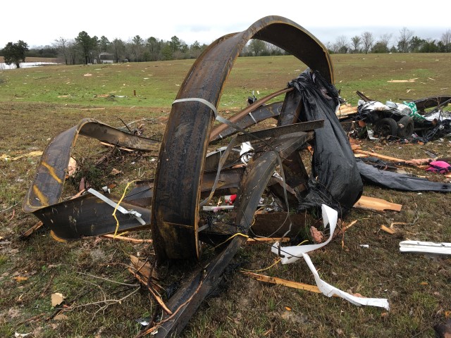
The tornado touched down southeast of Demopolis, west of US Highway 43. The tornado moved northeastward and produced damage near Starmont Lane and Orchard Drive. Several trees were uprooted or were snapped off. Two homes suffered minor damage. The most concentrated damage occurred at US Highway 43 near CR 54. This is the location where two manufactured homes were destroyed and two homes were damaged. The one injury and the one fatality occurred in the manufactured home that was totally destroyed. Several trees were blown down in this location as well. The tornado continued across US Highway 43 where it destroyed a barn and downed many more trees. The tornado then lifted before it crossed French Creek near the quarry. The tornado damage path was 1.29 miles long and was 400 yards wide at its widest point.
|