NWS Birmingham, Alabama
Weather Forecast Office
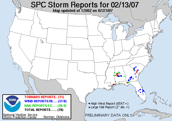
Newbern Tornado - February 13, 2007
Hale and Perry Counties
A National Weather Service Storm Survey Team surveyed the damage in Perry and Hale Counties, and found evidence of a weak EF0 tornado on the Enhanced Fujita scale.
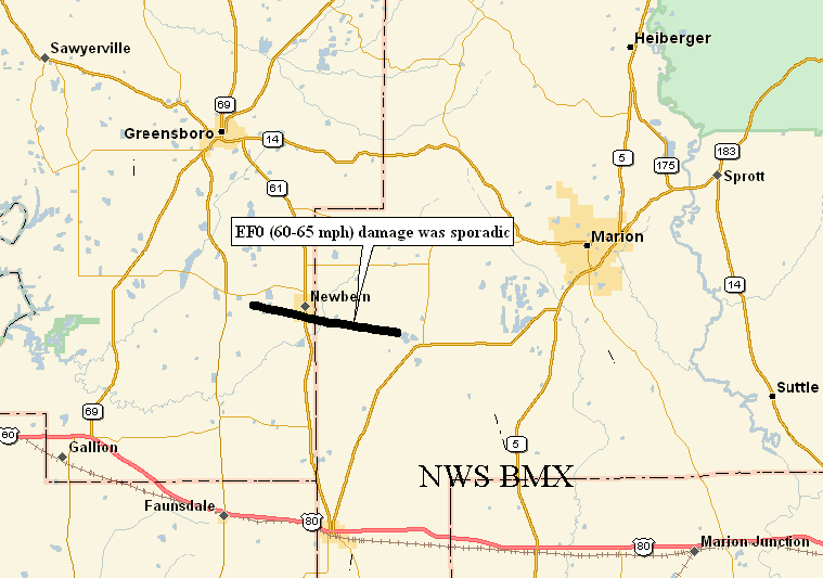
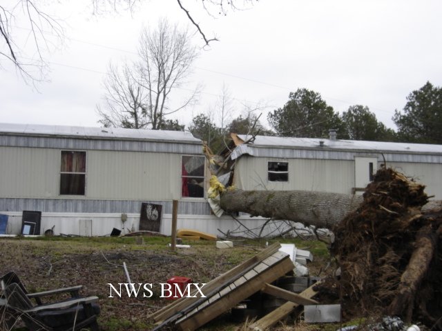
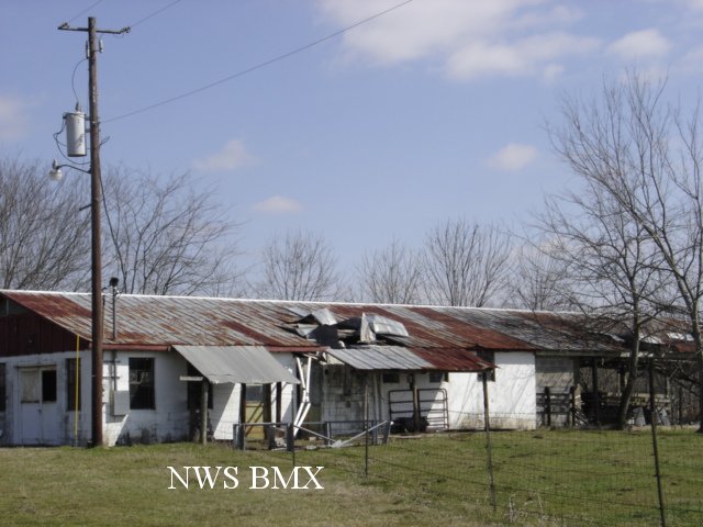
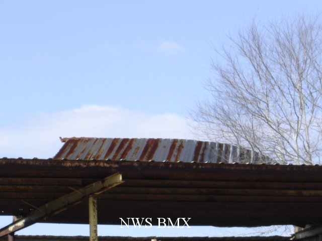
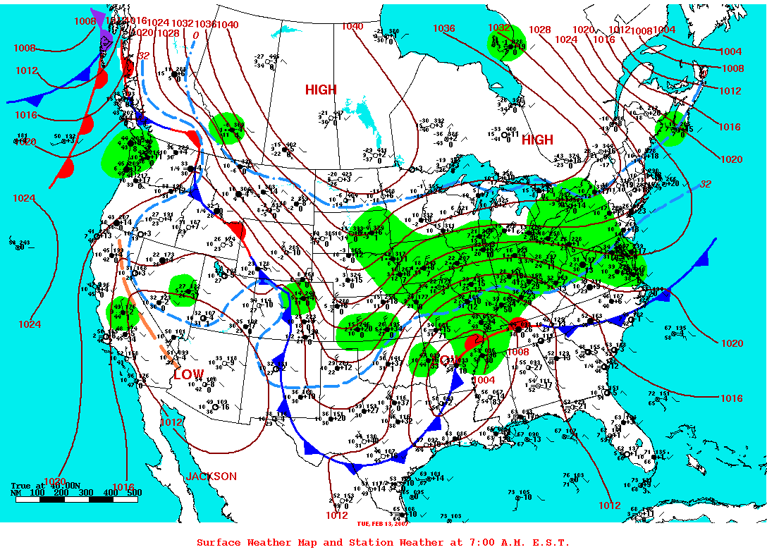
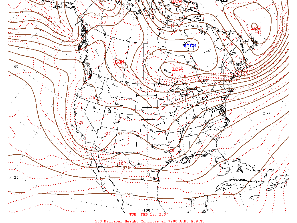
Shortly after 5:00 PM CST…a tornado touched down in far eastern Hale County just west of the town of Newbern and traveled east into extreme western Perry County. The tornado damage path was approximately 6 miles long and 25 yards wide at its widest point. The storm did not cause widespread damage along the whole 6 mile path…but there was evidence of sporadic tree damage along the entire path. The most extensive damage occurred in the Newbern area, on Baby Road, where several old barns were damaged and numerous trees were downed. This location is approximately eight miles southeast of Greensboro, on the Hale and Perry County line. Based on the damage…maximum sustained winds were estimated between 60 to 65 MPH.
A Tornado Warning was in effect for Hale and Perry Counties from 453 PM CST until 545 PM CST. A Severe Thunderstorm Watch was issued at 1250 PM CST and was upgraded to a Tornado Watch at 505 PM CST valid until 10 PM CST.
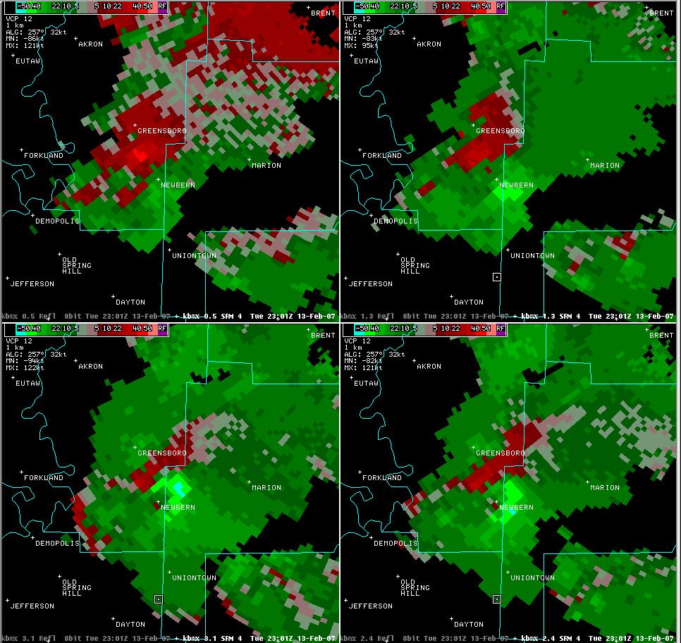 Storm Relative Velocity Image near the time of the tornado. |
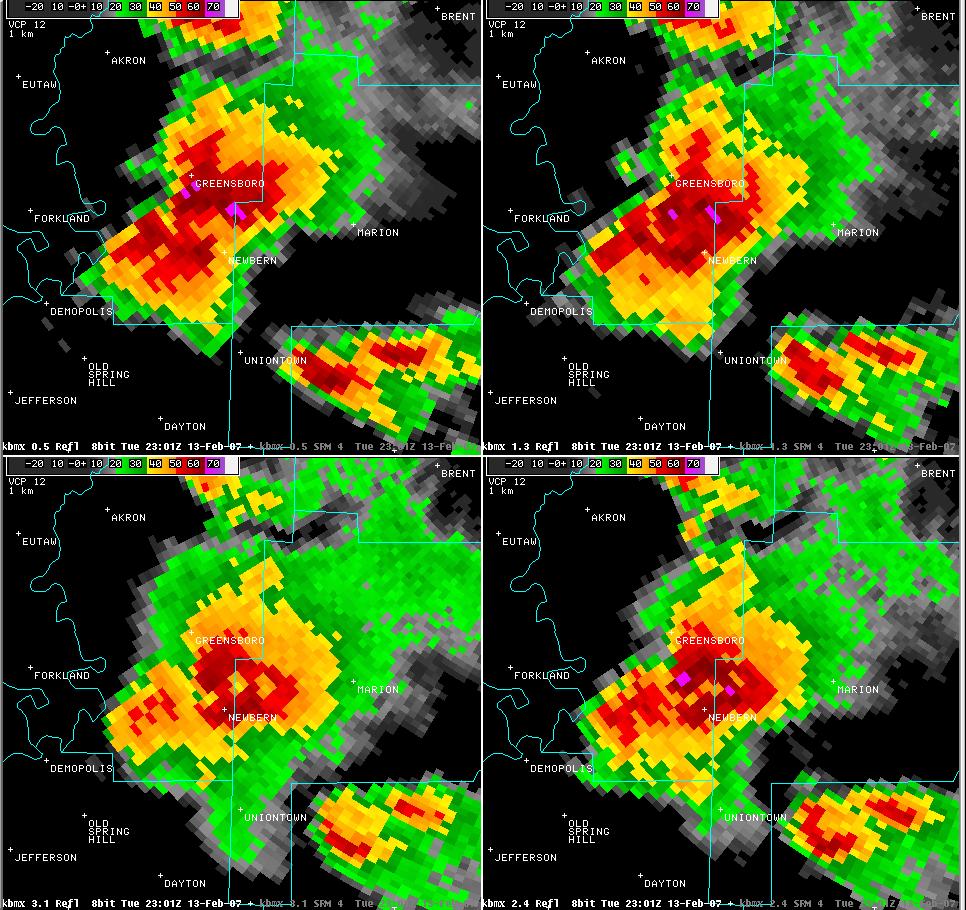 Reflectivity Image near the time of the tornado. |
|||||||||||||||||
|
|
||||||||||||||||||
Current Hazards
National Outlooks
Tropical
Local Storm Reports
Public Information Statement
Graphical Hazardous Weather Outlook
Current Conditions
Regional Weather Roundup
Rivers and Lakes
Drought Monitor
Forecasts
Forecast Discussion
Air Quality
Fire Weather
Aviation Weather
Graphical Forecasts
Climate and Past Weather
Past Events
Storm Data
Tornado Database
Daily Rainfall Plots
Tropical Cyclone Reports
Monthly Climate
Annual Climate
Warnings and Other Products
Tornado Warnings
Severe Thunderstorm Warnings
Flash Flood Warnings
Winter Weather Warnings
Special Weather Statements
Non-Precipitation Warnings
Flood/River Flood Warnings
Productos en Español
Conciencia y Preparación
Previsión de 7 Días
Weather Safety
NOAA Weather Radio
Severe Weather Preparedness
Severe Safety Rules
Tornado Safety Rules
Severe Safety w/ ASL
Awareness Weeks
Severe Weather
Hurricane Preparedness
Summer Safety Campaign
Winter Weather
US Dept of Commerce
National Oceanic and Atmospheric Administration
National Weather Service
NWS Birmingham, Alabama
465 Weathervane Road
Calera, AL 35040
205-664-3010
Comments? Questions? Please Contact Us.