National Weather Service United States Department of Commerce


Tornadoes of February 17, 2022

Overview
 

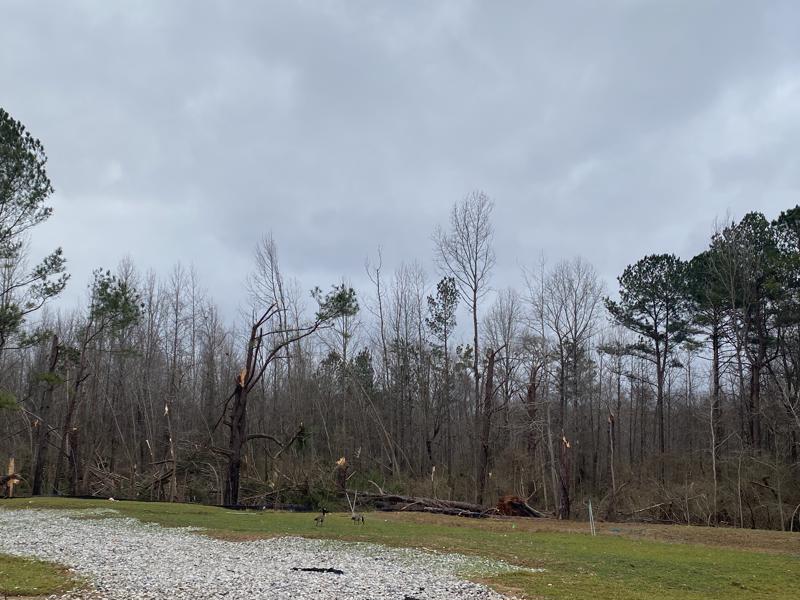
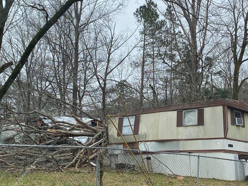
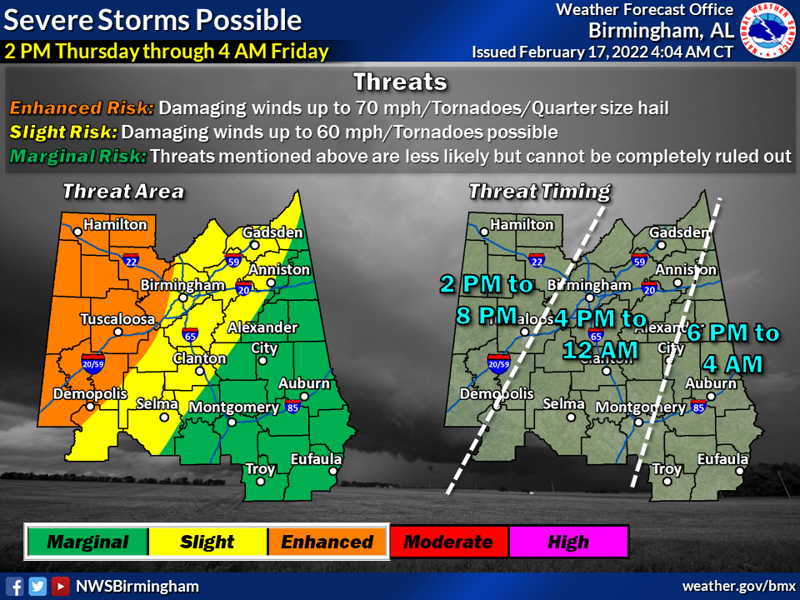
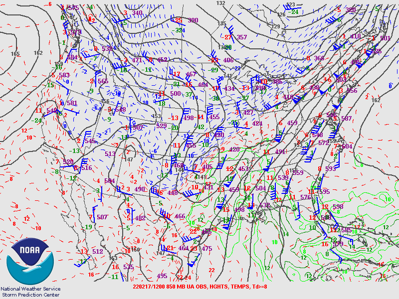
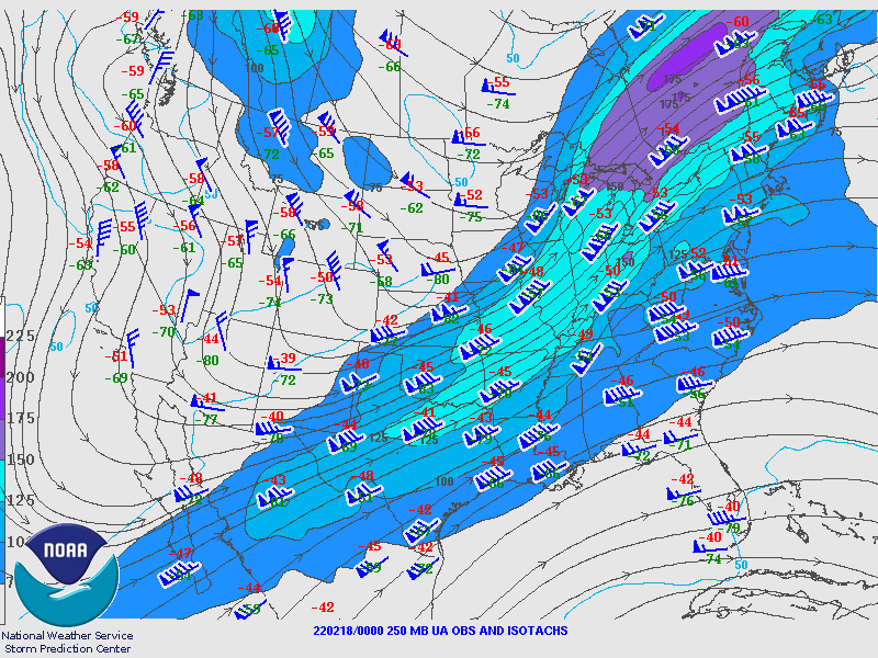
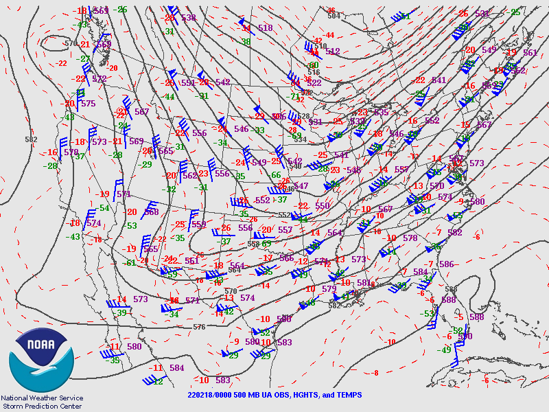
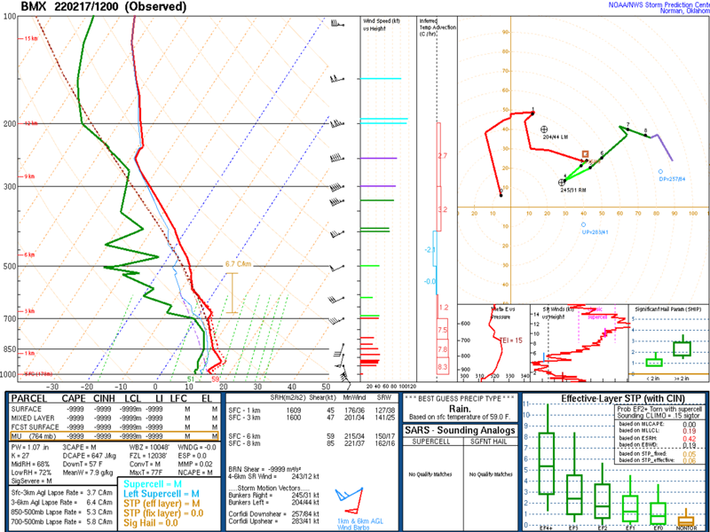
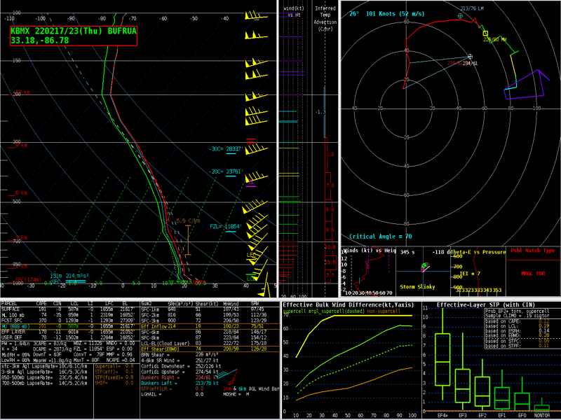
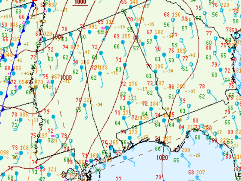
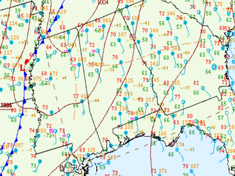
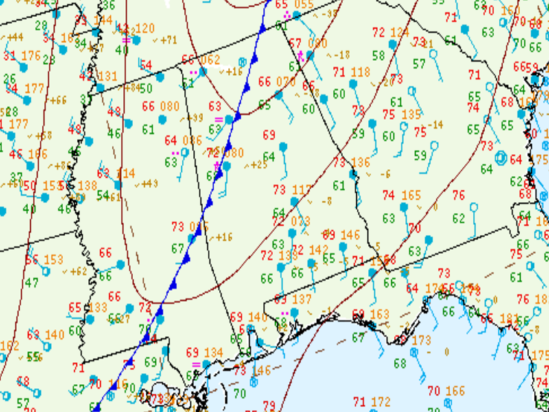
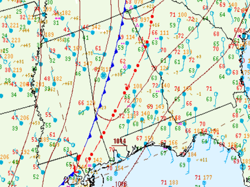
Several supercell thunderstorms developed ahead of a cold front, a couple of which produced weak tornadoes near and
north of the I-20 corridor. Additionally, several rounds of heavy rain produced some flash flooding along and north of I-20, and
strong gradient winds ahead of the front caused scattered tree damage.

 
Interactive Tornado Map


**The data below are considered PRELIMINARY.**

Location/Clickable Detailed Summary Link
Damage Rating/Estimated Maximum Wind Speeds
Injuries/Fatalities
Damage Path Length/Width
Starting Point/Time
Ending Point/Time
Sandtown Tornado
(Fayette and Tuscaloosa Counties)
EF-1
110 mph
None 3.45 miles
475 yards
5.5 SE Berry
33.595/-87.541
4:14 pm CST
6.3 E Berry
33.628/-87.498
4:19 pm CST
Lynns Crossing Tornado
(Jefferson County)
EF-1
100 mph

 
None 4.65 miles
1100 yards
1.9 NW Graysville
33.645/-87.000
4:53 pm CST
1.8 NE Lynn Crossing
33.686/-86.937
4:58 pm CST
Lake Purdy Tornado
(Shelby, Jefferson, and St. Clair Counties)
EF-1
95 mph

 
None 12.63 miles
400 yards
2 NNE Meadowbrook
33.4284/-86.6744
6:08 pm CST
3 ENE Leeds
33.5514/-86.5145
6:21 pm CST
 
Sandtown EF-0
 

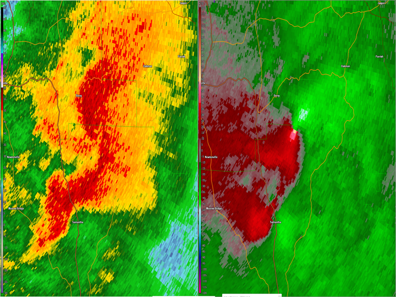
Sandtown EF-1 Tornado (Fayette and Tuscaloosa Counties)
  February 17, 2022


Event Summary

EF-1
Estimated Maximum Wind:
110 mph
Injuries/Fatalities:
None
Damage Path Length:
3.45 miles
Maximum Path Width:
475 yards
Approximate Start Point/Time:
5.5 SE Berry
33.595/-87.541
at 4:14 pm CST
Approximate End Point/Time:
6.3 E Berry
33.628/-87.498
at 4:19 pm CST


The tornado touched down just southwest of Old Cheatam Road in Tuscaloosa County. It then crossed into Fayette County southeast of Berry crossing Old Cheatam Road and County Road 56 where multiple softwood trees were uprooted or snapped. On County Road 56 there was also minor damage to a mobile home and an overturned outdoor shed. The tornado then began to lift further northeast as it approached County Road 46.


Radar Image
Reflectivity (left) and velocity (right) of the circulation as the tornado formed.
Images are from KGWX at 4:14 pm CST.
 
Lynns Crossing EF-1
 

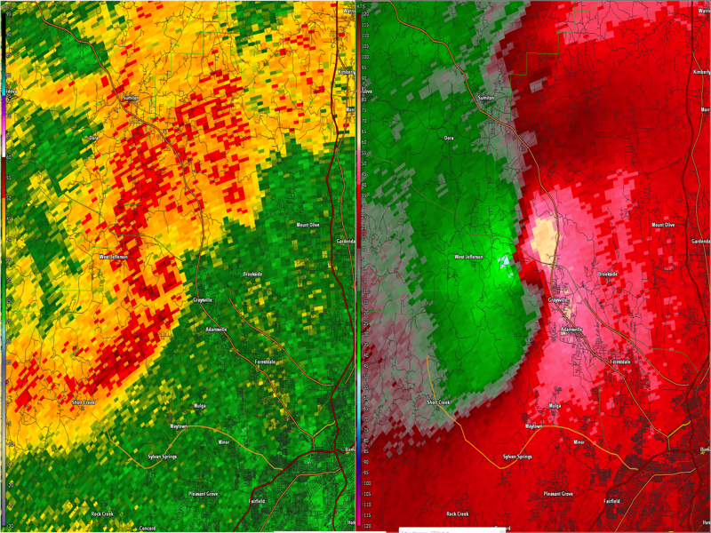
Lynns Crossing EF-1 Tornado (Jefferson County)
  February 17, 2022


Event Summary

EF-1
Estimated Maximum Wind:
100 mph
Injuries/Fatalities:
None
Damage Path Length:
4.65 miles
Maximum Path Width:
1100 yards
Approximate Start Point/Time:
1.9 NW Graysville
33.645/-87.000
at 4:53 pm CST
Approximate End Point/Time:
1.8 NE Lynn Crossing 33.686/-86.937
at 4:58pm CST


The tornado touched down just southwest of Interstate 22 near the Highway 78 exit. It began by crossing Flat Top Road near Interstate 22 and moved northeast crossing Highway 5 and Lynndale Road. Multiple soft and hardwood trees were uprooted and snapped, and several semi trucks were overturned on Interstate 22. The tornado then moved further northeast crossing Lynns Crossing Road where it began to weaken and lift.


Radar Image
Reflectivity (left) and velocity (right) of the circulation right before the tornado formed.
Images are from KBMX at 4:51 pm CST.
 
Lake Purdy EF-1
 

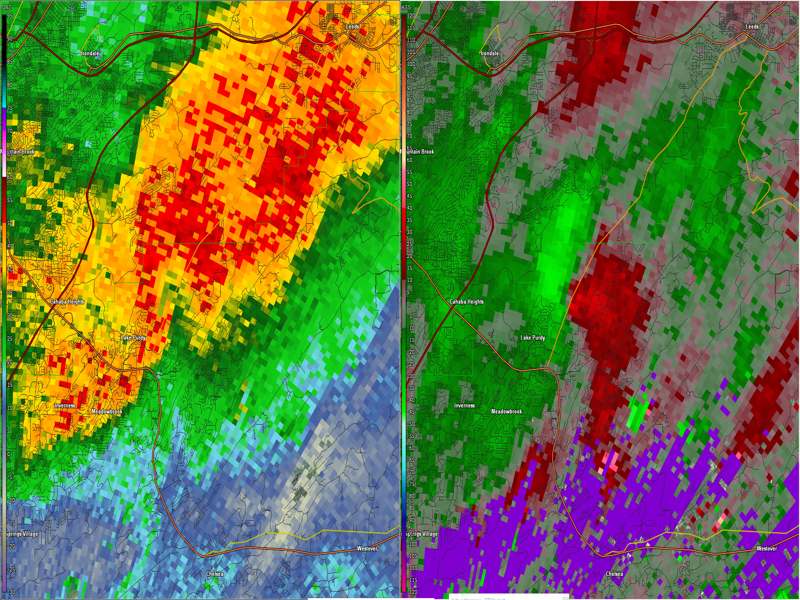
Lake Purdy EF-1 Tornado (Shelby, Jefferson, & St. Clair Counties)
  February 17, 2022


Event Summary

EF-1
Estimated Maximum Wind:
95 mph
Injuries/Fatalities:
None
Damage Path Length:
12.63 miles
Maximum Path Width:
400 yards
Approximate Start Point/Time:
2 NNE Meadowbrook
33.4284/-86.6744
at 6:08 pm CST
Approximate End Point/Time:
3 ENE Leeds
33.5514/-86.5145
at 6:21 pm CST


A tornado touched down in the Lake Purdy community just west of Highway 119 Thursday evening. Tree damage was noted along Brook Highland Parkway with one tree blocking the roadway. The tornado moved northeast causing minor roof damage to an apartment complex. Large trees were snapped and uprooted on both sides of
119 near a strip mall and a landscaping company. The tornado then continued to move northeast snapping a large stand of softwoods on the east side of Highway 119.

The community of Greystone saw large numbers of trees downed. At least one home had a tree fall on the structure. The tornado was likely at its widest and most intense near this location. The tornado then straddled the Shelby-Jefferson county line impacting mostly forested areas on the west side of Double Oak Mountain before
approaching Leeds. Sporadic tree and power line damage was noted along Highway 25. Several homes sustained roof or minor structural damage near Oak Crossing. One mobile home had a tree completely fall through the home and destroy the structure. The tornado then began to weaken rapidly as it approached Highway 78 with only sporadic very minor damage noted before the tornado lifted just inside the St. Clair county line.


Radar Image
Reflectivity (left) and velocity (right) of the circulation just after the tornado formed.
Images are from KBMX at 6:09 pm CST.


Damage Photo
 Tree Damage
Damage Photo
 Tree on a mobile home
 
Outlooks & Reports
 

Local Day 2 Outlook
Local Day 2 Outlook
Feb 16 at 1223 pm

Local Day 1 Outlook
Local Day 1 Outlook
Feb 17 at 404 am

Storm Reports
Storm Reports
Feb 17

Surface & Upper Air Charts
 

250mb Analysis
250mb Analysis
Feb 17 at 6 am

500mb Analysis
500mb Analysis
Feb 17 at 6 am

850mb Analysis
850mb Analysis
Feb 17 at 6 am

250mb Analysis
250mb Analysis
Feb 17 at 6 pm

500mb Analysis
500mb Analysis
Feb 17 at 6 pm

850mb Analysis
850mb Analysis
Feb 17 at 6 pm

KBMX Sounding
KBMX Sounding
Feb 17 at 6 am

KBMX Sounding
KBMX Sounding
Feb 3 at 5 pm


Surface Analysis
Surface Analysis
Feb 17 at 12 pm

Surface Analysis
Surface Analysis
Feb 17 at 3 pm

Surface Analysis
Surface Analysis
Feb 17 at 6 pm

Surface Analysis
Surface Analysis
Feb 3 at 9 pm