|
Event Summary
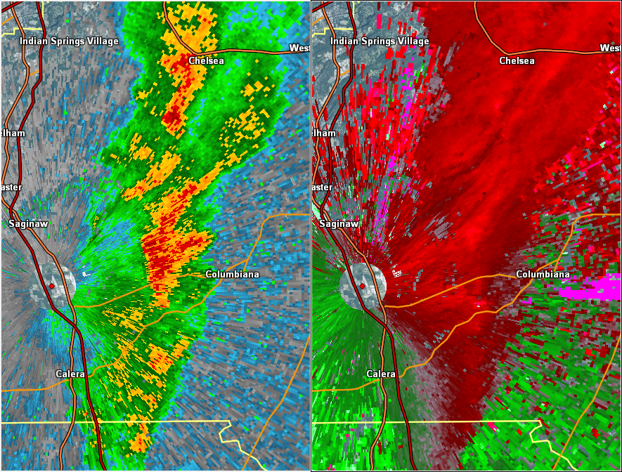
National Weather Service meteorologists surveyed damage in rural southern Shelby County just southwest of Columbiana and have determined that the damage was consistent with an EF-0 tornado. Maximum winds were estimated to be around 75 mph.
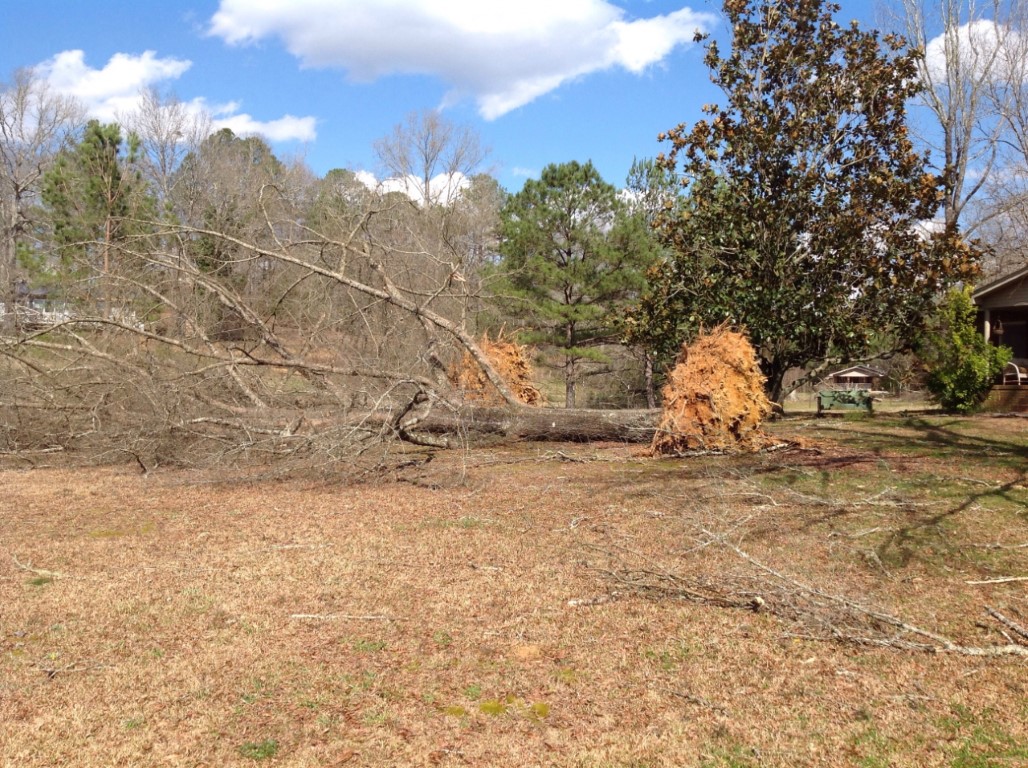
The tornado touched down along CR-97 near the intersection with CR-314. It then moved east-northeast over a largely rural and wooded area and crossed a small portion of CR-305 and Golden Rd before lifting along Peaceful Valley Rd. The majority of the damage consisted of snapped or uprooted trees. There was minor roof damage to a residence on CR-97, and a mobile home at the end of Golden Rd was partially shifted off its foundation.
|