|
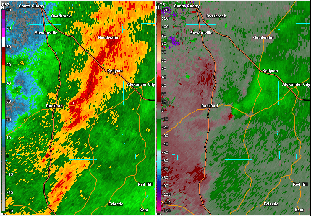
Event Summary
|
|
EF-1
|
|
Estimated Maximum Wind:
|
95 mph
|
|
Injuries/Fatalities:
|
None |
|
Damage Path Length:
|
5.01 miles
|
|
Maximum Path Width:
|
550 yards
|
|
Approximate Start Point/Time:
|
3 SE Rockford
32.8576/-86.1845
at 154 am
|
|
Approximate End Point/Time:
|
1 NNW Hwy 9 & Hwy 22
32.8804/-86.1032
at 201 am
|
NWS Meteorologists surveyed damage in Coosa County southeast of Rockford and determined it was the result of a tornado.
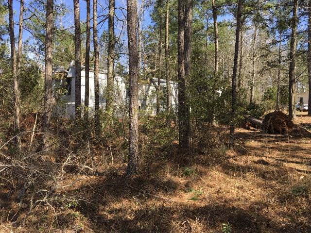
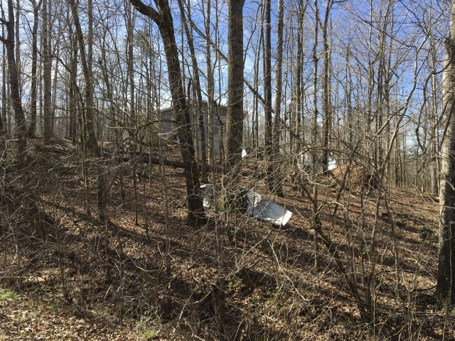
The tornado touched down initially in a grove of pine trees just east of County Road 40 in Coosa County, uprooting about a half dozen mature trees. It then traveled east-northeastward to Nixburg Rd, where several pines were uprooted, and a quarter of the metal roofing was peeled off a home. From there, the tornado continued across a wooded area in the Little Sam Jack Creek basin and then crossed County Road 30 and County Road 101. Numerous pines were uprooted or snapped in the area, and a few hardwoods were uprooted. The tornado path then crossed Alabama Hwy 22, where several pines and a hardwood were uprooted. One of the pines caused major damage to the corner of a manufactured home, and one uprooted hardwood grazed the front of another home causing minor damage. The tornado dissipated in the woods somewhere between Alabama Hwy 22 and Alabama Hwy 9.
|