National Weather Service United States Department of Commerce

Deer Trace EF-1 Tornado (Lowndes)
February 28, 2011


EF-1
Estimated Maximum Wind:
100-110 mph
Injuries/Fatalities:
None
Damage Path Length:
4.96 miles
Maximum Path Width:
200 yards
Approximate Start Point/Time:
4.2 WNW Tyson
32.2105/-86.5114
537 pm 
Approximate End Point/Time:
1.7 NE Tyson
32.1965/-86.4282
542 pm 

A National Weather Service Damage Assessment Team has surveyed the storm damage in Lowndes County and has determined that the damage was caused by a tornado.  

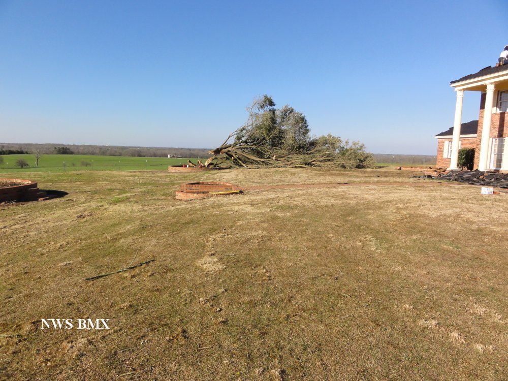
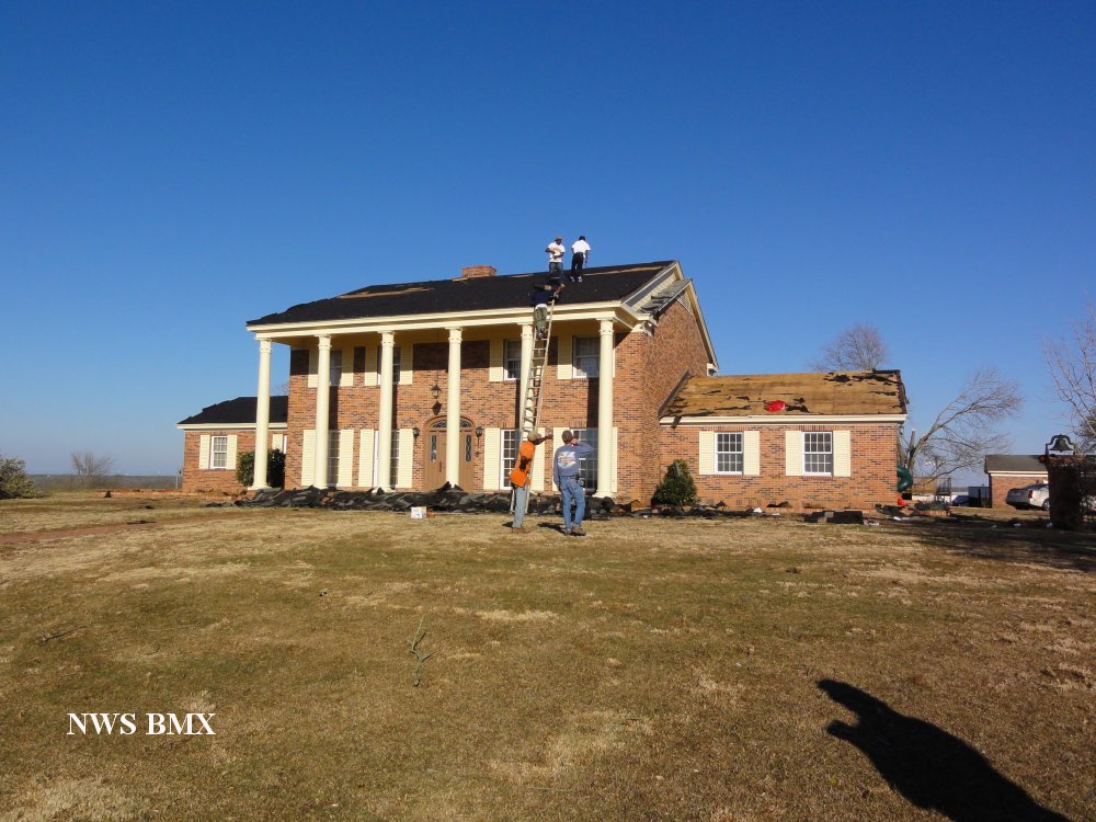
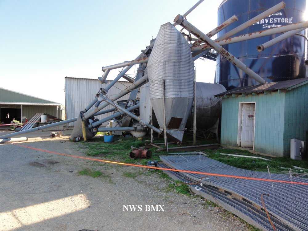
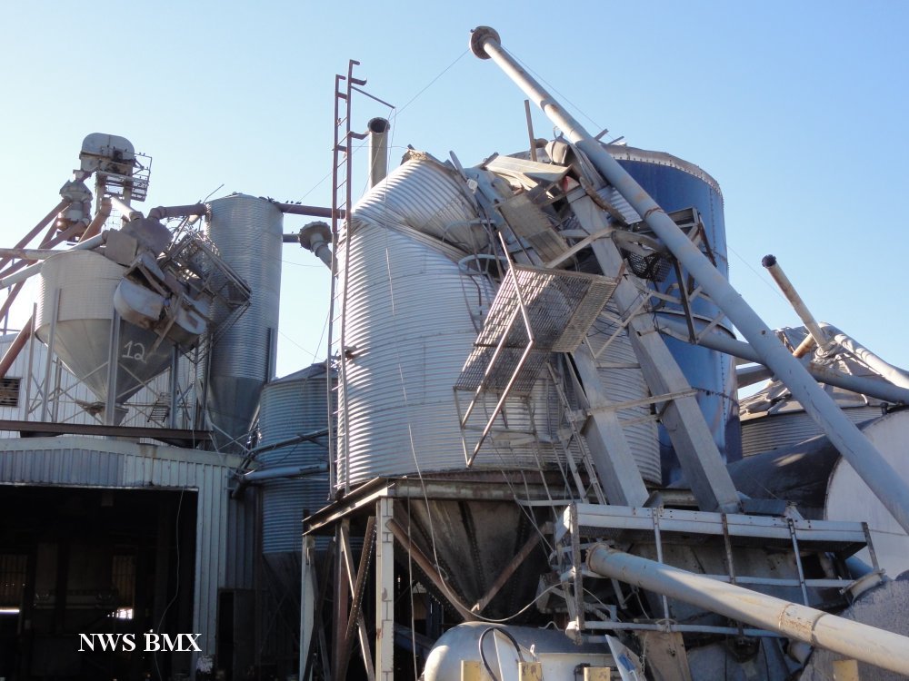
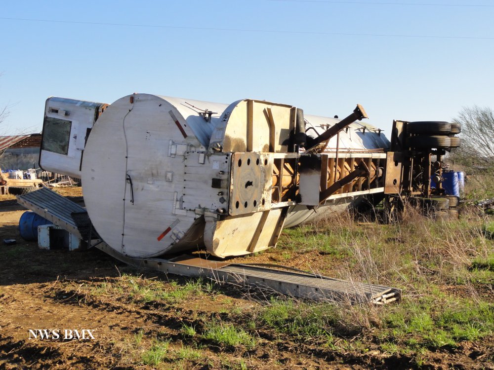
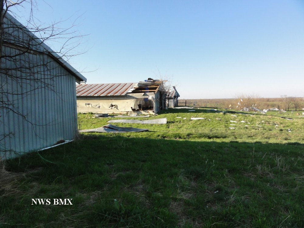
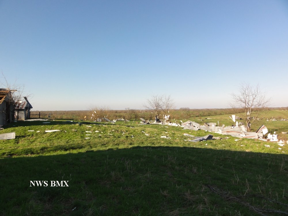
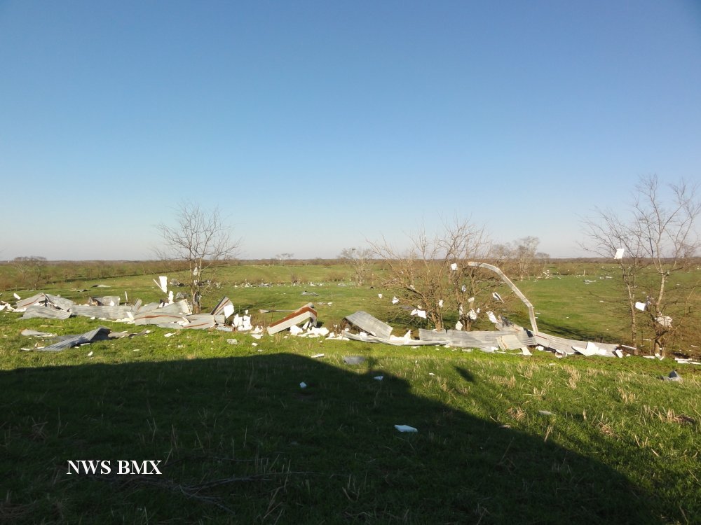
The tornado touched down just to the west of the intersection of Deer Trace Road and County Road 37. The tornado tracked to the southeast for almost 5 miles, crossed over the intersection of County Roads 26 and 5, and lifted just to the west of Interstate 65. Along the path, 5 grain elevators were destroyed, 3 chicken houses were damaged or destroyed and one home had nearly total roof removal on the windward side. Numerous trees were snapped, including a healthy live oak snapped at the base.


Damage and Debris

Old Oak Tree Snapped Off


Damage and Debris

Roof Damage


Damage and Debris

Grain Silo Damage


Damage and Debris

Grain Silo Damage


Damage and Debris

Trailer Overturned


Damage and Debris

Roof Damage


Damage and Debris

Debris


Damage and Debris

Debris Field