Lowndes & Montgomery County Tornado - March 1, 2007
EF-2
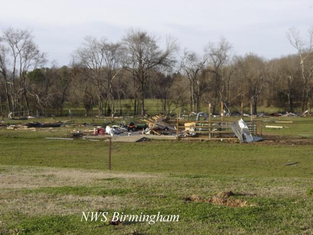
National Weather Service meteorologists surveyed significant storm damage in southeastern Lowndes County and southwest Montgomery County. The damage was the result of a tornado. The tornado has been rated an EF-2 on the Enhanced Fujita Scale with estimated maximum winds of 135 mph.
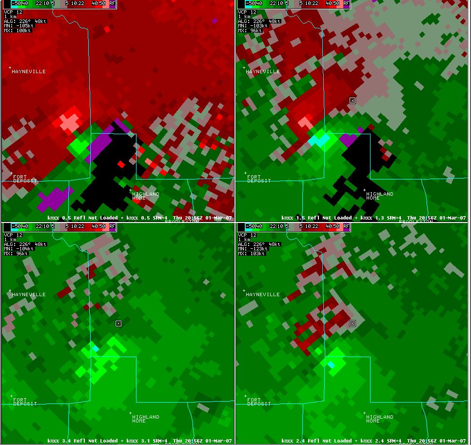
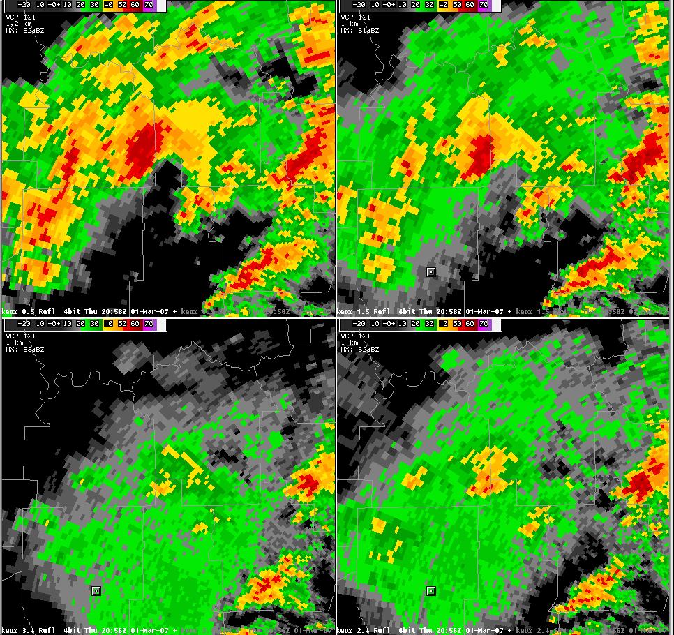
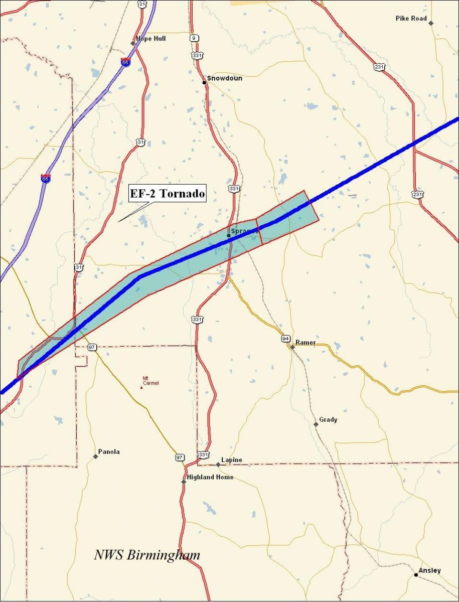
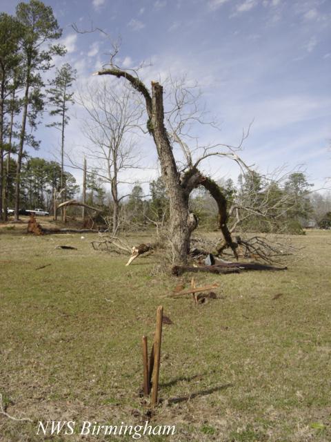
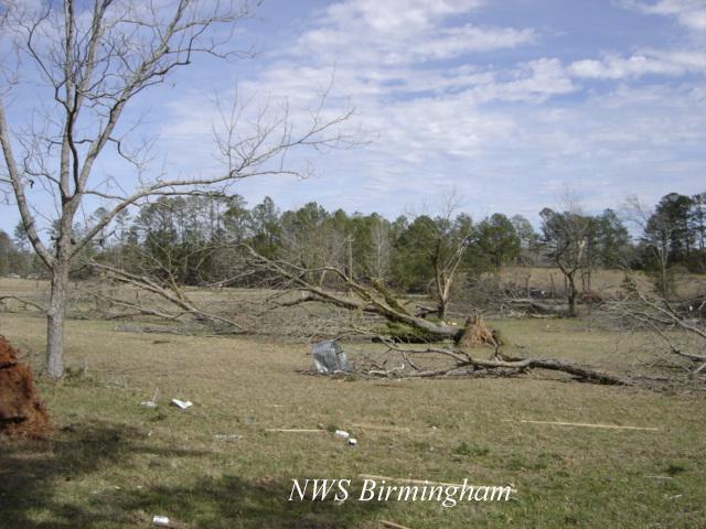
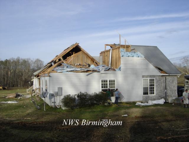
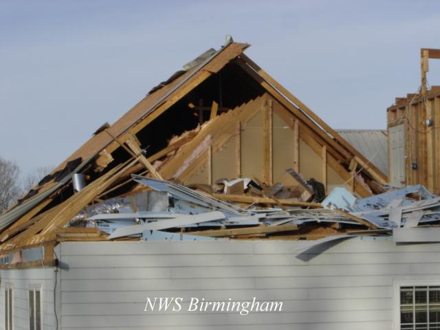
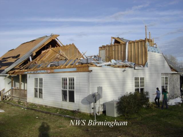
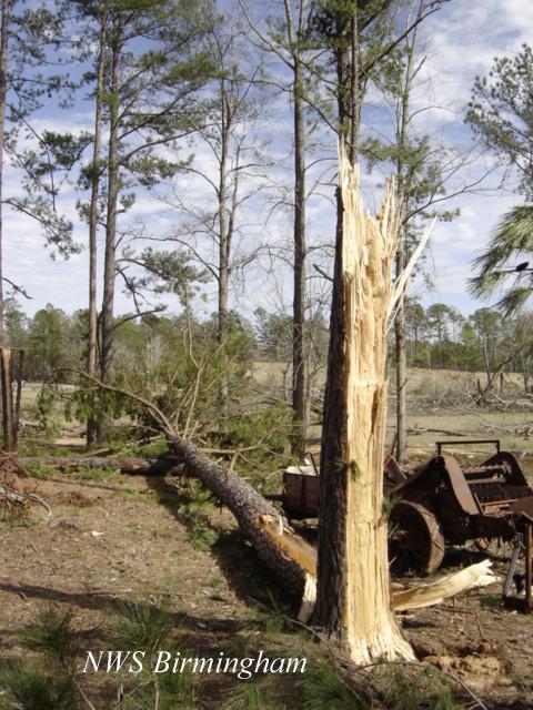
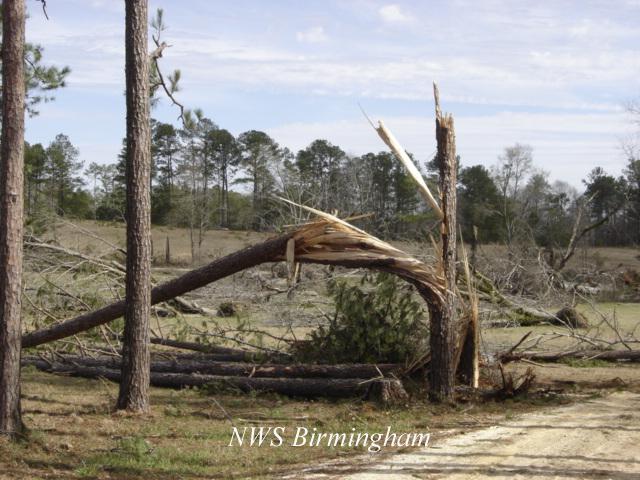
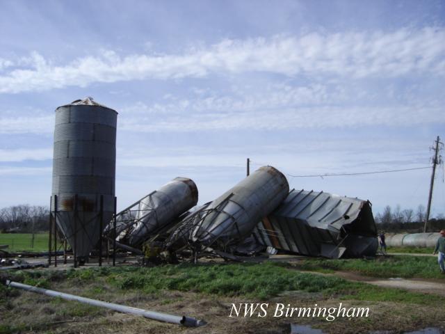
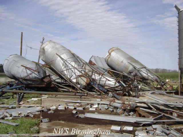
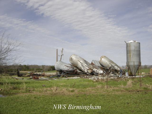
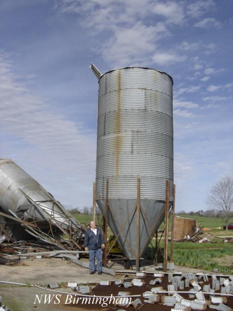
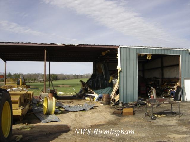
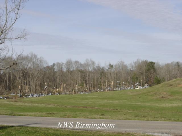
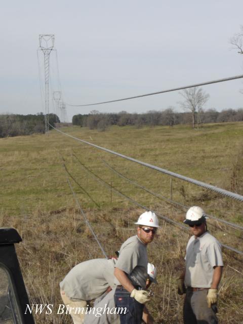
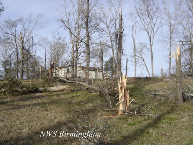
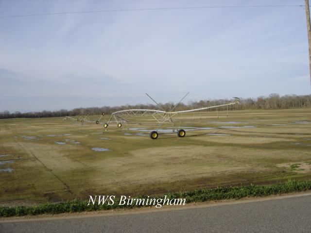
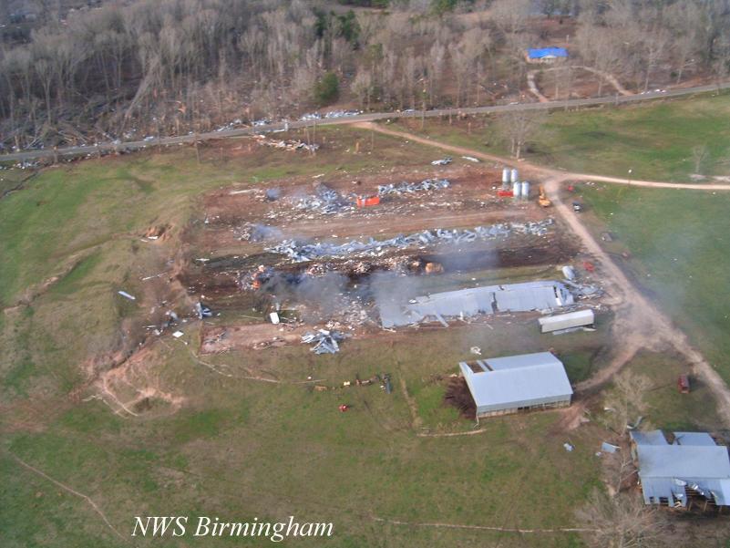
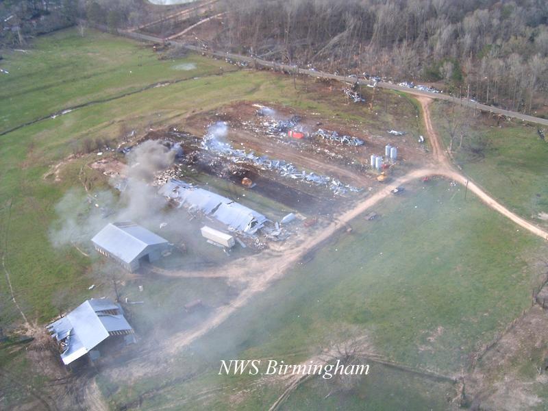
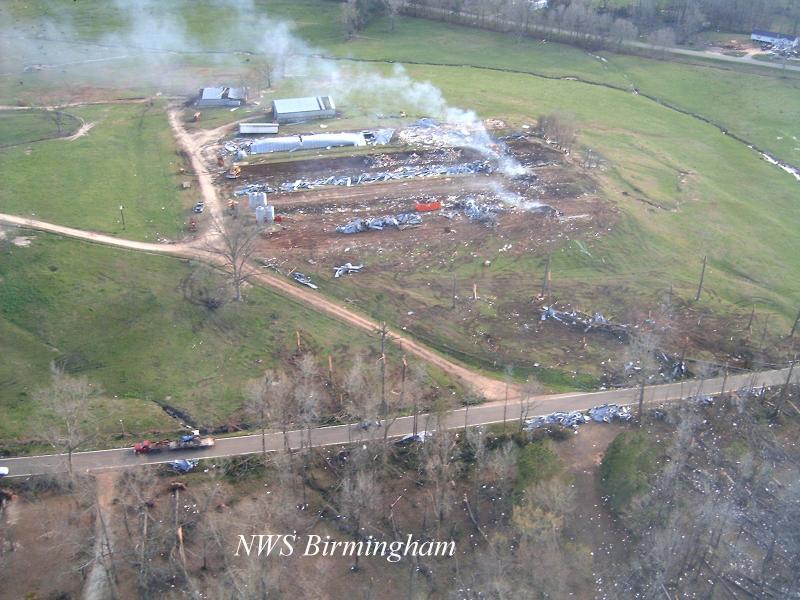
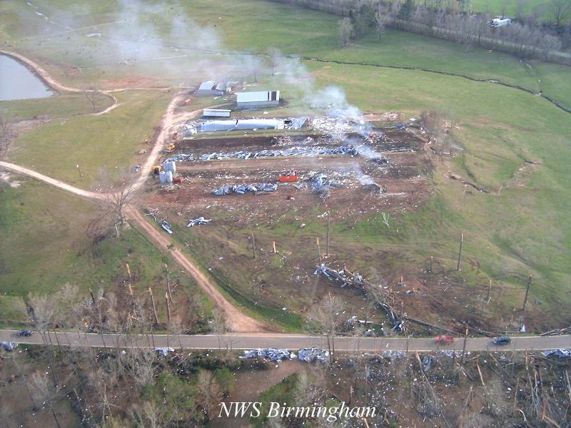
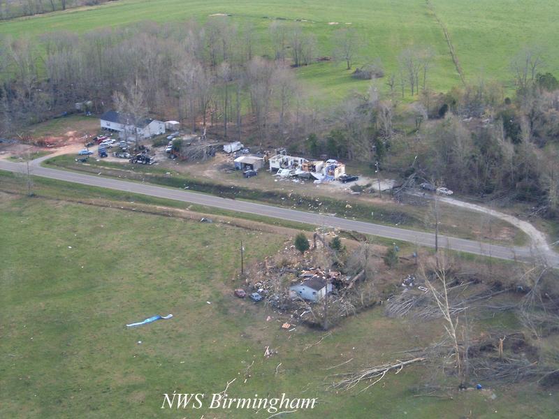
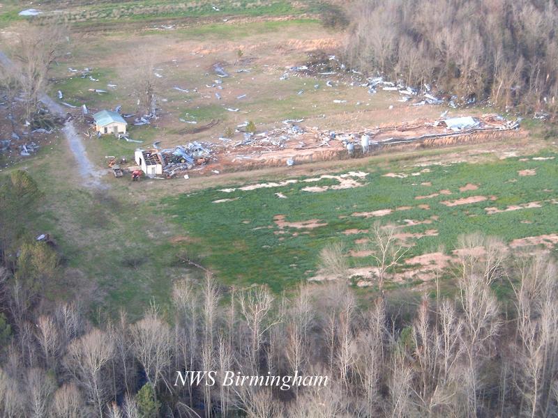
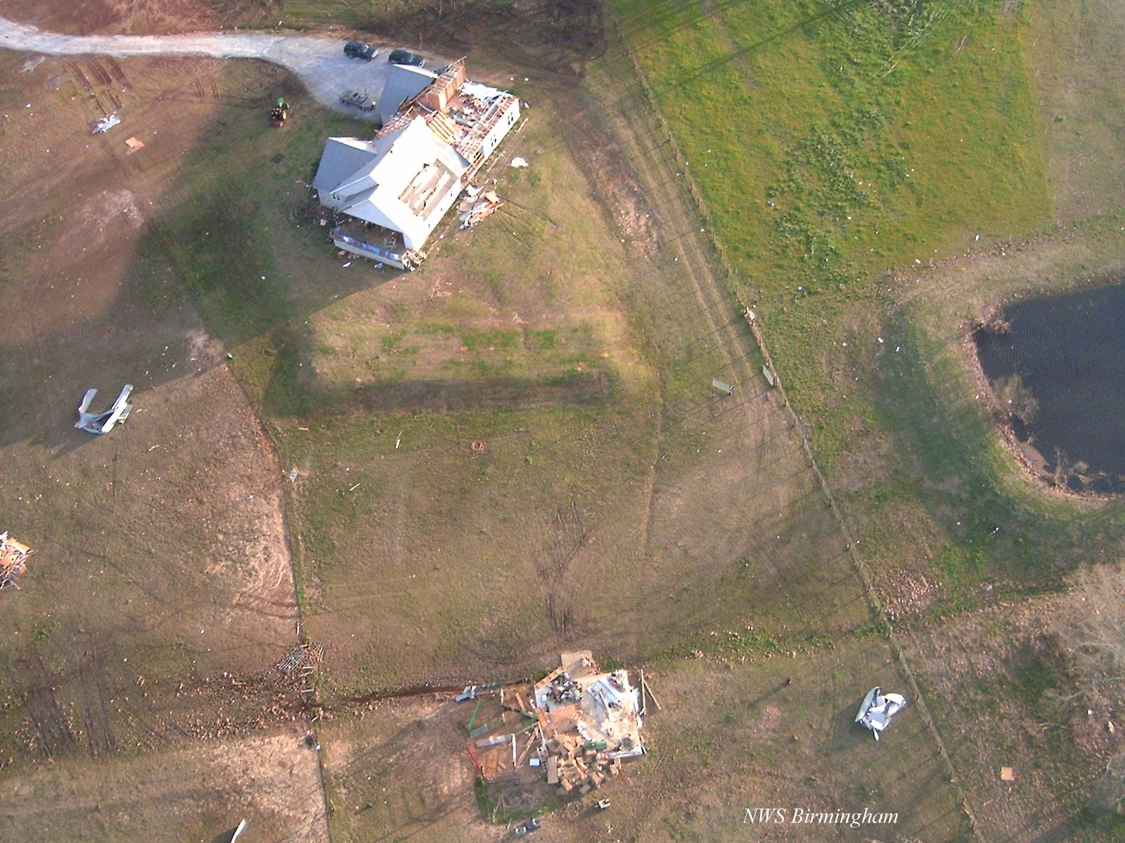
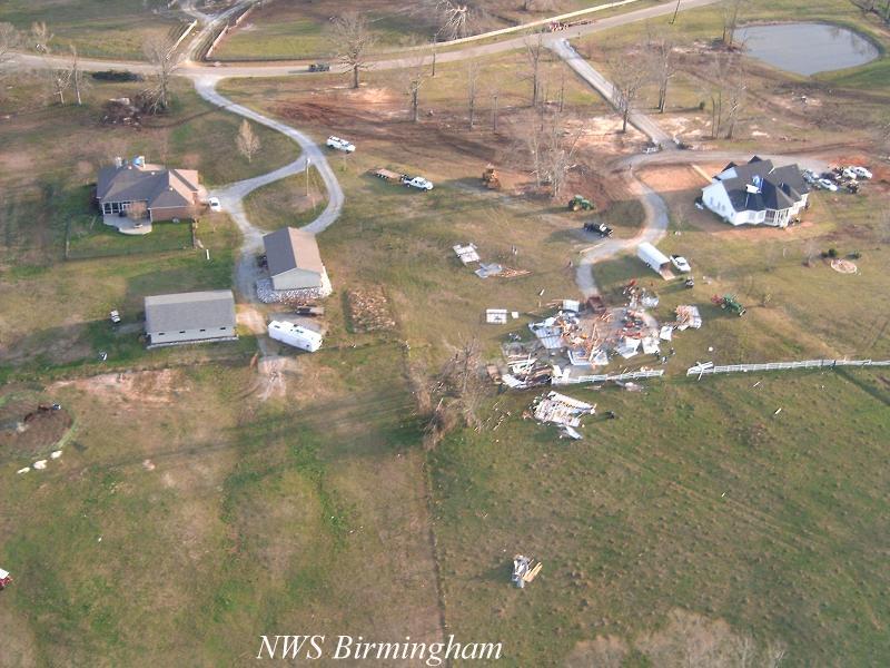
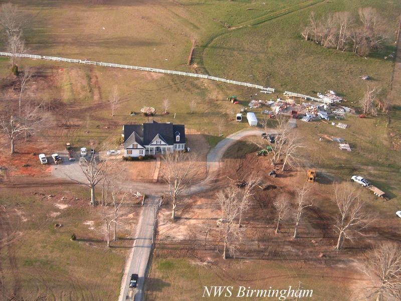
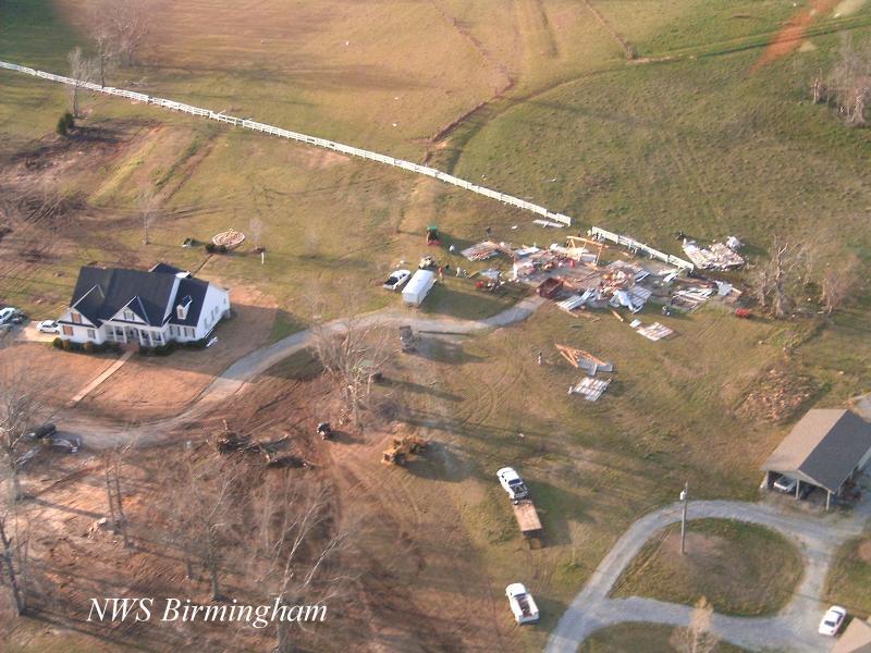
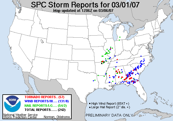
A large tornado touched down in far southeastern Lowndes County...along US Highway 31 in the Sandy Ridge Community. The tornado tracked northeastward and affected the Sandy Ridge community, the Davenport community, the Fleta community, Ada, Sprague and the Ridgeland Farm subdivision. The tornado lifted just east of US Highway 231 near the Carters Hill community. Six minor injuries were reported with the tornado. Two of the injuries occurred when an automobile was thrown off the road over 300 feet. At least 39 homes suffered varying degrees of damage. Three of the homes were completely destroyed. At least 23 out-buildings or barns were damaged. Five large chicken houses were completely obliterated near the Davenport community. One high voltage power transmission line was totally destroyed. Fourteen grain silos were destroyed. Four of the grain silos were picked up and thrown up to one half of a mile away from where they were anchored. At least 10 automobiles were significantly damaged. Hundreds of trees were snapped off or uprooted along the damage path. The damage path was approximately 26.8 miles long and 600 yards wide at its widest point. Maximum sustained winds were estimated at 135 mph. The tornado was on the ground from 248 PM CST until 326 PM CST. A Tornado Warning was in effect for Lowndes County from 220 PM CST valid until 300 PM CST. A Tornado Warning was in effect for Montgomery County from 211 PM CST valid until 345 PM CST. All of central Alabama was outlooked for a High Risk of Severe Thunderstorms including the chance of violent tornadoes. A Tornado Watch was valid from 730 AM CST until 8 PM CST.
Click on the images below for larger picture. The shading on the tornado damage path map indicates areas of the most significant damage.
The National Weather Service would like to thank the Lowndes County Emergency Management Agency, the Alabama State Troopers and Alabama Power for providing support during the storm survey process.
|
|
||||||||||||||||||||||||||||||||||||||||||||