|
Event Summary
|
|
EF-1
|
|
Estimated Maximum Wind:
|
90 mph
|
|
Injuries/Fatalities:
|
None |
|
Damage Path Length:
|
10.10 miles
|
|
Maximum Path Width:
|
500 yards
|
|
Approximate Start Point/Time:
|
Shottsville
34.2608/-88.1254
at 954 PM CST
|
|
Approximate End Point/Time:
|
2 SW Pigeye
34.2841/-87.9513
at 1007 PM CST
|
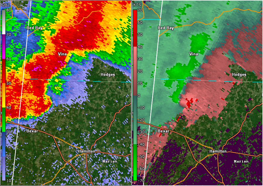
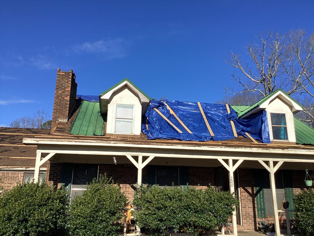
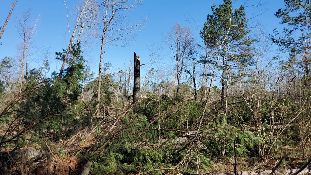
Storm damage was surveyed east of Shottsville and determined to be consistent with an EF1 tornado with 90 mph peak winds. The tornado began near the Shottsville Community Church along County Road 56 where it produced minor damage to the exterior of the church building. From there, the tornado continued east northeast before reaching Reid Road where a higher degree of damage was first noted. There were multiple uprooted softwood trees in a broad area stretching from Reid Road to AL-19. There was also a home on Reid Road which sustained damage to its metal roof, and a large tree fell on top of a barn in the backyard. While the degree of surrounding tree damage was noteworthy, several homes within the path on AL-19 were undamaged. The tornado continued east-northeast uprooting several softwood trees along Triplett Rd and producing a more concentrated area of uprooted and snapped softwood trees along County Road 317 which prompted the EF1 rating. The tornado eventually reached Nichols Cemetery Road where it appeared to be weakening as the damage mostly consisted of broken large branches. However, upon reaching County Road 178 the tornado uprooted multiple softwood trees before lifting shortly thereafter in a wooded area east of County Road 178.
The data is PRELIMINARY and may be subject to change.
|