|
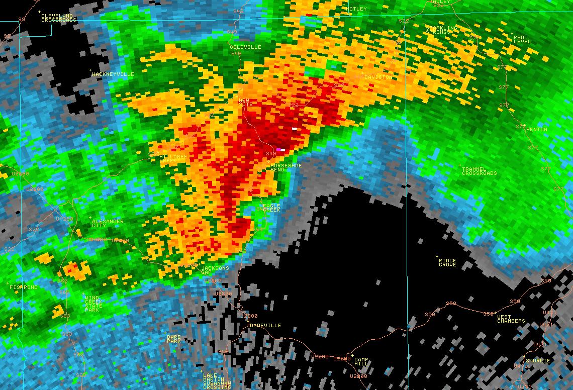
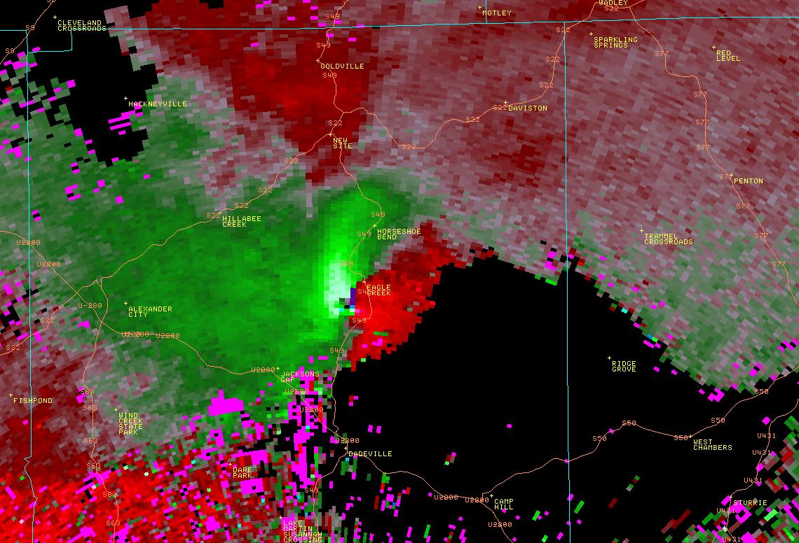
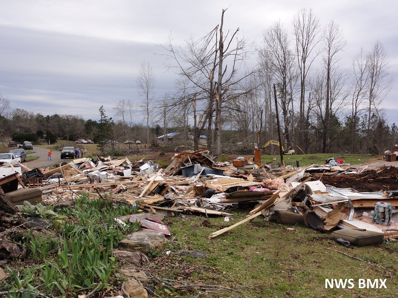
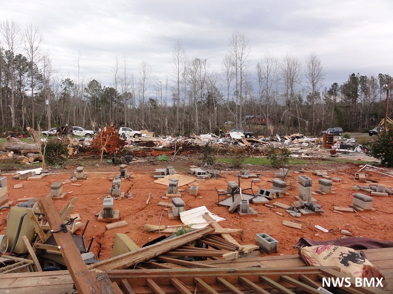
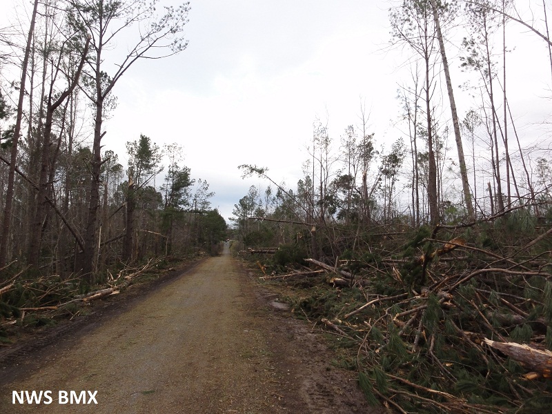
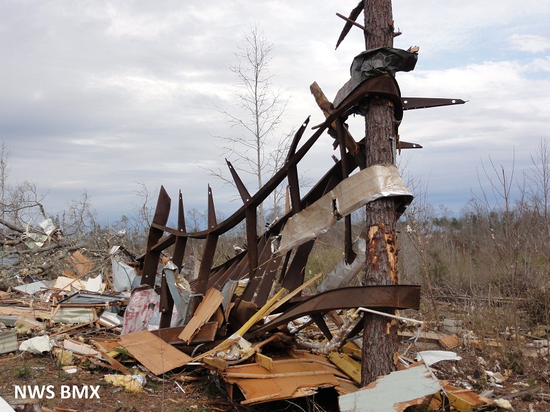
National Weather Service meteorologists have surveyed the damage in Tallapoosa and Chambers Counties and determined that it was the result of an EF2 tornado. The tornado began just west of Highway 63 in western Tallapoosa County, where it uprooted and snapped scores of trees. It continued northeastward and passed just north of Wind Creek State Park, where it produced significant and widespread tree damage between Highway 128 and the shores of Lake Martin. The tornado caused significant damage to several homes in the Pineywoods area. It then crossed Lake Martin and came ashore in the River Bend subdivision, where it again snapped or uprooted hundreds of trees. The tornado crossed Highway 280 just west of Midway and produced minor tree damage and then continued east-northeastward where it passed north of Jacksons Gap. As it tracked just south of Eagle Creek, the tornado path widened to over one quarter mile. It destroyed one double-wide and three single-wide manufactured homes in this location. The occupants of the double-wide evacuated the home prior to the destruction of their home and safely rode out the storm in a sturdy shelter. As the storm crossed AL Highway 49, it lofted and destroyed a single-wide and caused the storm`s only fatality. The tornado path broadened to approximately 1000 yards as it crossed Elder Road. Farther to the east, approximately 14 homes received mainly roof damage and scores of trees were snapped or uprooted on Buttston Road just north of Denver Road. The tornado continued into eastern Tallapoosa County. Due to the erratic damage pattern, it appeared that there were multiple vortices and this caused pockets of more intense damage within the broad circulation. The broad circulation continued into western Chambers County, where it maintained a half mile path width as it crossed County Road 55 near Sandy Creek as a strong 120 mph EF2. Thousands of hardwood and softwood trees were uniformly snapped across this path with a more definitive core to the track at this ocation. After it crossed Chattahospee Creek, it passed just north of Trammel Crossroads, where a single-wide manufactured home was destroyed. The tornado began to weaken and narrow as it continued into central Chambers County before it lifted along County Road 160, about 2 miles northwest of U.S. Highway 431.
Tornado Warnings were in effect from 1034 pm until 1145 pm.
Tornado Watches were in effect from 435 pm until 5 am.
|