NWS Meteorologists surveyed damage in southwestern Autauga County and determined it was the result of a tornado.
A brief tornado touched down just to the west of County Road 33 northwest of Autaugaville. It traveled northeast paralleling County Road 33 for a short distance before lifting. Only tree damage was observed along the path with several trees uprooted and some large limbs broken.
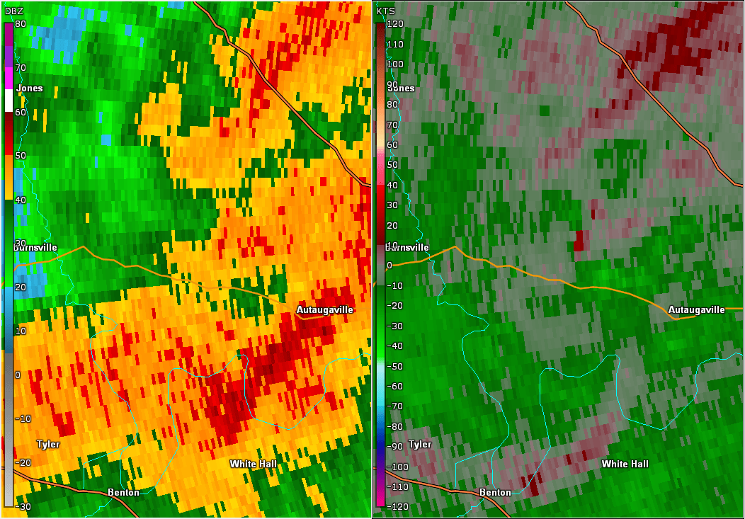
Reflectivity (left) and velocity (right) of the tornado as it touched down.
Images are from KMXX at 119 pm.