|
Event Summary
|
|
EF-1
|
|
Estimated Maximum Wind:
|
100 mph
|
|
Injuries/Fatalities:
|
None |
|
Damage Path Length:
|
7.09 miles
|
|
Maximum Path Width:
|
250 yards
|
|
Approximate Start Point/Time:
|
4 S Dawson Mill
32.5282/-86.7880
at 844 pm
|
|
Approximate End Point/Time:
|
1 SSW Vida Junction
32.5665/-86.6841
at 855 pm
|
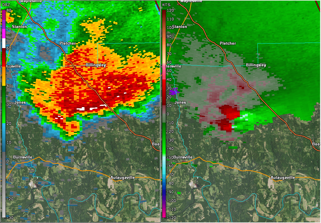
NWS Meteorologists surveyed damage in western Autauga County and determined it was the result of a tornado.
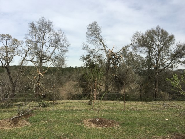
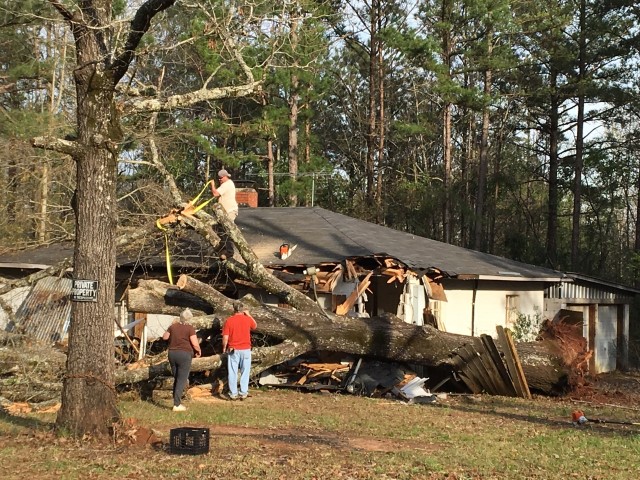
The tornado touched down just west of County Road 15, near the intersection of County Road 45. This location is about 10 miles northwest of Autaugaville. A few homes suffered minor roof damage and several trees were uprooted or were snapped off. The tornado moved northeast along County Road 15 and damaged numerous trees. The tornado turned eastward and crossed County Road 38, County Road 40, County Road 79, and County Road 137. Trees were downed along the way. The tornado weakened and narrowed east of County Road 137 and then lifted before it crossed US Highway 82. The end location is about 8 miles northwest of Booth. Much of the damage was confined to trees along the path. Some path adjustments may be made after some drone footage is reviewed.
Special thanks to the Autauga County EMA for their assistance in the survey.
|