|
Event Summary
|
|
EF-0
|
|
Estimated Maximum Wind:
|
70 mph
|
|
Injuries/Fatalities:
|
None |
|
Damage Path Length:
|
4.38 miles
|
|
Maximum Path Width:
|
75 yards
|
|
Approximate Start Point/Time:
|
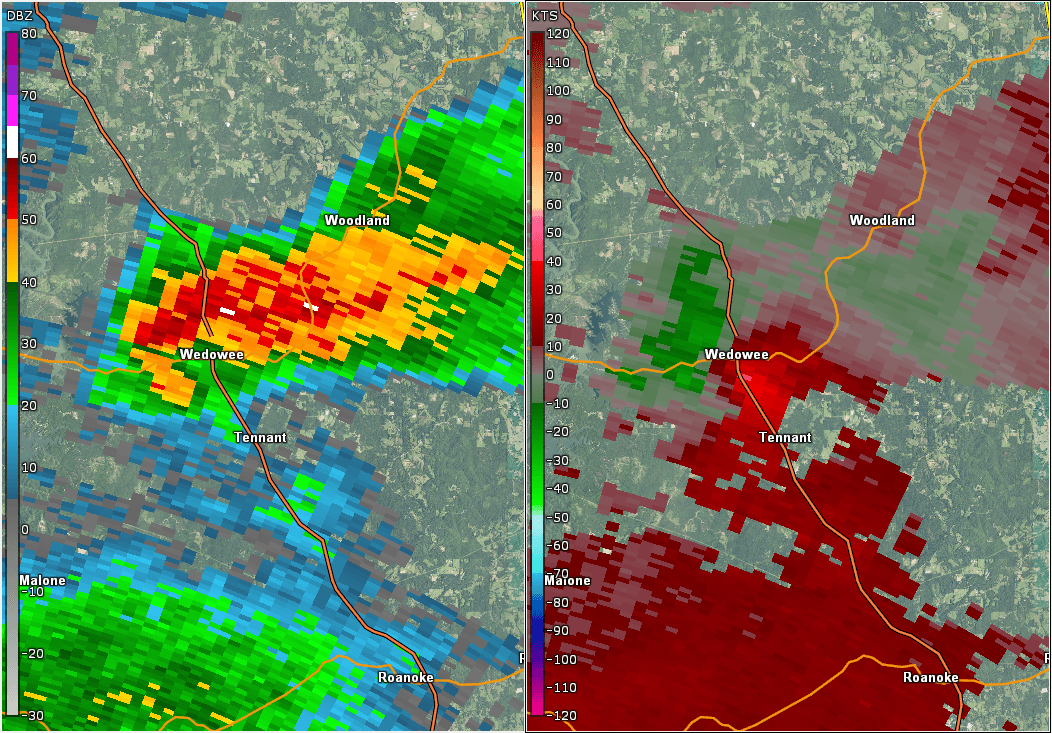
1 SSW Wedowee
33.2979/-85.4907
at 1000 pm
|
|
Approximate End Point/Time:
|
3 SSW Woodland
33.3342/-85.4290
at 1009 pm
|
NWS Meteorologists surveyed damage in central Randolph County and determined it was the result of a tornado.
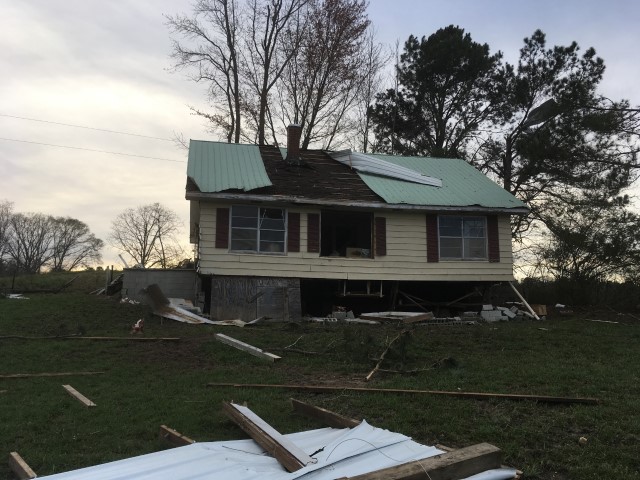
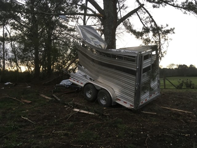
The same supercell that produced 3 previous EF-0 tornadoes in Chilton and Coosa Counties, produced a fourth EF-0 tornado in the Wedowee area. Damage was very spotty/isolated, suggestive of a fairly weak circulation from a pasture area just off County Road 15 and Main Street South, northeast to the Highway 48 and County Road 56 intersection area. A barn/outbuilding was destroyed along with roofing damage done to the corner of one of five chicken houses, with no tree damage nearby. This further points toward a weak circulation that as only able to damage vulnerable structures with wind entry/uplift points. The tornado damage path was 4.38 miles long and was 75 yards wide at its widest point.
|