|
Event Summary
|
|
EF-2
|
|
Estimated Maximum Wind:
|
115 mph
|
|
Injuries/Fatalities:
|
2 injuries |
|
Damage Path Length:
|
5.08 miles
|
|
Maximum Path Width:
|
1000 yards
|
|
Approximate Start Point/Time:
|
4 ENE Edmund Pettus Bridge
32.4240/-86.9542
at 12:32 pm CDT
|
|
Approximate End Point/Time:
|
Burnsville
32.4769/-86.8952
at 12:45 pm CDT
|
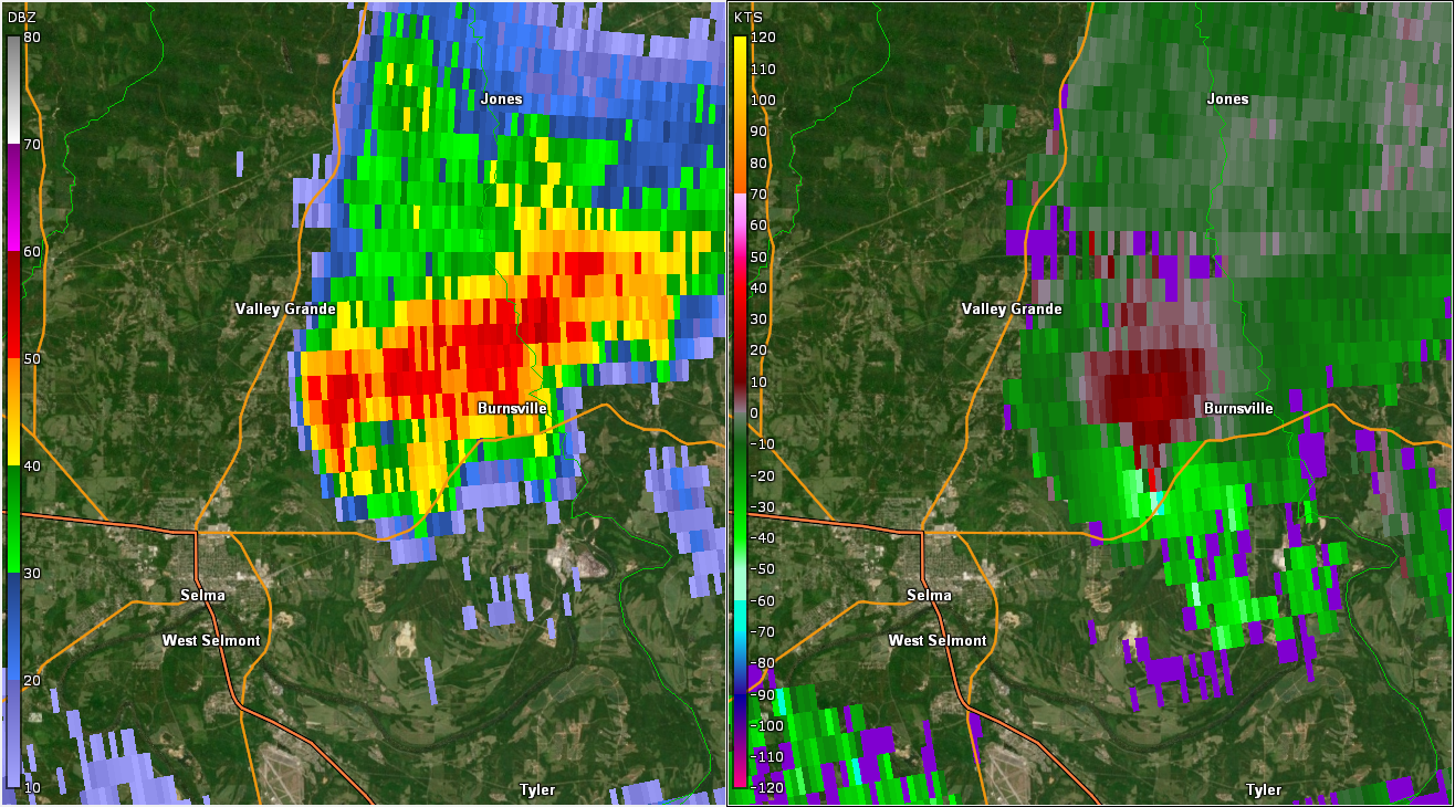
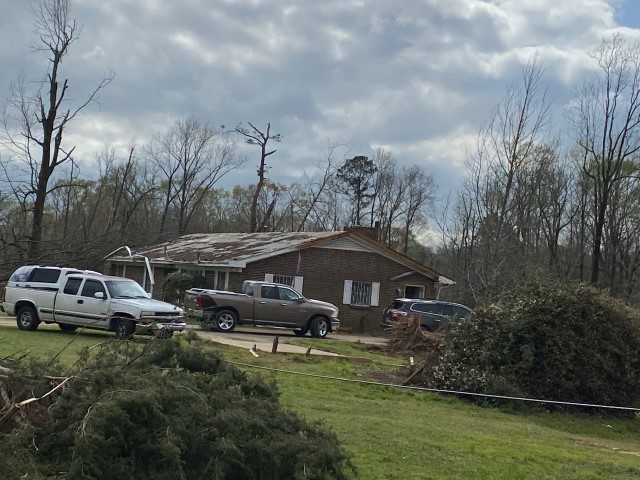
National Weather Service meteorologists surveyed the damage in Northeastern Dallas County and determined it was the result of an EF-2 tornado.
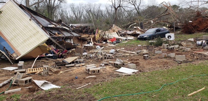
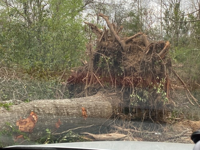
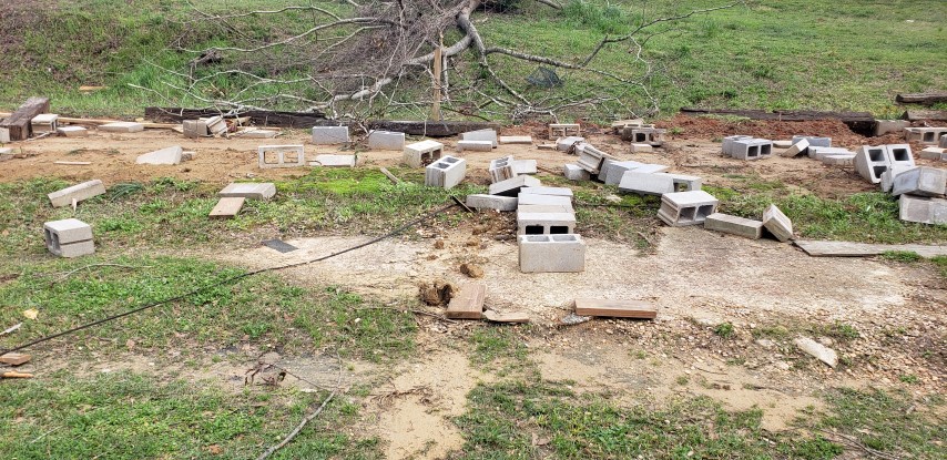
A tornado touched down just southwest of Brantley in Dallas County early Wednesday afternoon. The tornado first touched down near Water Avenue just south of State Road 14 initially producing minor tree damage. The tornado quickly intensified snapping and uprooting large stands of hardwood trees as it moved into the Burnsville community. Near State Road 14 and County Road 871, a well built home sustained structural damage including the loss of a carport, roof damage, broken windows, and partial loss of one wall structure. An unanchored manufactured home next door was completely destroyed with the remaining contents blown across the road and scattered over 100 yards. A vehicle at this residence was rolled and sustained damage. Based on this damage, the tornado was rated EF-2 with maximum winds of around 115 mph. The tornado continued to move rather slowly off to the northeast causing additional trees to fall. Several additional homes along the path sustained structural damage of mainly roof uplift and loss of shingles. Another manufactured home with some anchoring was rolled and blown apart on the north side of State Road 14. There were two occupants inside the home who were sheltering. They survived and crawled out with minor injuries. Further northeast along State Road 14, a two story home sustained structural damage from the tornado along with additional damage from falling trees. Here very large hardwood trees were snapped near the base. A motorist trying to evade the tornado attempted to take shelter here and narrowly missed a large falling tree. At this point the tornado was likely at its widest reaching nearly 1000 yards. The tornado crossed State Road 14 moving into a mostly forested area producing additional significant tree damage before crossing County Road 261. Here a wide sway of trees and power lines were downed. The tornado finally weakened and lifted before reaching County Road 880.
|