|
Event Summary
|
|
EF-1
|
|
Estimated Maximum Wind:
|
110 mph
|
|
Injuries/Fatalities:
|
None |
|
Damage Path Length:
|
1.93 miles
|
|
Maximum Path Width:
|
670 yards
|
|
Approximate Start Point/Time:
|
2 W Morvin
31.9900/-88.0225
at 4:34 pm CDT
|
|
Approximate End Point/Time:
|
2 NNW Morvin
32.0107/-88.0003
at 4:40 pm CDT
|
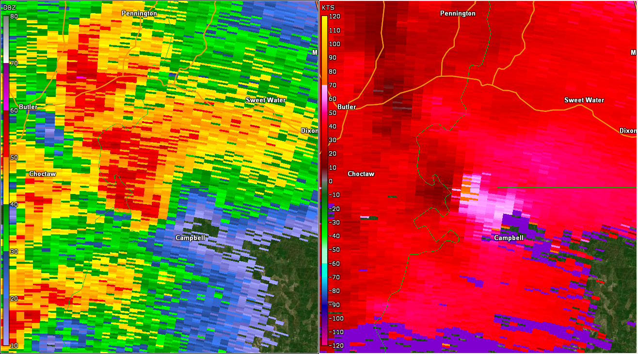
National Weather Service meteorologists surveyed the damage in Southwestern Marengo County and determined it was the result of an EF-1 tornado.
This long track tornado began in the NWS Mobile forecast area and traveled almost 35 miles through Wayne, Choctaw, and Clarke Counties as an EF-2 tornado. It weakened to an EF-1 tornado as it crossed into Marengo County. It continued to snap and uproot numerous trees as it crossed Highway 69. The tornado dissipated in a wooded area northeast of Highway 69. The tornado damage path in Marengo County was 1.93 miles long and was 670 yards wide at its widest point. The maximum winds noted in Marengo County were estimated around 110 mph.
|