National Weather Service United States Department of Commerce


Rosa EF-1 Tornado (Blount County)
  March 17, 2021


Event Summary

EF-1
Estimated Maximum Wind:
100 mph
Injuries/Fatalities:
None
Damage Path Length:
12.89 miles
Maximum Path Width:
300 yards
Approximate Start Point/Time:
2 S Fairview
33.9227/-86.5587
at 5:43 pm CDT
Approximate End Point/Time:
2 ENE Hendrix
34.0614/-86.4172
at 6:05 pm CDT


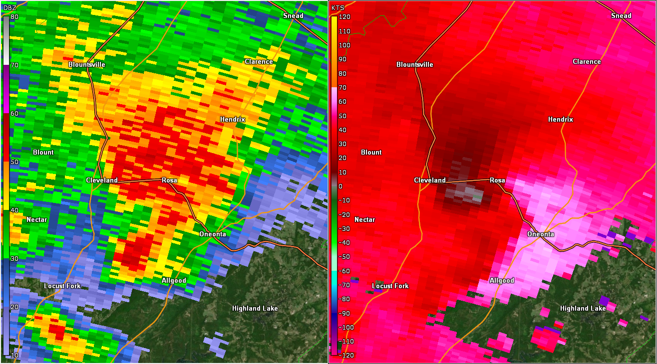
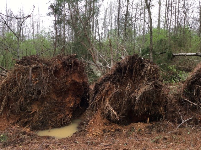
National Weather Service meteorologists surveyed the damage in just north of Oneonta in Blount County and determined it was the result of an EF-1 tornado.

The tornado began near Tim King Road along Hunt Mountain. It moved northeast and crossed Highway 231 and ended along Wilson Chapel Road. Damage consisted mainly of snapped and uprooted trees. The tornado then crossed Wilson Chapel Road where it snapped a couple of trees and rolled a camper at a residence before dissipating. The tornado damage path was 12.89 miles long and was 300 yards wide at its widest point. The maximum winds were estimated around 100 mph. 


Radar Image
Reflectivity (left) and velocity (right) of the circulation during the time of the tornado.
Images are from KBMX at 5:51 pm CDT.


Damage Photo

 Trees Uprooted & Snapped


Damage Photo

  Trees Uprooted & Snapped


Back to Main Event Page