|
Event Summary
|
|
EF-1
|
|
Estimated Maximum Wind:
|
110 mph
|
|
Injuries/Fatalities:
|
None |
|
Damage Path Length:
|
2.77 miles
|
|
Maximum Path Width:
|
650 yards
|
|
Approximate Start Point/Time:
|
1 W Maytown
33.5371/-87.0217
at 4:30 pm CDT
|
|
Approximate End Point/Time:
|
2 NNW Mulga
33.5684/-86.9937
at 4:38 pm CDT
|
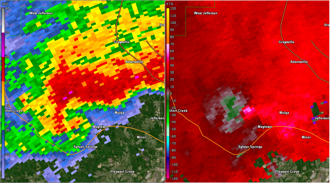
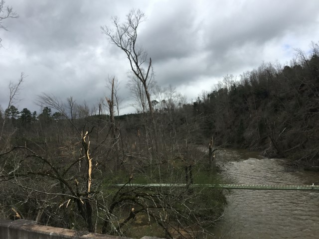
National Weather Service meteorologists surveyed the damage in Jefferson County and determined it was the result of an EF-1 tornado.
Trees were snapped and uprooted, with relatively minor structural damage. The tornado touched down along Crocker Road. At a landfill along Porter Road, several garage doors were blown in, a tractor trailer was blown over, and an outbuilding was destroyed. The tornado reached its maximum intensity where Shady Grove Road crosses Village Creek, snapping numerous trees. The tornado continued into an inaccessible wooded area near Bayview Lake and dissipated prior to reaching Hazelwood Road. This was the second tornado produced by this supercell. The tornado damage path was 2.77 miles long and was 650 yards wide at its widest point. The maximum winds were estimated around 110 mph.
|