|
Event Summary
|
|
EF-0
|
|
Estimated Maximum Wind:
|
70 mph
|
|
Injuries/Fatalities:
|
None |
|
Damage Path Length:
|
0.13 miles
|
|
Maximum Path Width:
|
75 yards
|
|
Approximate Start Point/Time:
|
4 WSW Oak Grove
32.6004/-86.6099
at 8:35 pm CDT
|
|
Approximate End Point/Time:
|
4 WSW Oak Grove
32.6013/-86.6080
at 8:36 pm CDT
|
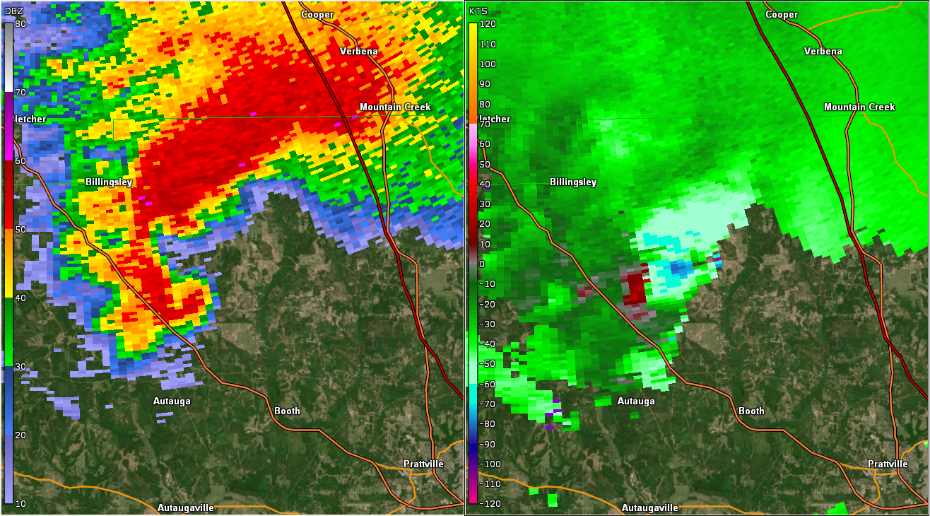
National Weather Service meteorologists surveyed the damage in south of White City in Autauga County and determined it was the result of an EF-0 tornado.
The tornado briefly touched down along County Road 43 just west of County Road 21 where a metal outbuilding was destroyed, a couple of softwood trees were snapped, and large branches were broken. The tornado also caused damage to a nearby carport which was lofted into an open field. Then the tornado continued northeast into an open pasture where it lifted. The tornado damage path was 0.13 miles long and was 75 yards wide. The maximum winds were estimated around 70 mph.
|