National Weather Service United States Department of Commerce

Tornadoes of March 19, 2018

Event Summary for Central Alabama

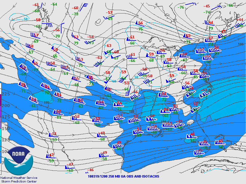
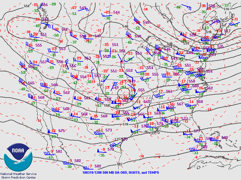
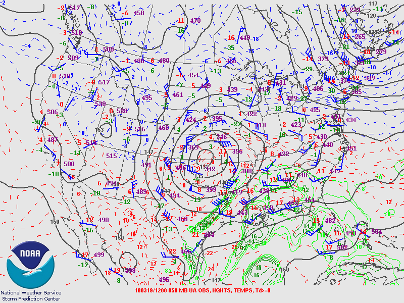
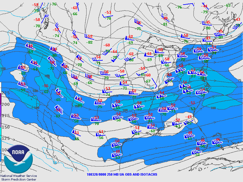
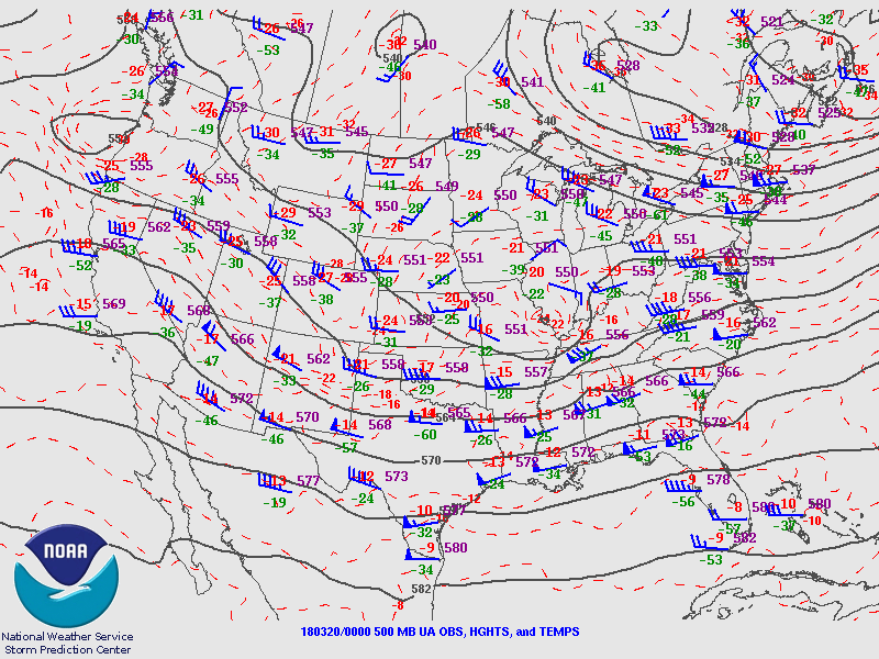
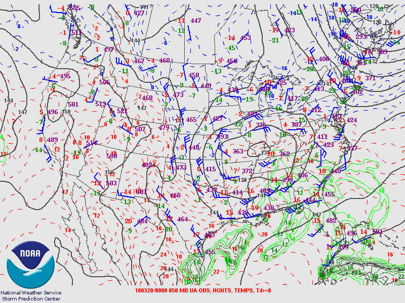
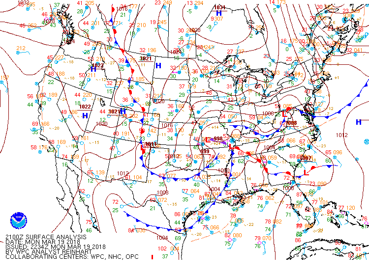
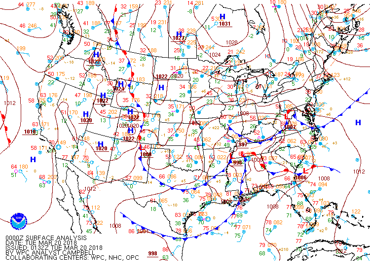
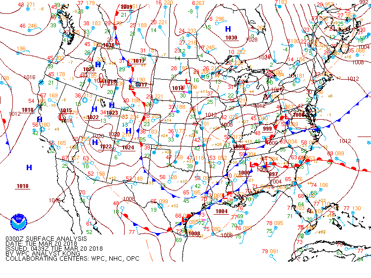
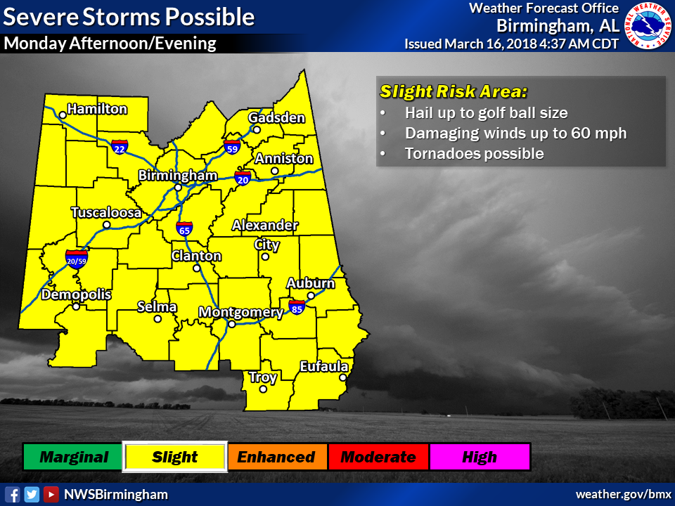
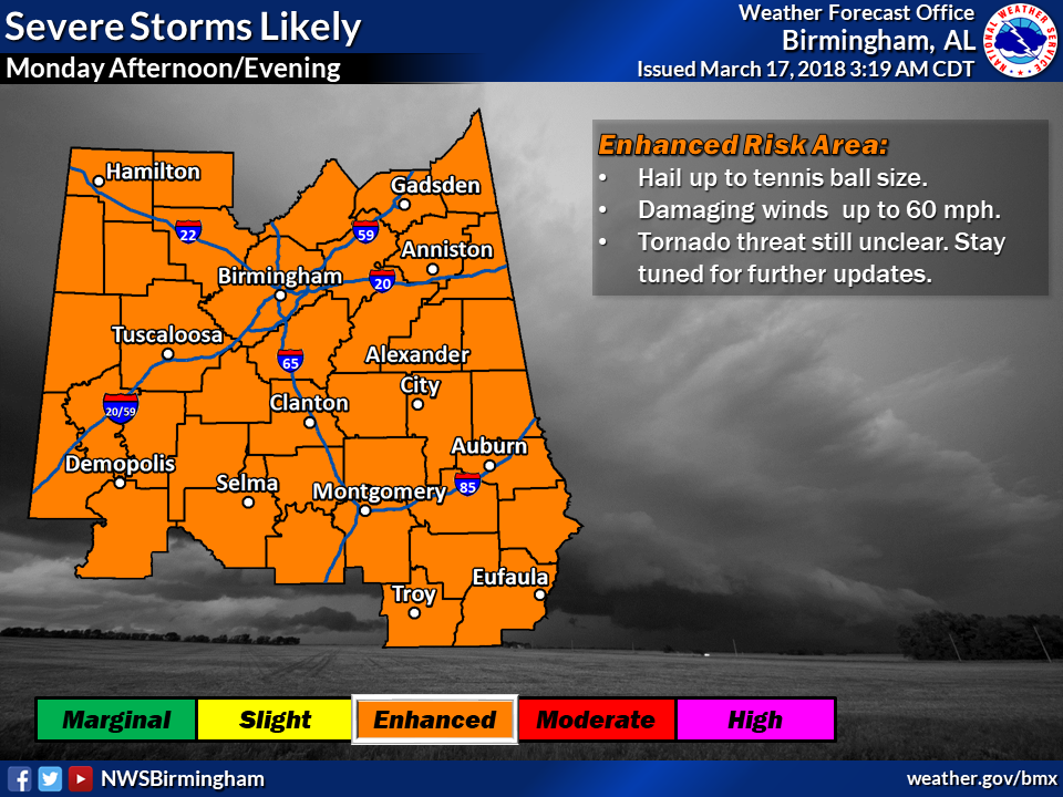
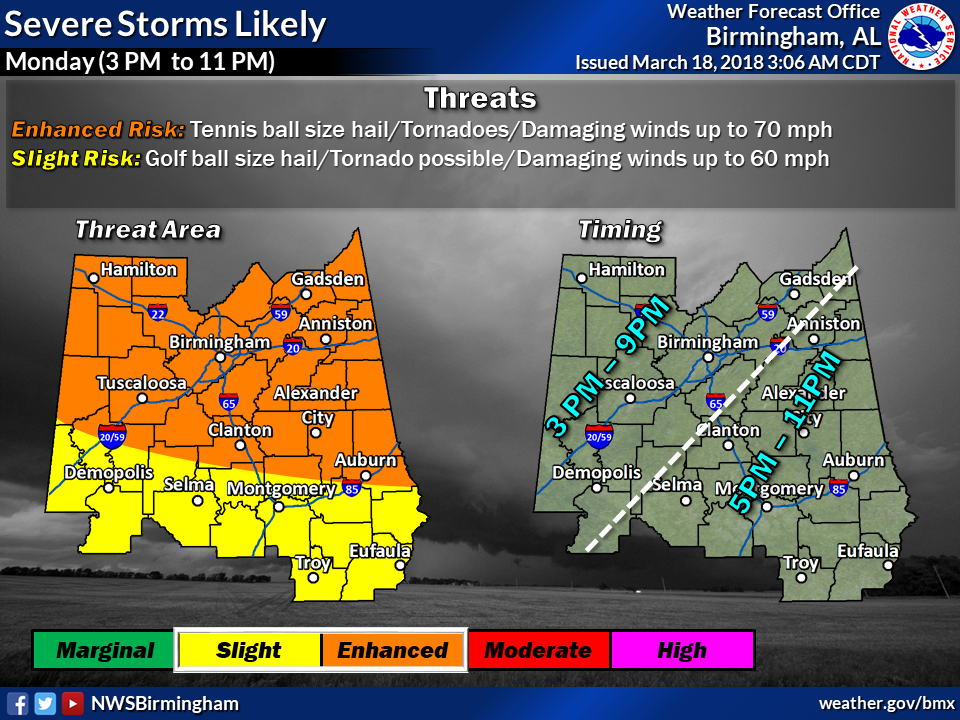
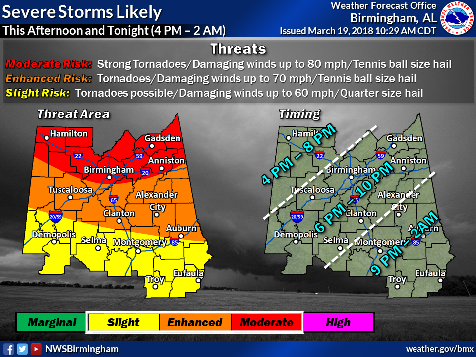
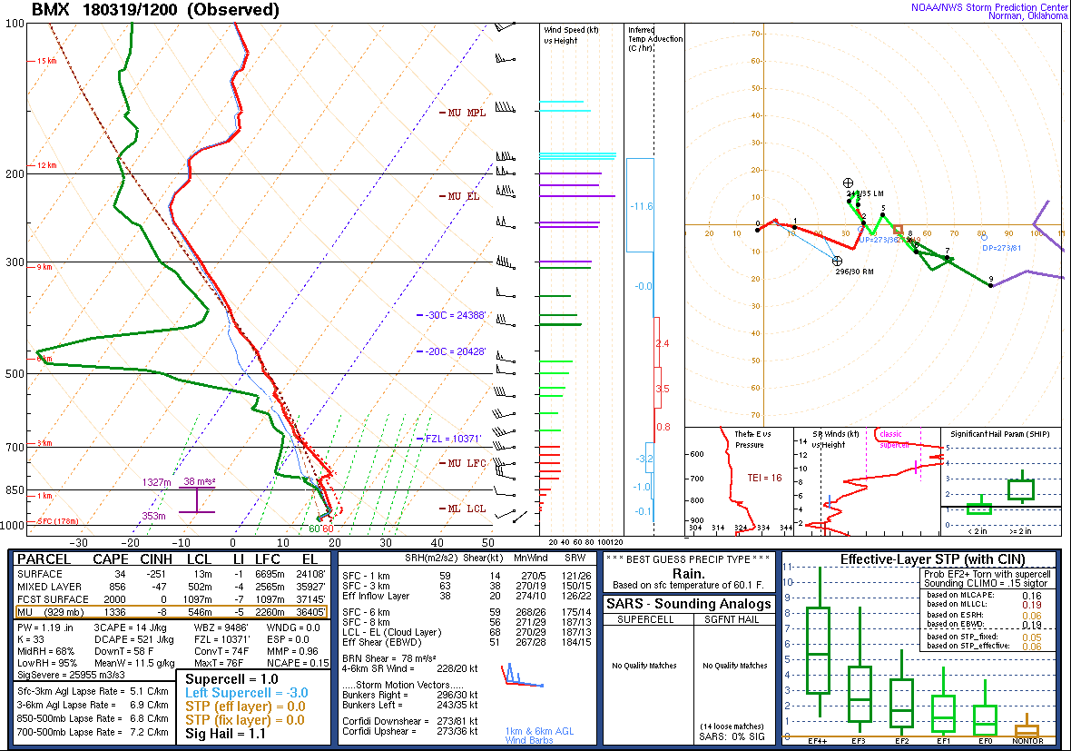
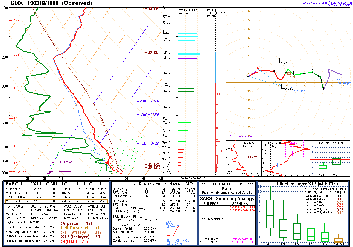
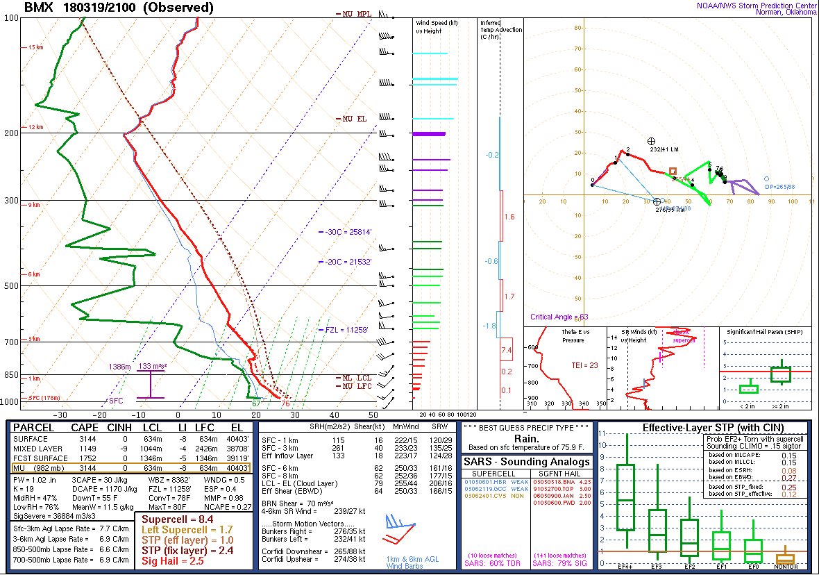
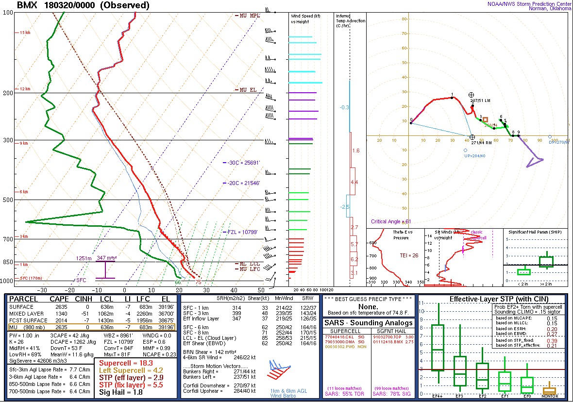
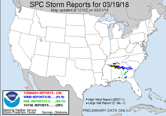
Six tornadoes and hail up to 3 inches in diameter affected the northern areas of Central Alabama on the afternoon and evening hours of March 19th, with a rare PDS (Particularly Dangerous Situation) Tornado Watch issued for a large chunk of Central Alabama. An environment favorable for significant severe thunderstorms developed as a low-amplitude upper-level trough moved into the region and a weak surface low passed by toward the north. These two features resulted in a deep column of wind shear. Additionally, moist southerly flow, warm surface temperatures, and colder temperatures aloft yielded a moderately unstable air mass. The evolution of the atmosphere in Central Alabama was captured through several special weather balloon releases by the NWS Birmingham office. Weather research teams were also working on the ground and in the air across North Alabama, collecting data that helped short-term forecasting and warning operations, but also for future studies.

Initially, thunderstorms were producing large to very large hail. However, the tornado threat ramped up into the late-afternoon and evening hours as wind speeds at low levels increased with the arrival of a low-level jet. Additional severe thunderstorms produced large hail and tornadoes during the evening, mainly focused across the northeastern portions of Central Alabama. The worst storm of the event was a cyclic supercell that produced three separate tornadoes, with tracks stretching from near Ashville to and beyond the Georgia state line. One of those tornadoes was significant and long-track, producing EF-3 damage to structures at several points along its path. Thankfully, there were no fatalities with this storm system, and limited injuries. We credit this to the residents of Central Alabama heeding watches and warnings issued during the event, which was forecast five days in advance.

The information contained below is from the 6 individual tornado tracks that occurred. The data is PRELIMINARY and may be subject to change.

Interactive Tornado Map:
View larger map
 
 
Location/Clickable Detailed Summary Link
Damage Rating/Estimated Maximum Wind Speeds
Injuries/Fatalities
Damage Path Length/Width
Starting Point/Time
Ending Point/Time
EF-0
80 mph
None
0.93 miles
100 yards

1 S Strawberry
34.2299/-86.4949
7:09 pm CDT

2 SSE Strawberry
34.2246/-86.4798
7:11 pm CDT
Blount Mountain Tornado
(Blount, St. Clair Counties)
EF-1
90 mph
None
6.43 miles
880 yards

3 S Highland Lake
33.8515/-86.4152
7:50 pm CDT

1 S Whitney Junction
33.8539/-86.3042
7:56 pm CDT
Ashville/Southside Tornado
(St. Clair, Etowah, Calhoun Counties)
EF-2
120 mph
1 Injury
15.73 miles
1760 yards

2 NE Ashville
33.8552/-86.2398
8:02 pm CDT

3 W Silver Lakes Golf Course
33.8806/-85.9688
8:21 pm CDT
Centre Tornado
(Cherokee County)
EF-1
90 mph
None
1.07 miles
400 yards

3 SSE Centre
34.1095/-85.6522
8:20 pm CDT

3 SE Centre
34.1216/-85.6406
8:22 pm CDT
Jacksonville Tornado
(Calhoun, Cleburne Counties)
EF-3
150 mph
4 Injuries 34.29 miles
2000 yards
3 SSW Silver lakes Golf Course
33.8453/-85.9472
8:23 pm CDT

4 SSE Mars Hill
33.7943/-85.3665
9:10 pm CDT

Finks Lake Tornado
(Calhoun County)
EF-0
65 mph
None 0.84 miles
138 yards
2 W Weaver
33.7502/-85.8464
9:07 pm CDT

2 WSW Weaver
33.7418/-85.8364
9:10 pm CDT


Pertinent Geographic Information Systems (GIS) Data from this Event


Severe Weather Episode Data 

250 mb
250 mb Analysis
March 19 at 7 am

500 mb
500 mb Analysis
March 19 at 7 am

850 mb
850 mb Analysis
March 19 at 7 am

250 mb
250 mb Analysis
March 19 at 7 pm

500 mb
500 mb Analysis
March 19 at 7 pm

850 mb
850 mb Analysis
March 19 at 7 pm

Surface
Surface Analysis
March 19 at 4 pm

Surface
Surface Analysis
March 19 at 7 pm

Surface
Surface Analysis
March 19 at 10 pm

Severe Threats
Local Severe Outlook
Issued March 16 at 437 am

Severe Threats
Local Severe Outlook
Issued March 17 at 319 am

Severe Threats
Local Severe Outlook
Issued March 18 at 306 am

Severe Threats
Local Severe Outlook
Issued March 19 at 1029 am

KBMX Sounding
KBMX Sounding
March 19 at 7 am

KBMX Sounding
KBMX Sounding
March 19 at 1 pm

KMBX Sounding
KBMX Sounding
March 19 at 4 pm

KBMX Sounding
KBMX Sounding
March 19 at 7 pm

KBMX Sounding
KBMX Sounding
March 19 at 9 pm

Storm Reports
Storm Reports
 March 19

Radar Loop
Radar Loop
March 19 6pm-10pm

Rainfall Plot
Rainfall Plot
March 19th