|
Event Summary
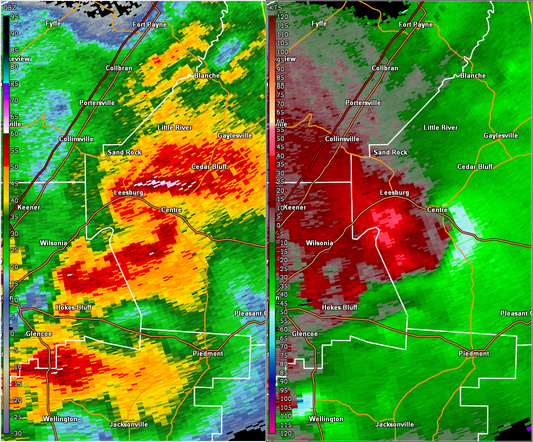
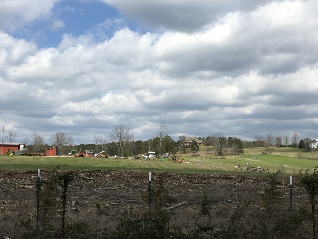
National Weather Service meteorologists surveyed damage in central Cherokee County just south of Centre and determined that the damage was consistent with an EF-1 tornado. The short-lived tornado began near Highway 9 and the Cherokee County Country Club Golf Course. The tornado moved northeast along County Road 163. At the intersection of Highway 9 and County Road 163, a home sustained damage to the garage door and an adjacent pine tree was snapped. Just east of this location, at least ten pine trees were
snapped along portions of the golf course. One half mile to the northeast, shingles were blown off several apartment buildings. Just north of the apartment complex, a farm outbuilding was completely destroyed and the metal panels were thrown 300 yards downstream across a field. The tornado dissipated shortly thereafter before it reached Highway 411.
|
|
|
|
EF-1
|
|
Estimated Maximum Wind:
|
90 mph
|
|
Injuries/Fatalities:
|
None |
|
Damage Path Length:
|
1.07 miles
|
|
Maximum Path Width:
|
400 yards
|
|
Approximate Start Point/Time:
|
3 SSE Centre
34.1095/-85.6522
at 8:20 pm CDT
|
|
Approximate End Point/Time:
|
3 SE Centre
34.1216/-85.6406
at 8:22 pm CDT
|
|