|
Event Summary
|
|
EF-3
|
|
Estimated Maximum Wind:
|
150 mph
|
|
Injuries/Fatalities:
|
13 Injuries |
|
Damage Path Length:
|
80.38 miles
|
|
Maximum Path Width:
|
2300 yards
|
|
Approximate Start Point/Time:
|
3 N Duffys Bend
32.6892/-87.7387
at 4.26 pm CDT
|
|
Approximate End Point/Time:
|
3 WSW Wilsonville
33.2209/-86.5249
at 6:04 pm CDT
|
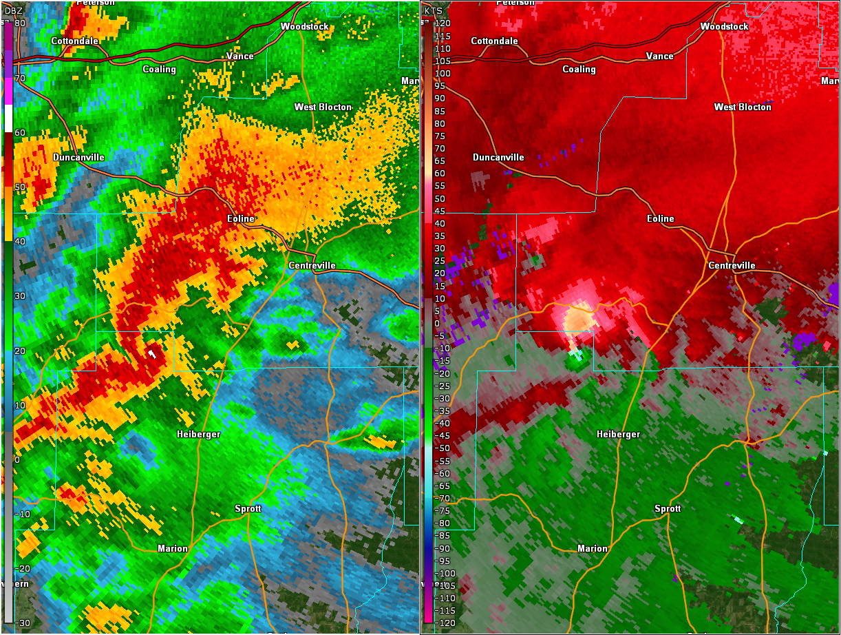
National Weather Service meteorologists surveyed the damage that extended from near Sawyerville in Hale County northeastward to near Wilsonville in Shelby County and determined it was the result of an EF-3 tornado.
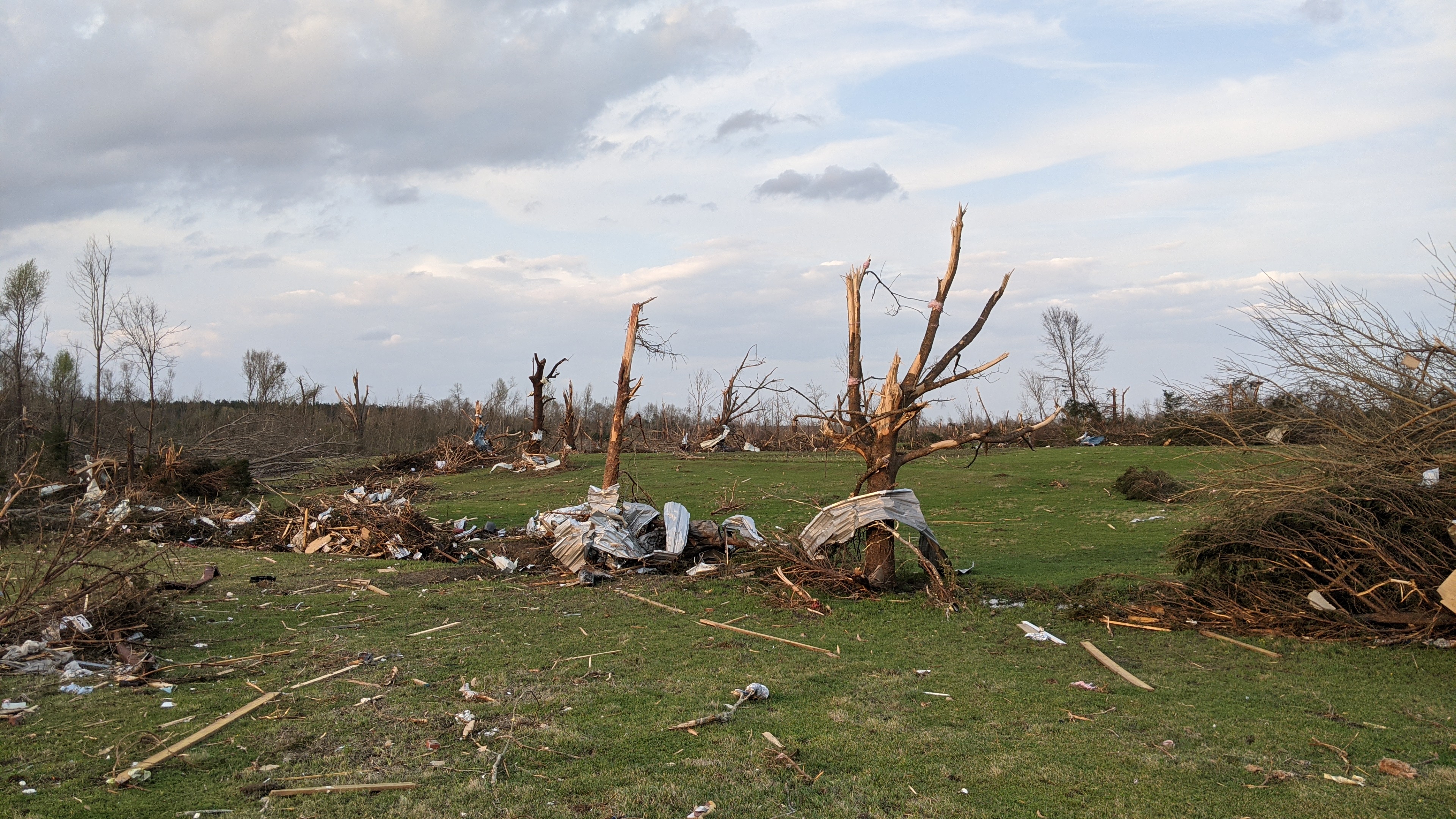
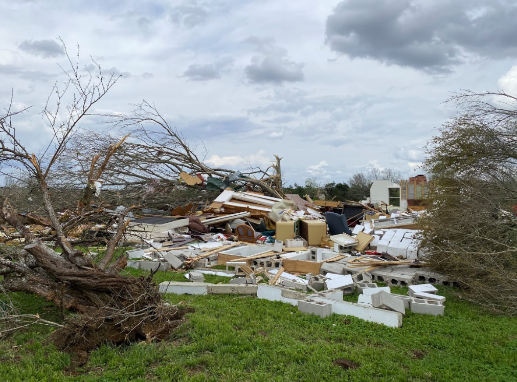
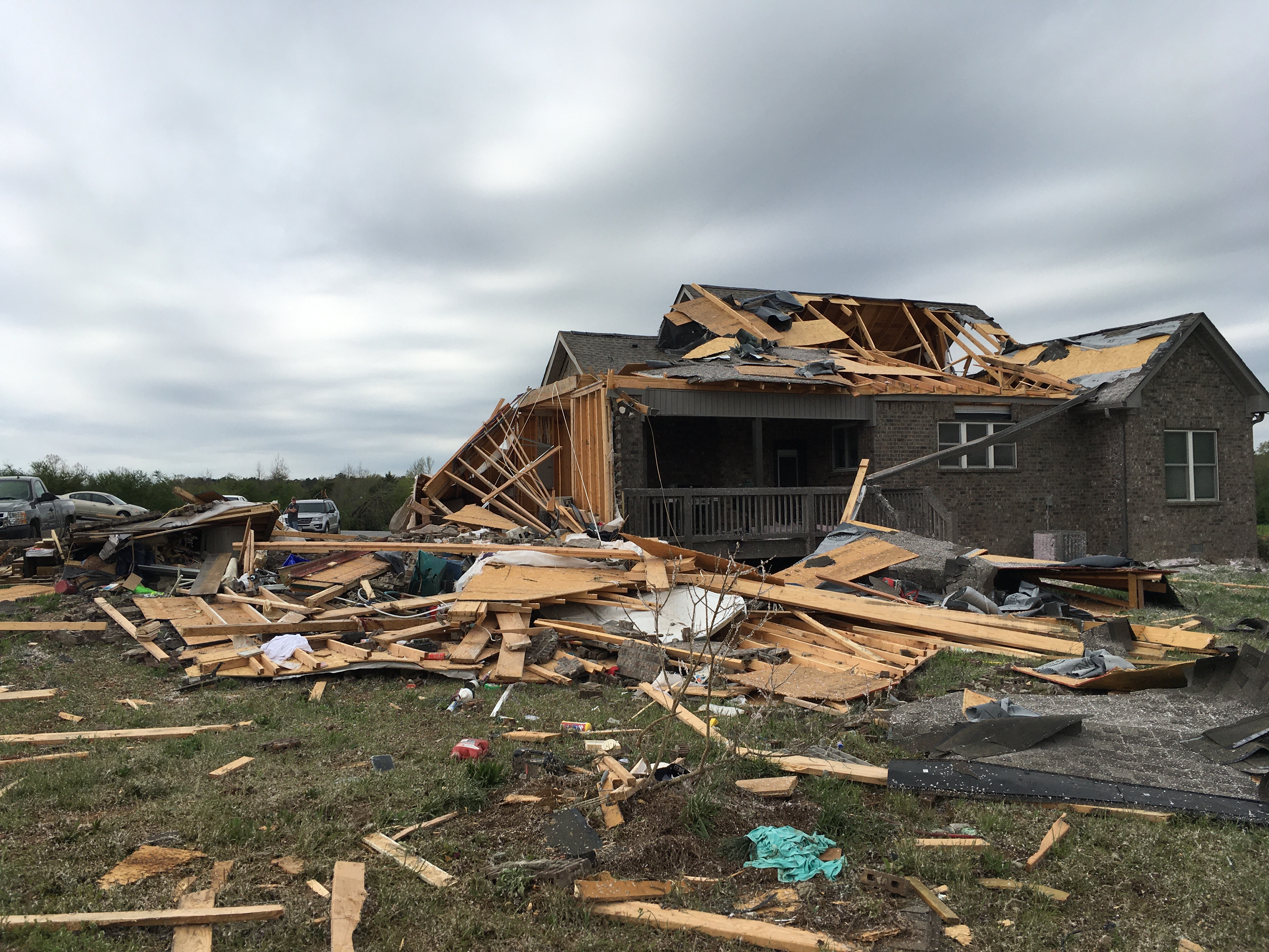
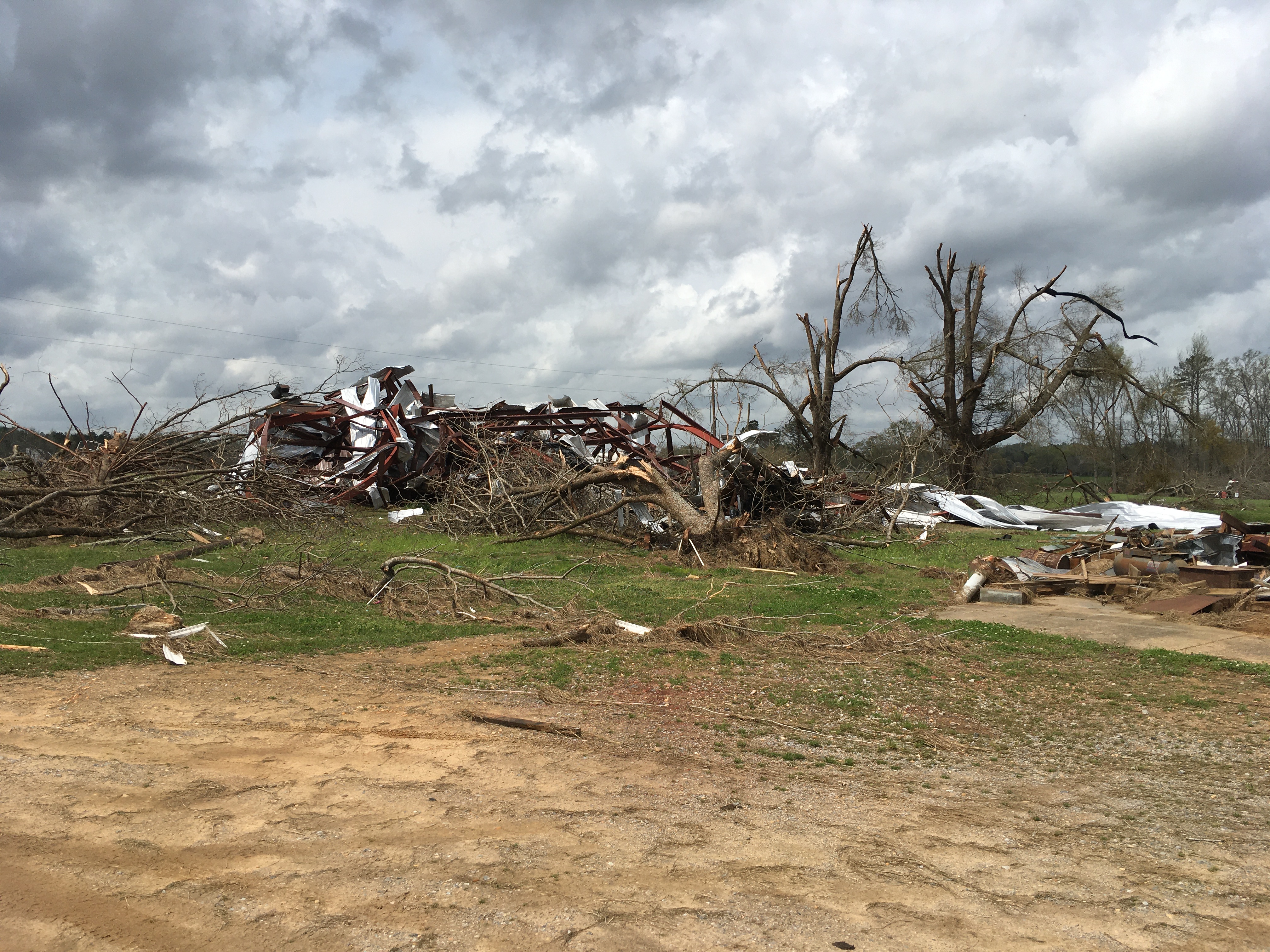
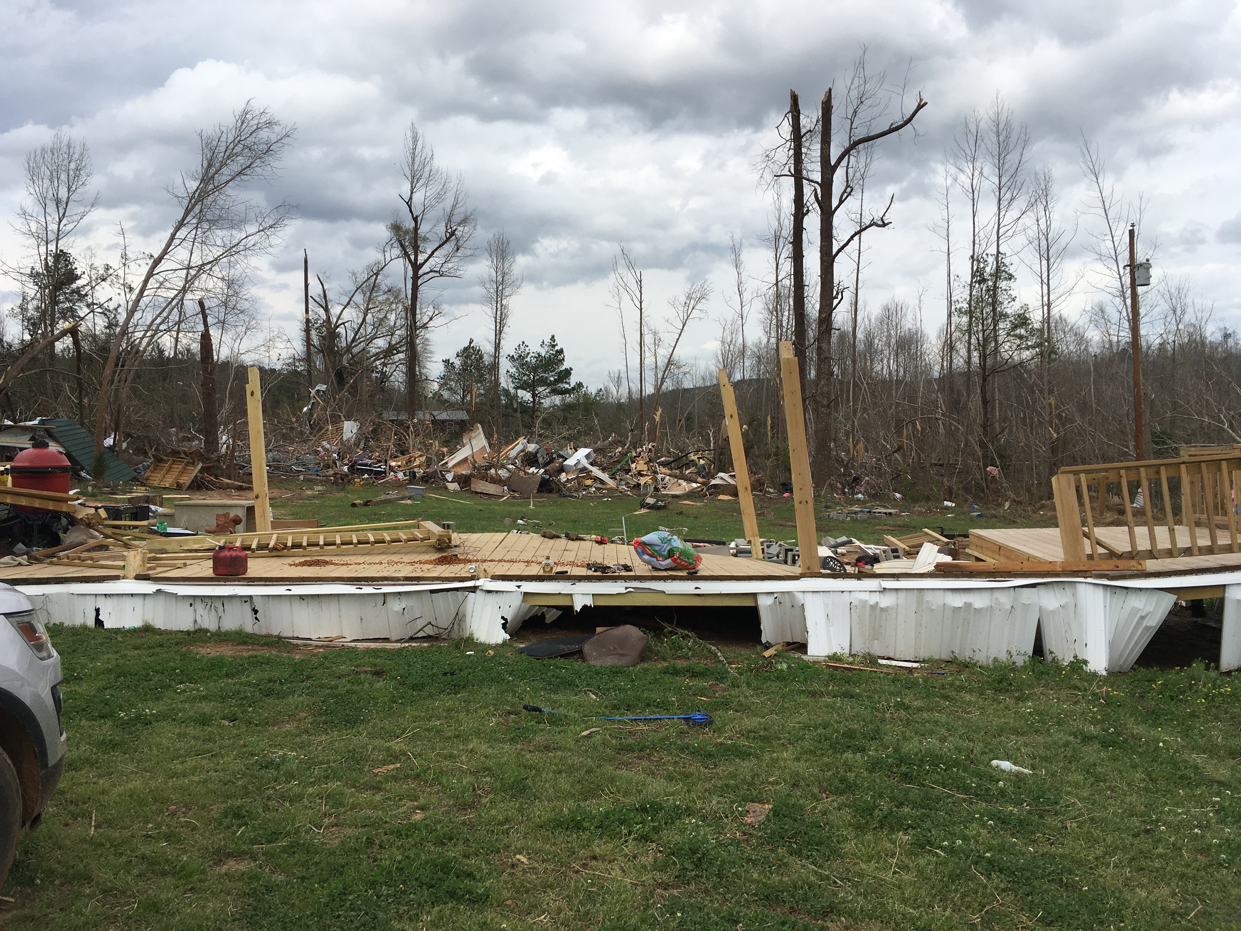
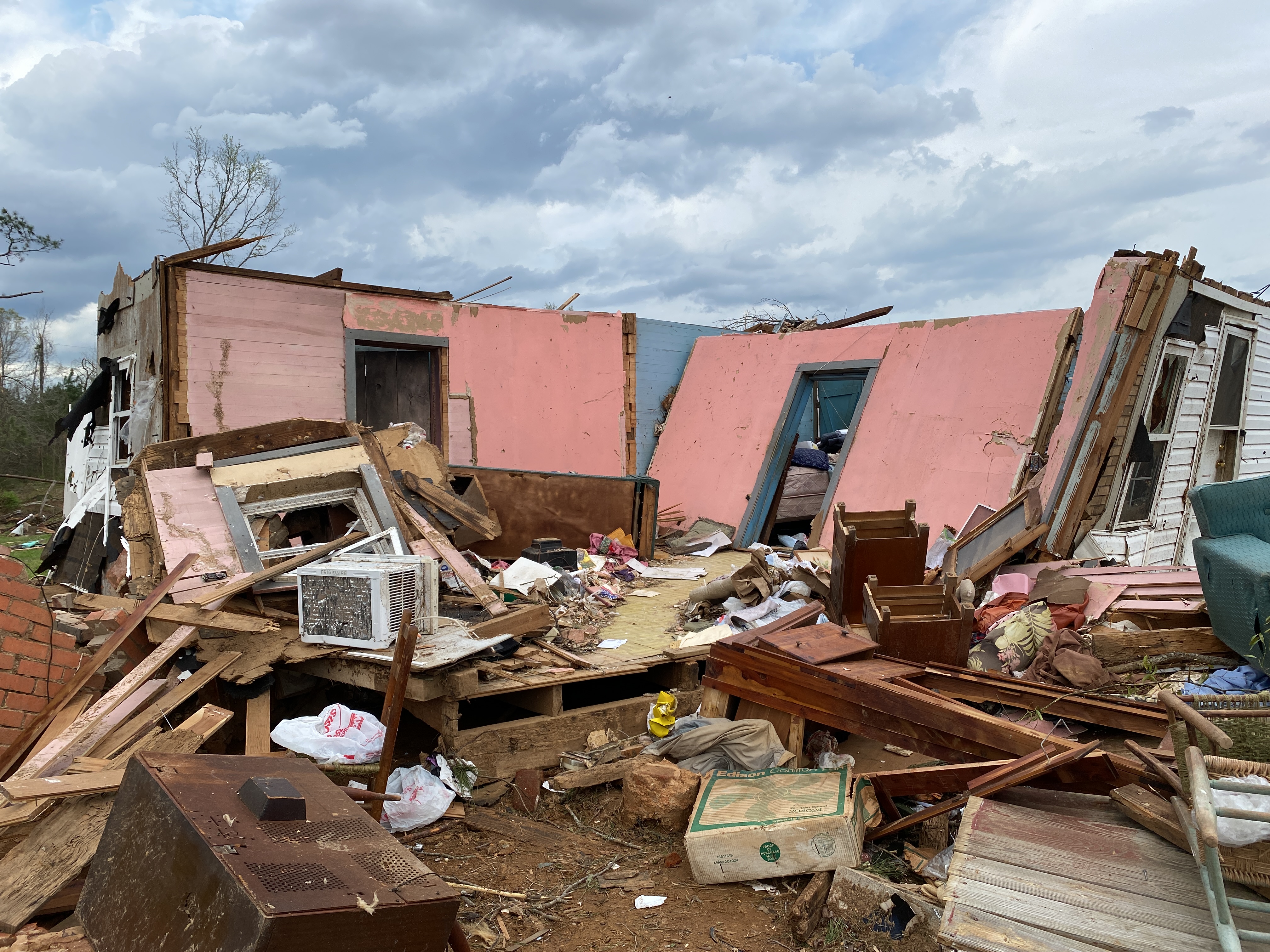
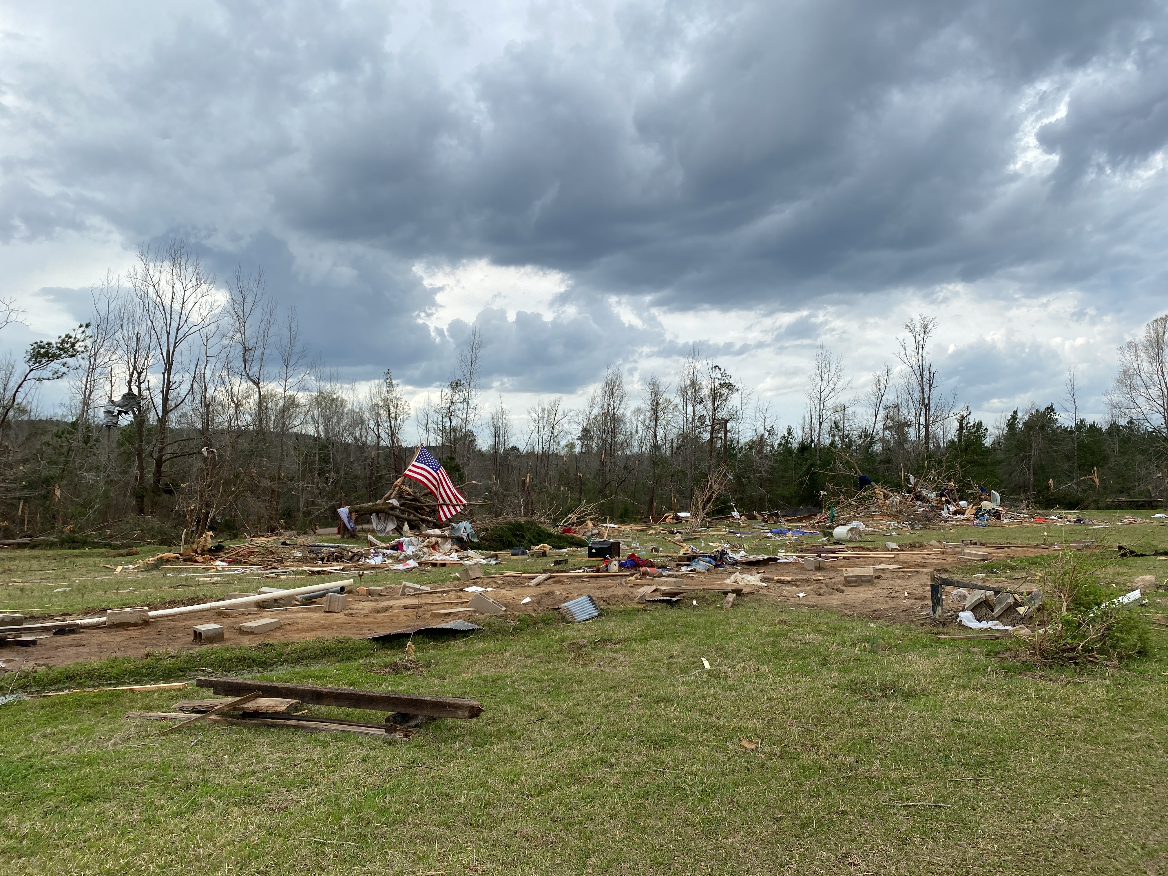
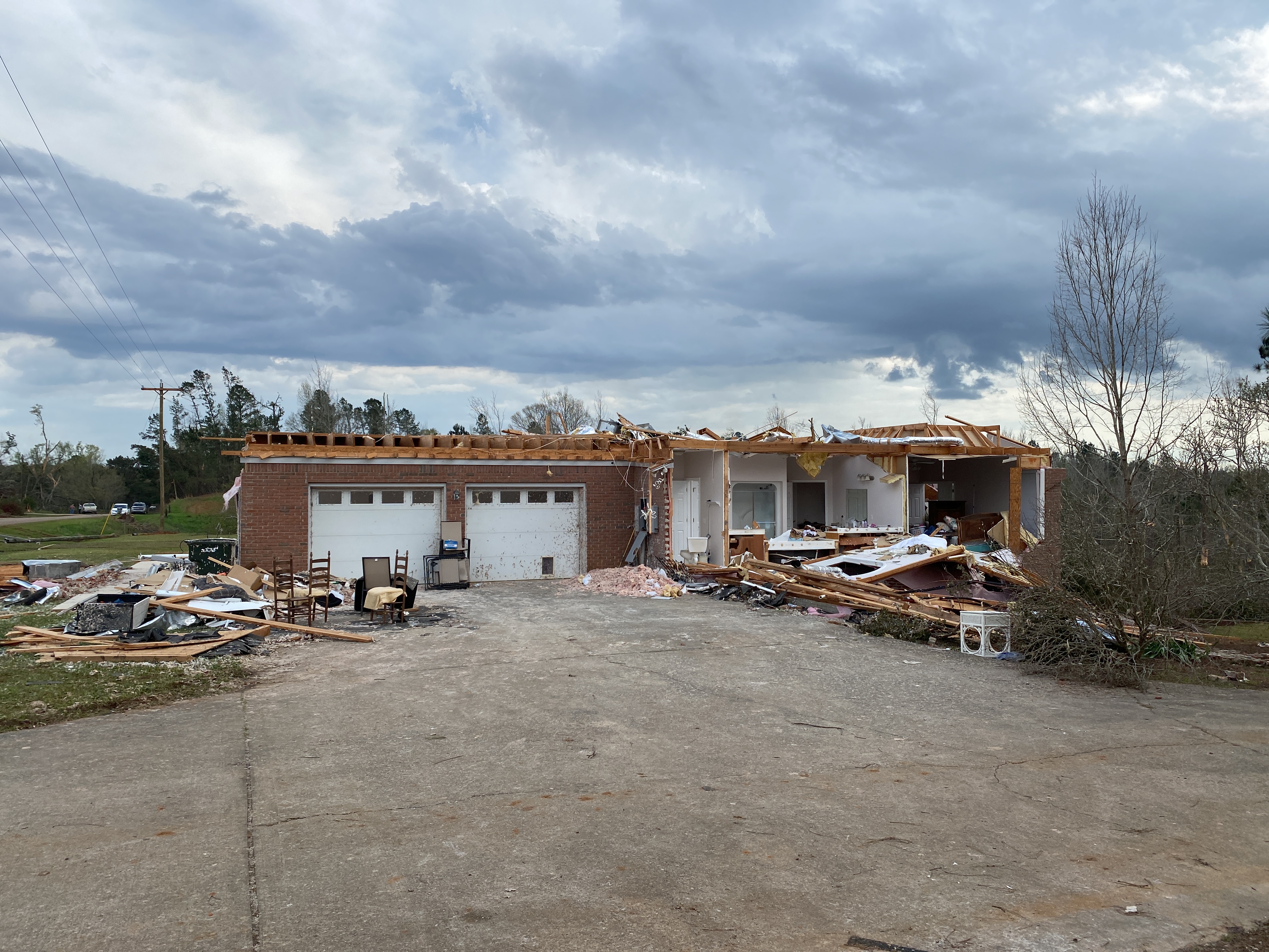
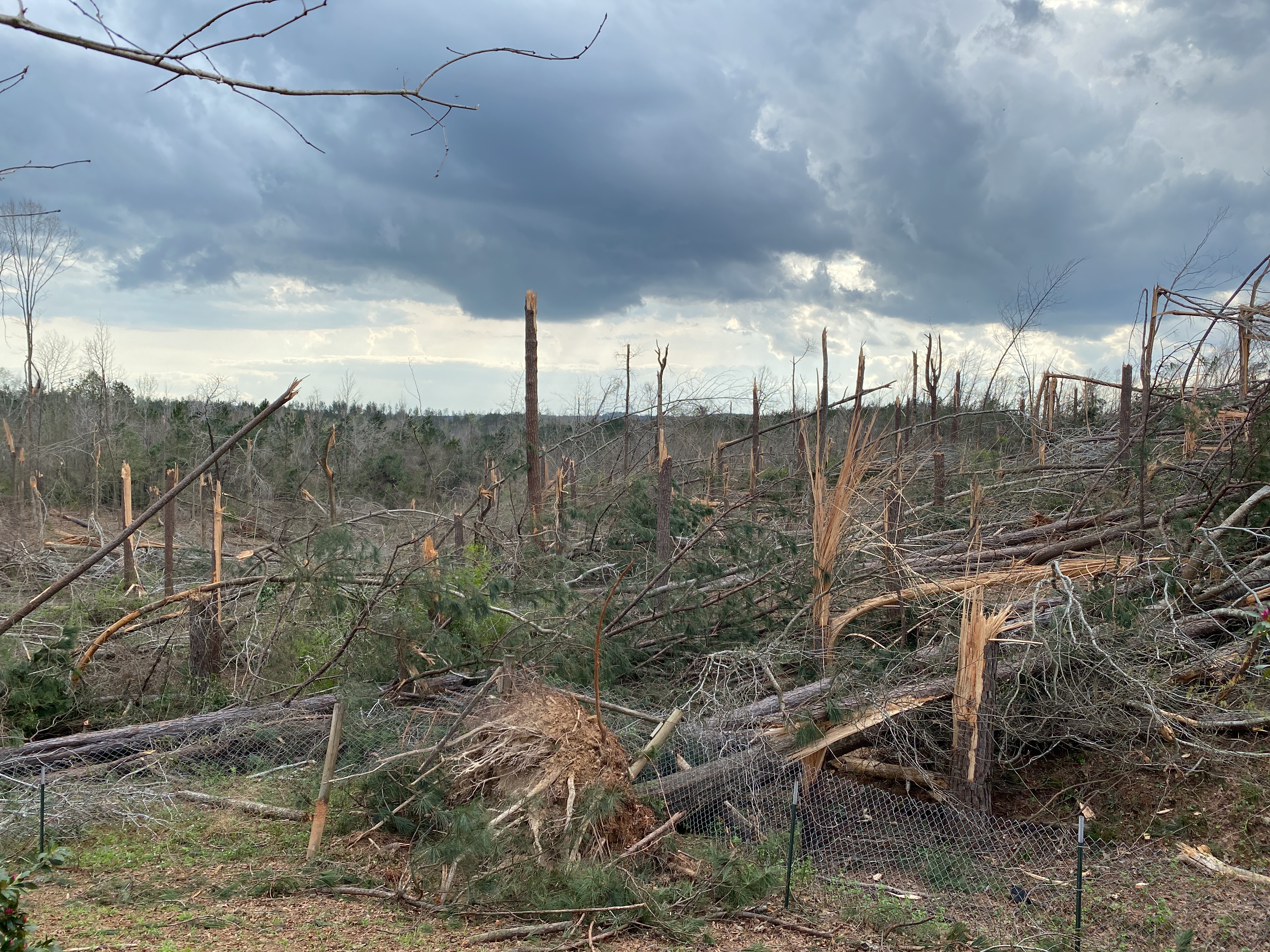
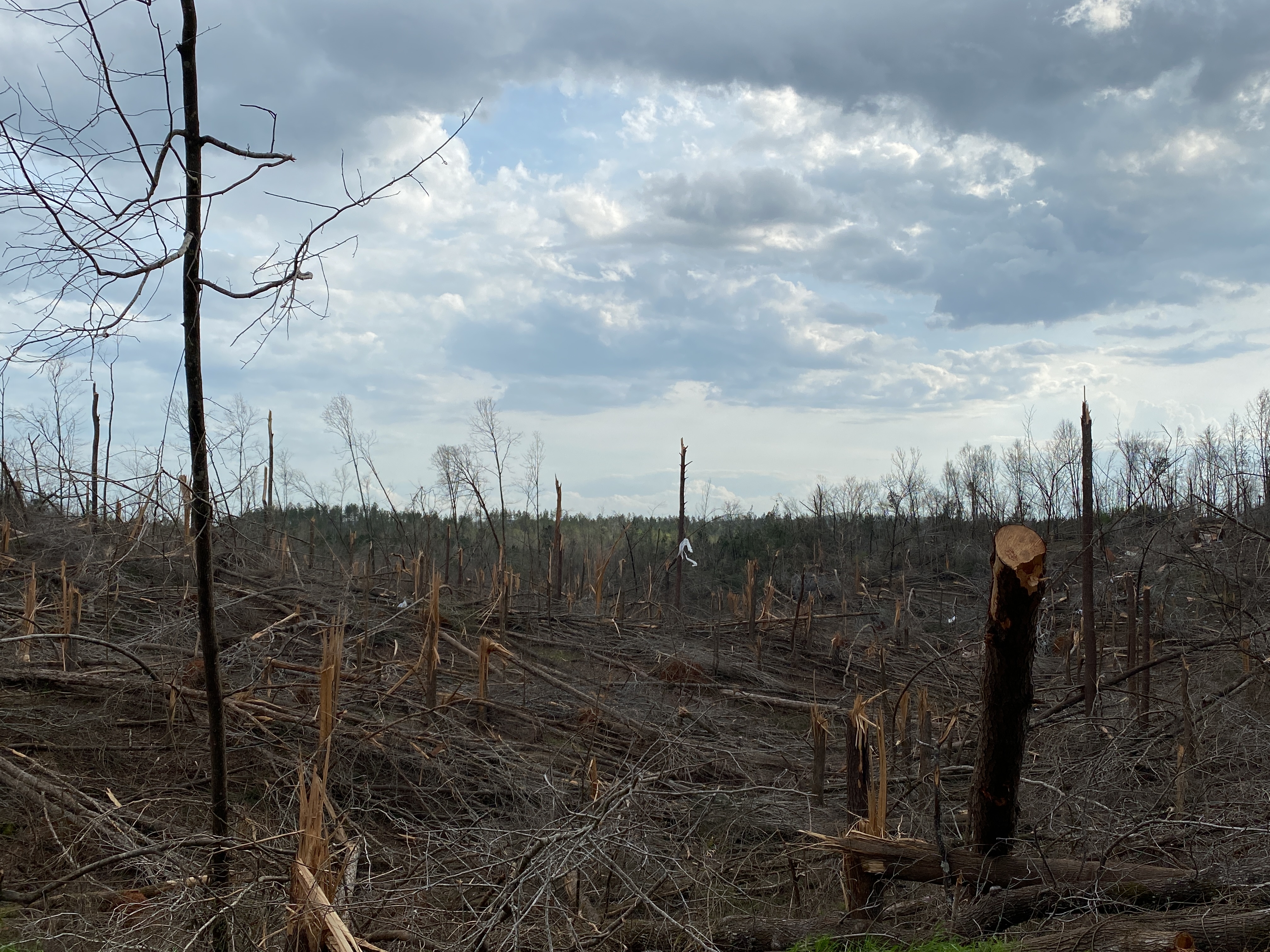
A strong, long-track tornado scarred the landscape across Hale, Perry, Bibb, Chilton, and Shelby Counties during the afternoon of March 25, 2021. It is estimated that the tornado had a 98 minute life span, with a path length of 80 miles and a width upwards of 2,300 yards, or 1.3 miles. Its impossible to know the exact number but, to put it in perspective, tens and tens of thousands of trees were snapped or uprooted. The volume and extent of snapped trees was incredible, pushing the rating to EF-3, around 150 mph. This is mainly for the portion of the track from Hale to Perry to Bibb Counties. Along the tornados path, hundreds and hundreds of residences were damaged or destroyed, either directly by wind or due to fallen trees. At least 13 injuries occurred. Many people we spoke to during the damage survey stated they received the tornado warning and took shelter in a storm pit, interior room, or left their vulnerable residence for a sturdier building. This action certainly saved lives.
The tornado began along Highway 17 just south of Sawyerville in Hale County. The tornado rapidly gained strength and widened as it neared and crossed Highway 14. Across Hale County, a swath of hardwood and softwood trees were downed. Some debarking was observed just south of Highway 14, probably from high velocity debris throwing. Five Y-shaped transmission towers were downed on the north side of Highway 14. These towers are rated for 120+ mph winds according to Alabama Power. It is unknown whether this was due to a domino effect or direct blowdown of each tower. Either way, a powerful tornado occurred. esidential damage included wall collapse, roofing torn off, shifting off of foundation, or total structural loss. There were 6 relatively minor injuries in Hale County. The max rating for the Hale County portion of the track was EF-3.
The tornado then crossed far northern Perry County. Just inside the county line, along County Road 51, a mobile home was destroyed with a site built home on the same property sustaining roof loss and some shifting of the crawl space foundation. Extensive downing of trees continued, and was especially impressive when viewed from the national forest in the eastern part of the county due to visibility from hills. Trees were snapped and uprooted not only in the valley but also along the side of the hills, which really showed the reach of this tornado. Structural damage was most apparent in the vicinity of the confluence of County Road 23, Salem Church Road, and County Road 154 in the north-central part of the county. In this area, mobile homes were destroyed, with 1 site built home having roof loss and exterior wall failure, with another sustaining roof loss and some warping of the wood framing from wind entry. A nearby church had roof loss with an adjacent metal building sustaining a lot of damage consisting significant peeling of paneling and structure warping from wind entry. Other structural damage occurred along the path as well. The max rating for the Perry County portion of the track was EF-3.
Bibb County was next in line. The theme of extensive downed trees carried on. Views atop hills in western Bibb County really captured the breadth of this tornado. There were three primary areas of concentrated structural damage. Along Belcher Road, anchoring to a metal building used for farm equipment failed, sending the structure crashing into an adjacent house. Across the field, a site built home had sections of roof removed and its open face garage blown away, with an adjacent farm building collapsed. In Centreville city limits, snapped trees were prevalent near the Cahaba River. Along Montgomery Road east of town, heavy damage occurred. Mobile homes were crushed by fallen trees and site built homes had roof damage. Interestingly, there was a site built home, surrounded by snapped trees, that sustained some shingle loss and apparent shifting of the roofline and chimney. Considering the extent of tree damage on all sides, the house held up quite well. In Ashby, along Buzzard Road, several mobile homes were destroyed. Anchoring was not apparent, though at least one of the mobile homes was thrown a fair distance. Site built homes on the same street suffered light to heavy roof damage but were still standing. The tornado warning was received and several residents along this road took shelter in a brick home, which had relatively light damage. Other structural damage occurred along the path. There were 5 relatively minor injuries in Bibb County. The max rating for the Bibb County portion of the track was EF-3.
The tornado then moved through far northwest Chilton County, crossing County Road 73 and Highway 155. Trees were downed and structures damaged. The max rating for the Chilton County portion of the track was EF-1.
Shelby County was the last county to be affected by this tornado. The tornado moved into southern Calera, downing trees and blowing away an unanchored mobile home along County Road 67. Residents at this location left their mobile home after hearing of the tornado warning. This action likely saved their life as nothing was left. The tornado then crossed Interstate 65 and moved into a large neighborhood along and northeast of Timberline Drive. The majority of structural damage was confined to shingle and siding loss; however, at least 3 homes had portions of their roof removed, 2 of them significant in nature. Next, mostly rural areas were hit between Columbiana and Calera, south of Highway 70. The last area of notable damage was in Columbiana. Locations from Mooney Road to Mardis Ferry Road and adjacent roads had many trees downed. Numerous homes were heavily damaged by fallen trees, more so than directly from wind. There were a couple of exceptions, such as a site built home just east of the intersection of Looney Road and Shelby Road that had a section of roofing removed and the garage blown away, probably enhanced by wind entry in a vulnerable location. Several mobile homes were impacted near the intersection of Alston Farm Road and Mardis Ferry Road. Most sustained roofing damage or were crushed by fallen trees. One unanchored mobile home was blown away, with 2 injuries that required hospitalization. Other structures were damaged along the path as well. The tornado then quickly weakened, and seems to have ended as it approached Highway 25 after crossing County Road 7. The max rating for the Shelby County portion of the track was EF-1.
|