|
Event Summary
|
|
EF-1
|
|
Estimated Maximum Wind:
|
100 mph
|
|
Injuries/Fatalities:
|
None |
|
Damage Path Length:
|
12.05 miles
|
|
Maximum Path Width:
|
600 yards
|
|
Approximate Start Point/Time:
|
2 WNW I-20 Rest Area near Eutaw
32.8781/-87.9756
at 3:57 pm CDT
|
|
Approximate End Point/Time:
|
1 WSW Knoxville
32.9888/-87.8160
at 4:16 pm CDT
|
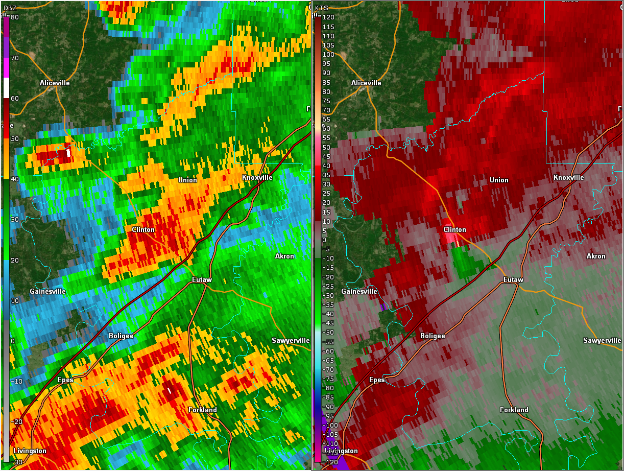
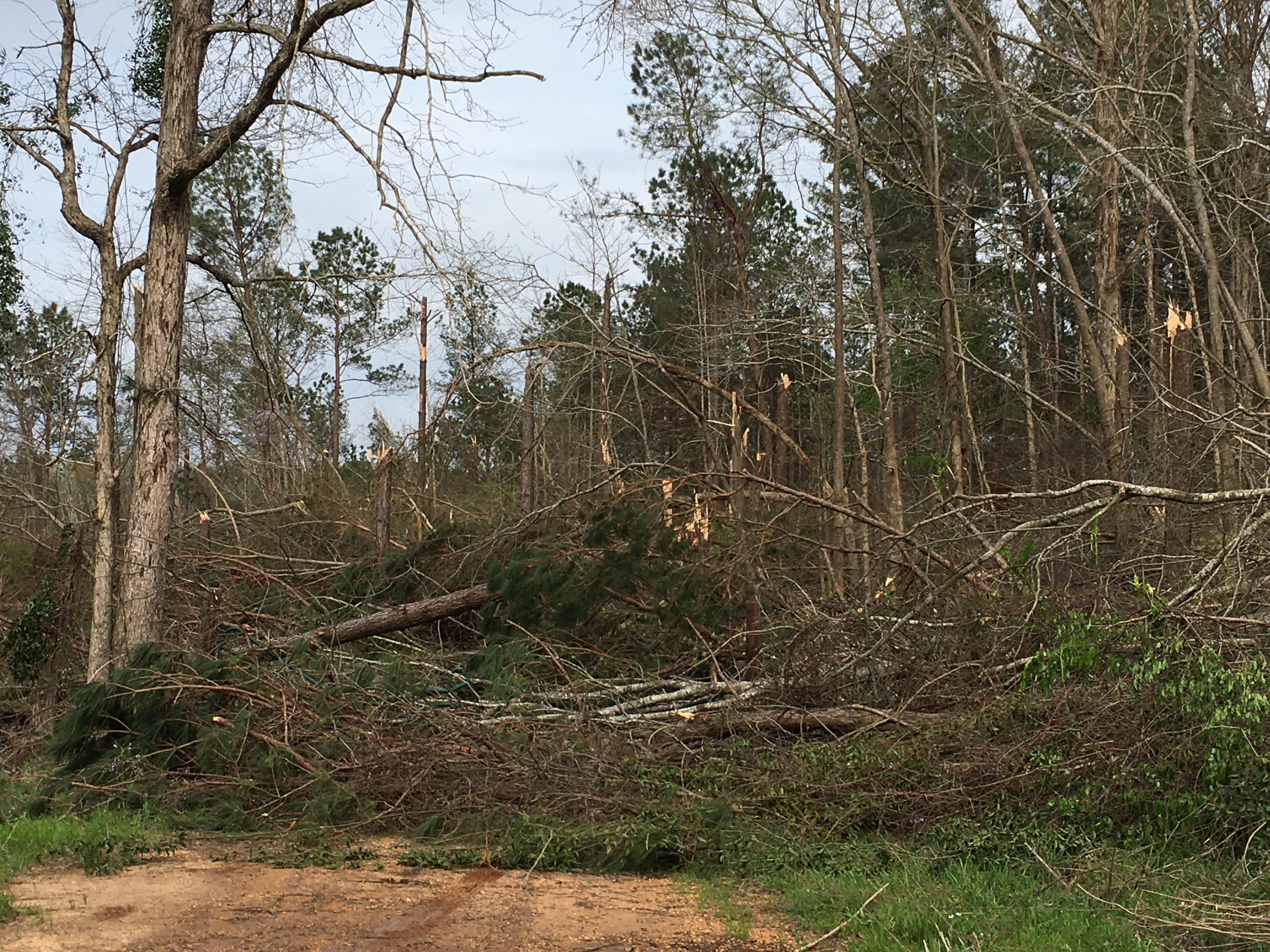
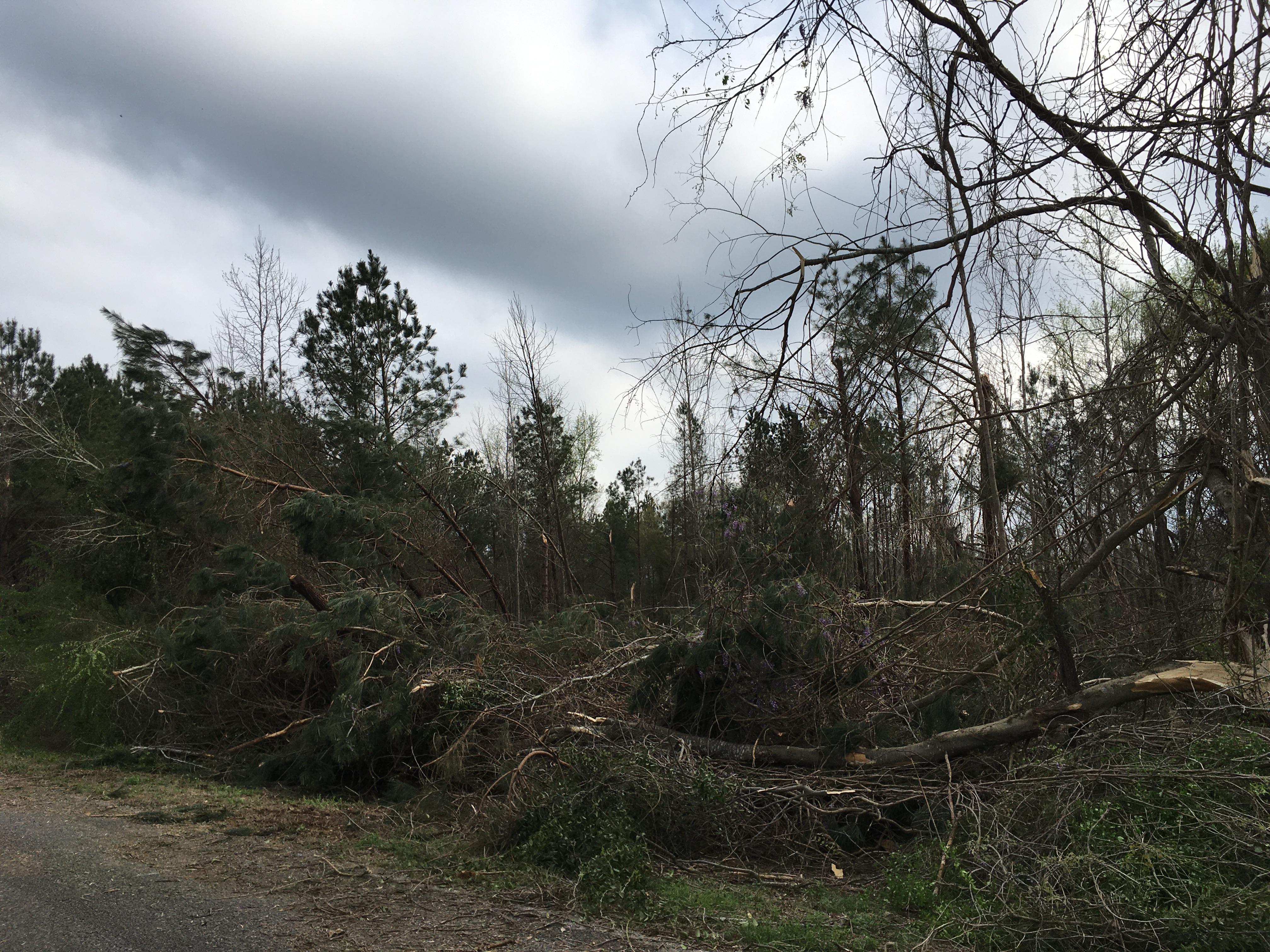
National Weather Service meteorologists surveyed the damage in northern Greene County south of Union and determined it was the result of an EF-1 tornado.
This EF1 tornado formed along County Road 174 and crossed Highway 14 between Clinton and Eutaw. It continued northeastward, snapping numerous trees along County Road 181 and County Road 199. The tornado then weakened with sparse damage, but based on storm chaser reports and tree damage on County Road 218 it did not dissipate until it was southwest of Knoxville.
|