|
Event Summary
|
|
EF-3
|
|
Estimated Maximum Wind:
|
140 mph
|
|
Injuries/Fatalities:
|
None |
|
Damage Path Length:
|
11.15 miles
|
|
Maximum Path Width:
|
1400 yards
|
|
Approximate Start Point/Time:
|
4 NE Havana
32.9386/-87.5753
at 12:16 pm CDT
|
|
Approximate End Point/Time:
|
2 NW Low Gap
33.0076/-87.4027
at 12:29 pm CDT
|
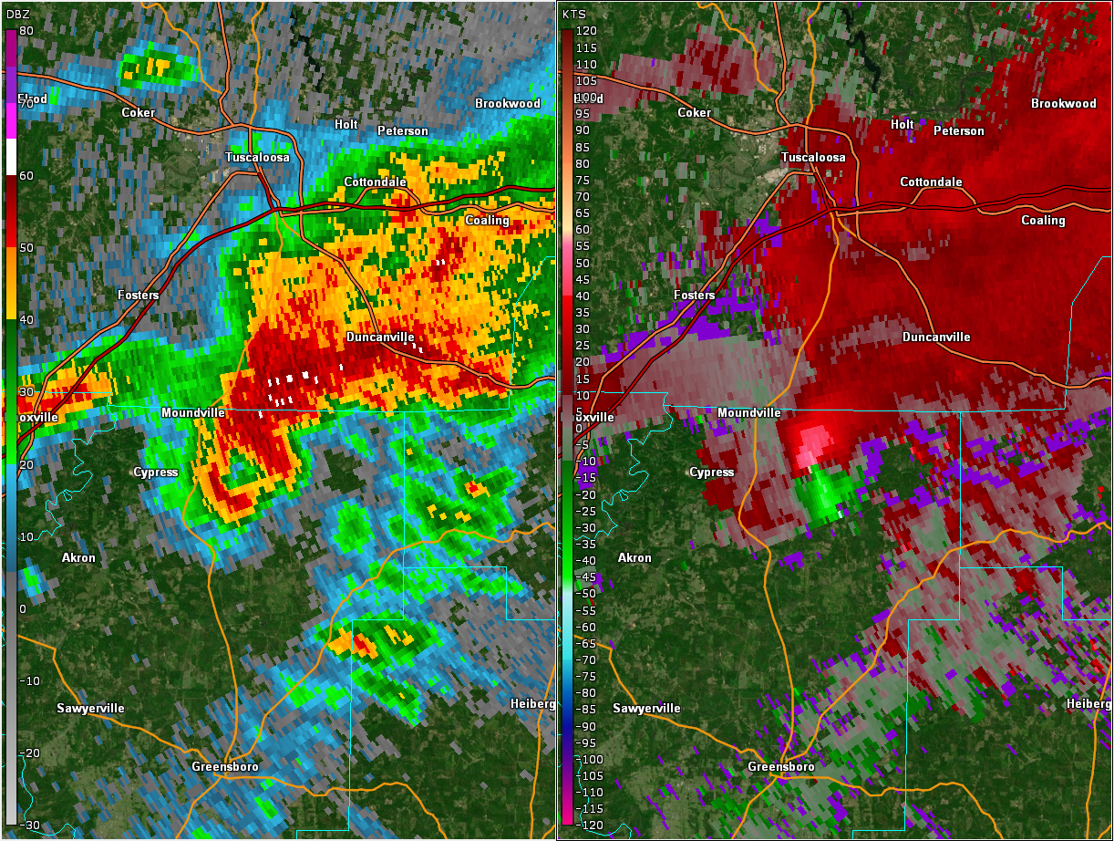
National Weather Service meteorologists surveyed the damage in northeastern Hale County southeast of Moundville and determined it was the result of an EF-3 tornado.
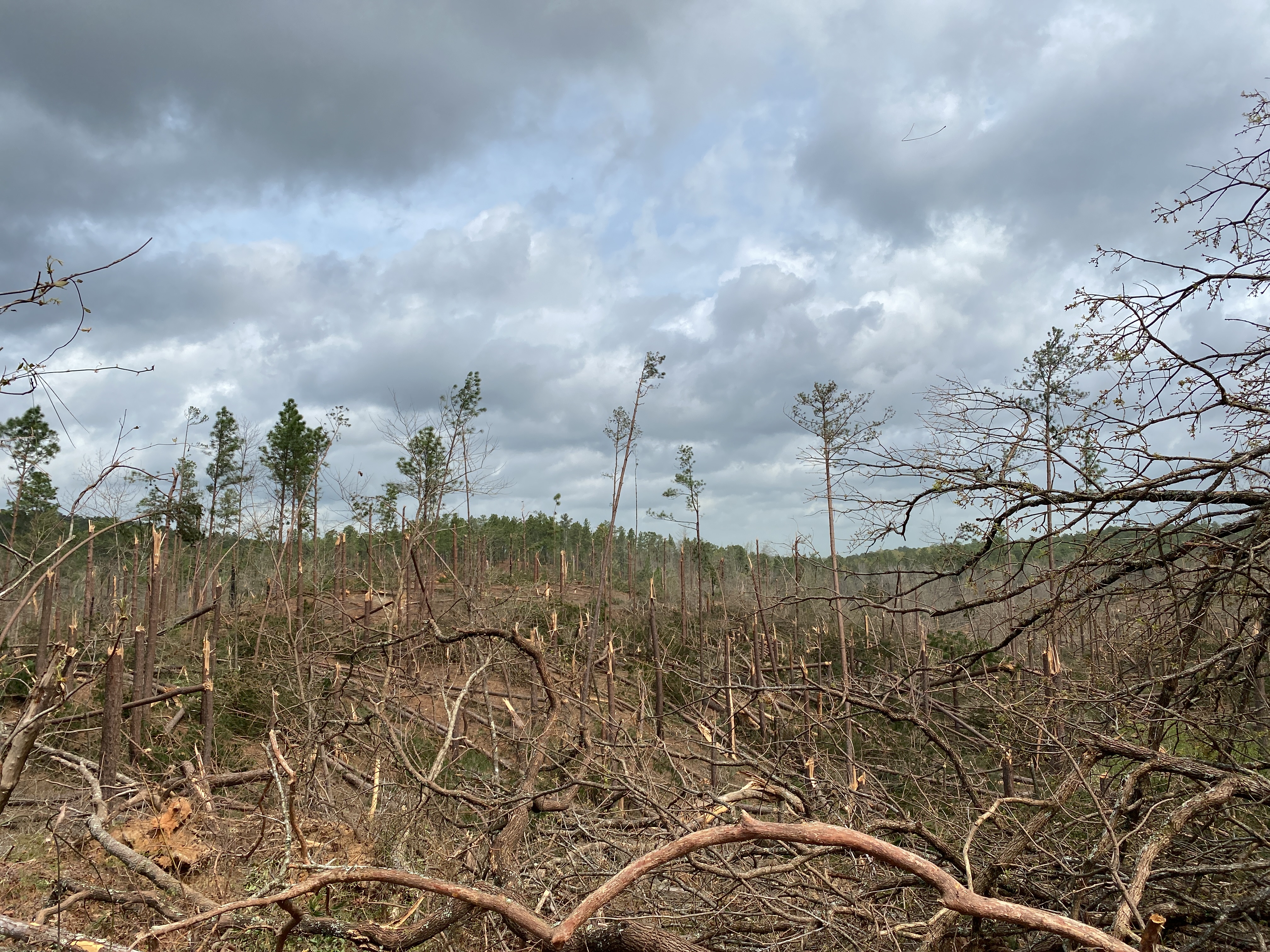
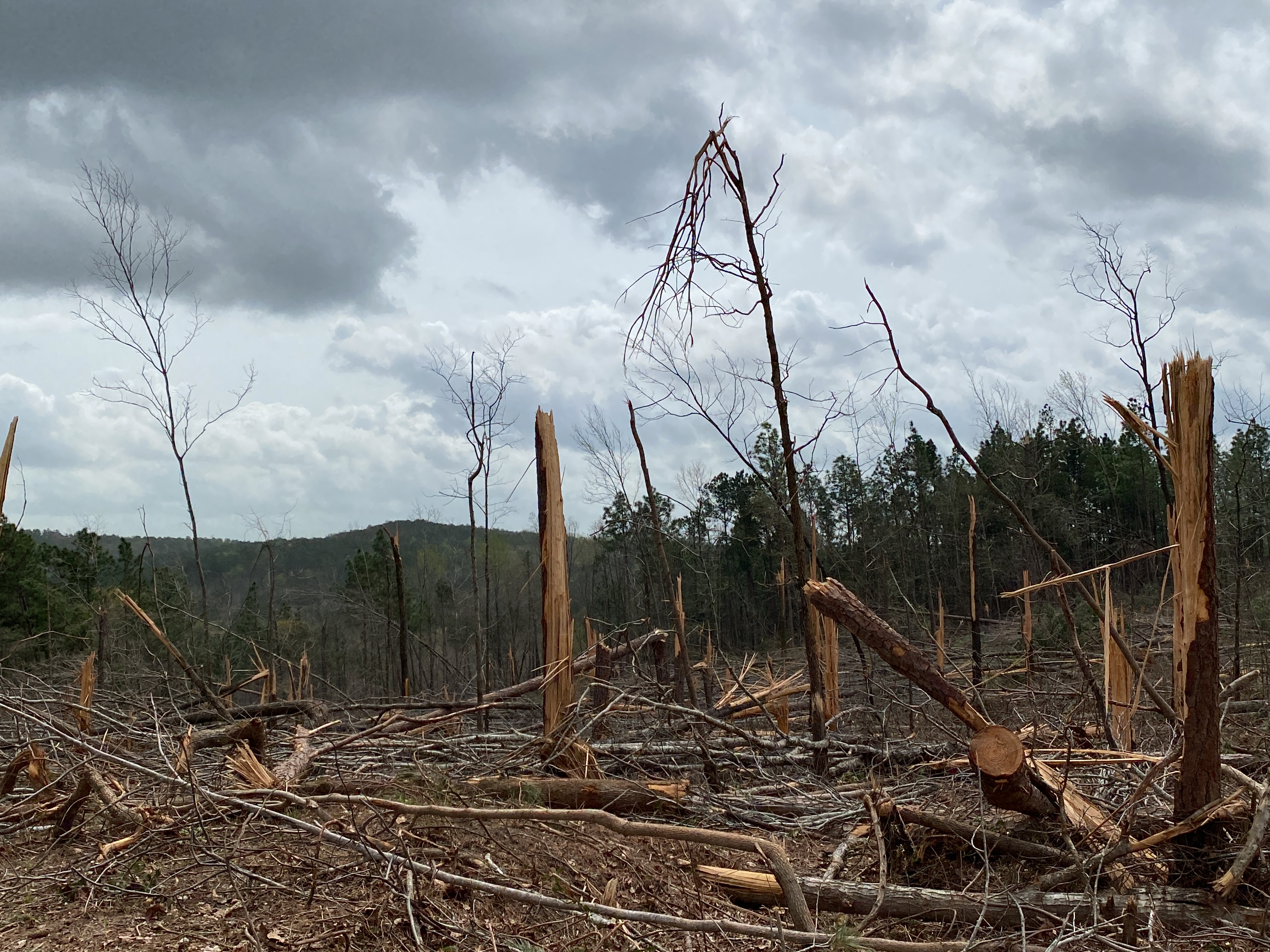
NWS Birmingham survey personnel found evidence of a tornado damage path in northeast Hale County. The tornado initially began in a heavily wooded area northeast of Gabriel Creek Rd and moved northeast. RADAR imagery suggests the tornado quickly intensified. Farther downstream, significant timber damage was observed on County Rd 50, as well as National Forest Rd 706. This timber damage was quite impressive and very wide at many points with both hardwood and softwood trees snapped and uprooted. The magnitude of timber damage suggested winds of 140 mph after consultation with experts. The tornado continued northeast causing further damage to a large swath of the Talladega National Forest in far northeast Hale County. It is believed the tornado dissipated shortly after crossing National Forest Rd 721, just into Tuscaloosa County, per aerial imagery provided by Alabama Law Enforcement Agency (ALEA) Helicopter footage.
|