|
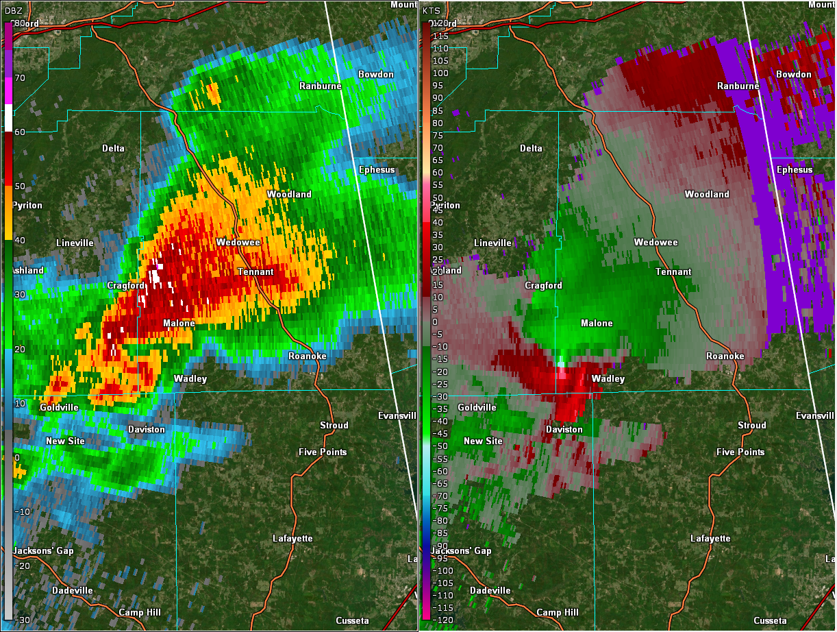
Event Summary
|
|
EF-2
|
|
Estimated Maximum Wind:
|
125 mph
|
|
Injuries/Fatalities:
|
None |
|
Damage Path Length:
|
31.13 miles
|
|
Maximum Path Width:
|
1000 yards
|
|
Approximate Start Point/Time:
|
1 N Goldville
33.0942/-85.7710
at 9:55 pm CDT
|
|
Approximate End Point/Time:
|
1 W Waresville
33.2313/-85.2566
at 10:31 pm CDT
|
National Weather Service meteorologists surveyed the damage in extreme southeastern Clay County northeastward to the Georgia state line near Wehadkee and determined it was the result of an EF-2 tornado.
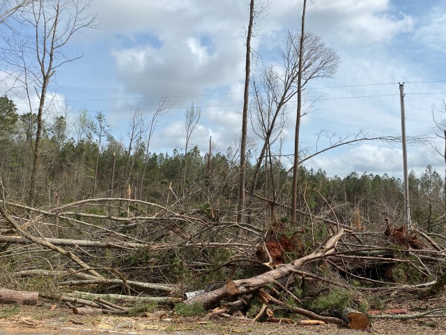
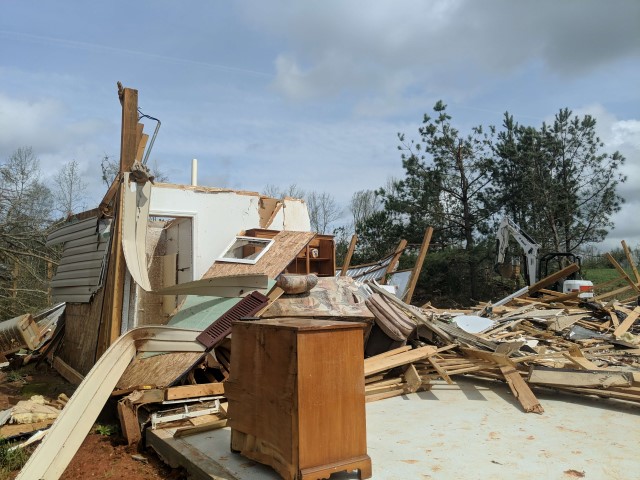
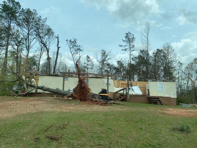
A strong tornado first touched down in extreme northern Tallapoosa County east of Goldville. The tornado started out very narrow but produced areas of significant tree fall and a distinct debris signature as it crossed remote forested and harvested forest areas of northern Tallapoosa county. The tornado crossed into extreme southeast Clay county, crossing Hodge Creek Road and producing extensive timber damage, including snapping and uprooting of large swaths of trees. Some minor structural damage was also noted in this area. The tornado moved northeast producing extensive tree damage in the Sikesville community. Numerous homes here also received minor to moderate roof damage. One home sustained major damage with all but one wall collapsed.
The tornado nearly paralleled County Line Road as it moved into Randolph County. All along CR 836, swaths of hardwood trees were either uprooted or snapped. The tornado widened once again as it approached CR 77. Here the tornado carved a wide path over mainly forested areas with some damage to barns and agricultural buildings. A chicken house on CR 845 was completely destroyed.
Substantial damage was noted in the Corinth community in southwest Randolph county. Along CR 43, a row of conventional homes had minor to moderate damage. Many homes in this area sustained complete loss of roof structure and blown out windows. The Corinth Fire Department was also damaged in this area.
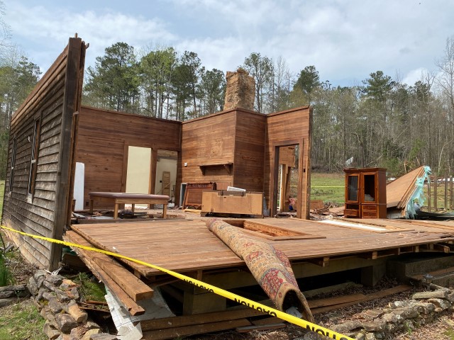
The tornado continued to move northeast, snapping trees and powerlines along CR 33 and CR 26. Homes in this area also received damage, mostly to roof structures. Homes were damaged along CR 65 just west of US Highway 431. Once the tornado crossed Highway 431, it produced extensive damage to homes and structures along CR 61 and CR 700. Several homes here had their roofs removed and trees were snapped near the base. Further east near CR 59, a 100 year old log cabin was mostly destroyed with only a couple of walls left standing. Tree damage in this area was also extensive.
Additional trees and power lines continued to be snapped along CR 16 and CR 87. A large farm building was destroyed near CR 701 and several chicken houses were also destroyed in this area. The tornado weakened notably east of CR 87 before lifting near CR 296 just west of the state line.
|