|
Large Hail, Tornado and Wind Events of March 26-28th, 2011
|
|
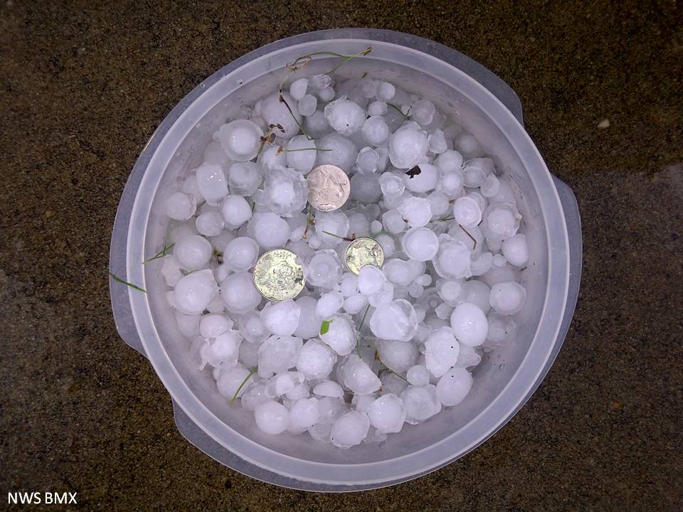
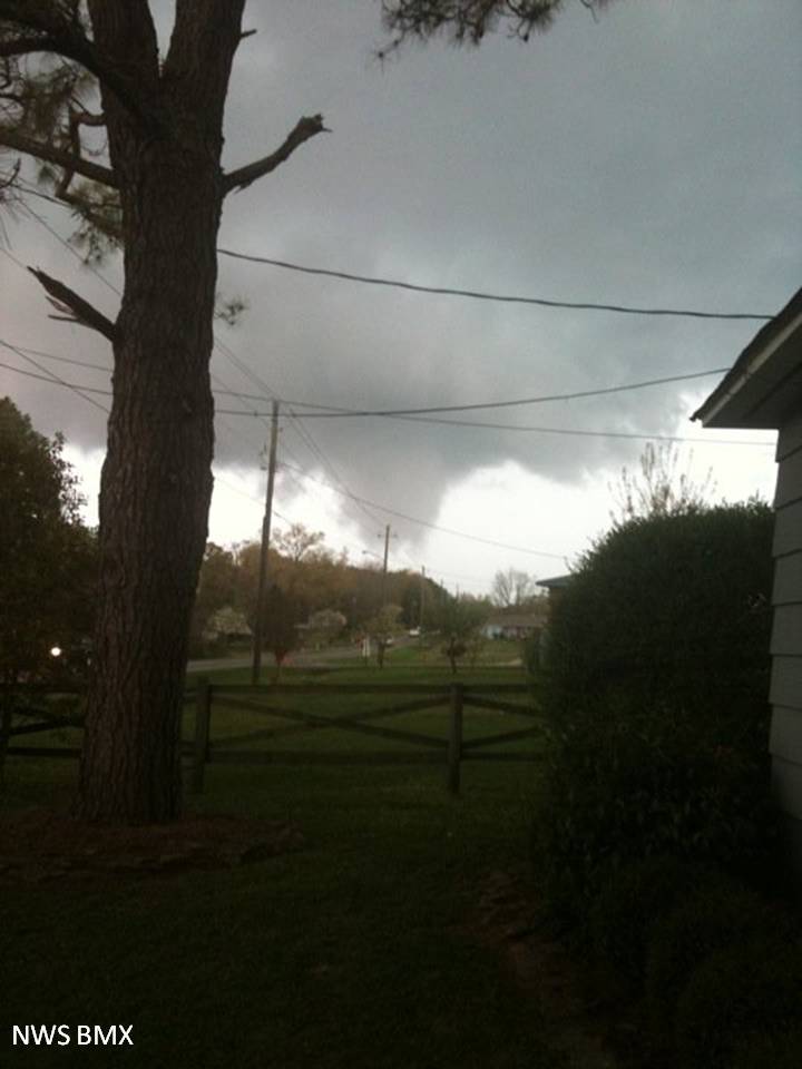
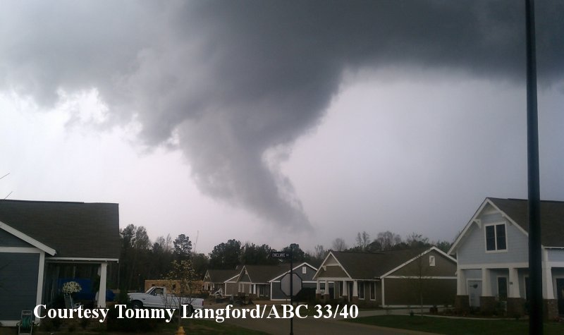
During the early afternoon hours of Saturday, March 26th, a quasi-stationary surface boundary that had drooped into northern Alabama in the morning hours, finally set up across northern portions of the Birmingham CWA. This boundary would be the triggering mechanism for many storms during the afternoon and overnight hours on the 26th. As the atmosphere warmed that afternoon, multiple supercell thunderstorms developed across the area. One in particular traveled across portions of Bibb and Shelby Counties, and as the storm approached Montevallo in southern Shelby County, an impressive wall cloud developed. Though there was sporadic wind damage from this storm, and it was concluded that a brief EF-1 tornado touched down just north of town. There was also straight line wind damage in Autauga County. In addition to the wind damage, numerous thunderstorms dropped hailstones that ranged from pea to golf ball sized. A few hail stones were measured at 3.5 inches in diameter in Tallapoosa County. Pictures of the funnel cloud in Montevallo and the hail stones can be found below. Hail producing thunderstorms continued into the afternoon of March 27th and the early morning hours of March 28th across all of central Alabama.
|
|
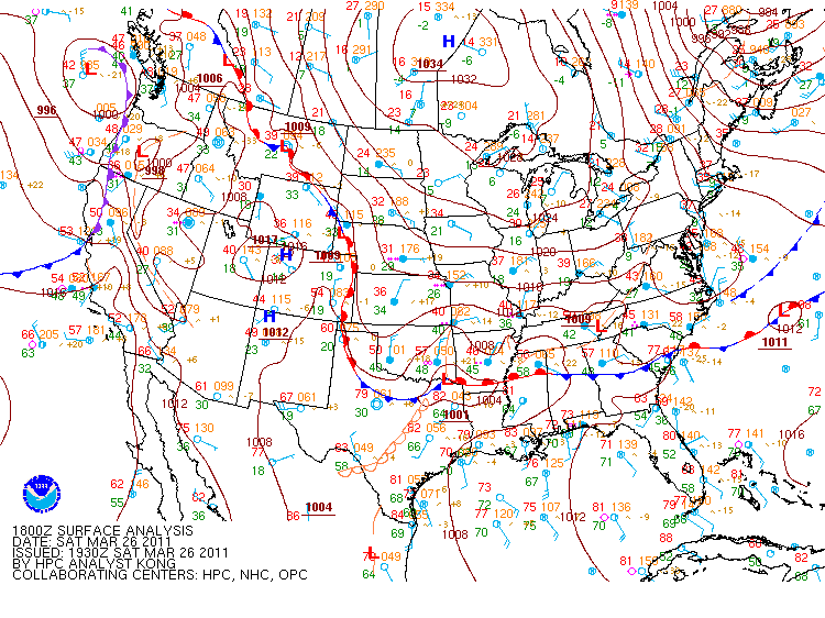
Surface Analysis at 1 pm on March 26th, 2011
|
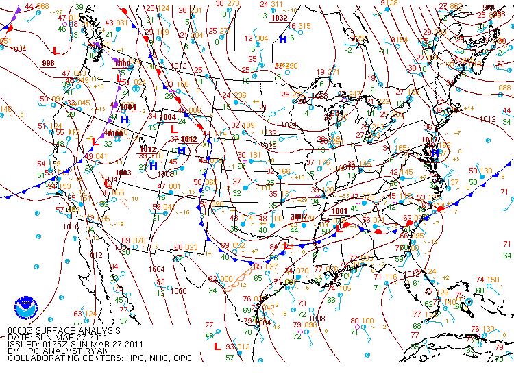
Surface Analysis at 7 pm on March 26th, 2011
|
| |
|
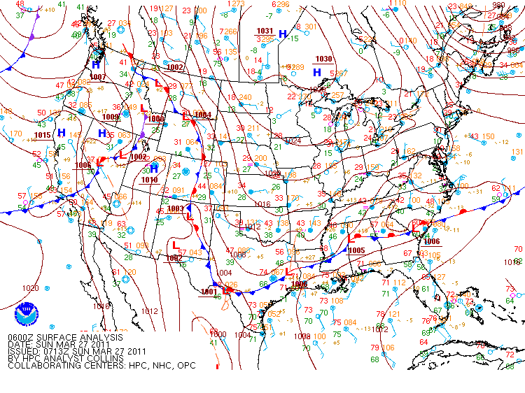
Surface Analysis at 1 am on March 27th, 2011
|
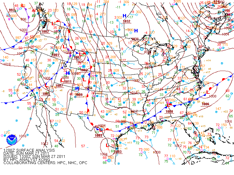
Surface Analysis at 7 am on March 27th, 2011
|
| |
|
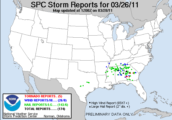
Storm Reports from March 26th, 2011
|
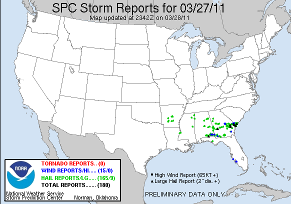
Storm Reports from March 27th, 2011
|
|
Montevallo EF-1 Tornado (Shelby)
March 26, 2011
|
|
|
EF-1
|
|
Estimated Maximum Wind:
|
90 mph
|
|
Injuries/Fatalities:
|
None
|
|
Damage Path Length:
|
0.2 miles
|
|
Maximum Path Width:
|
50 yards
|
|
Approximate Start Point/Time:
|
1.9 NW Aldrich
33.1223/-86.9194 410 pm
|
|
Approximate End Point/Time:
|
1.8 NNW Aldrich
33.1223/-86.9161 411 pm
|
|
| National Weather Service Meteorologist surveyed damage locations in southern Shelby County near Montevallo. It has been determined that the damage was produced by a brief tornado. The damage was consistent with winds around 90 mph. The tornado touched down near the intersection of County Road 10 and Homeland Way in the Aldrich Community. This location is approximately 3 miles northwest of Montevallo. Ten to twenty trees were either snapped off or were uprooted along the short damage path. One quarter of an outbuildings roof was peeled back and tossed 50 yards. The tornado damage path was 0.2 miles long and was 50 yards wide at its widest point. |
|
|
|
|
|
Hail stones collected in Elmore County on March 26th.
|
Funnel cloud from the supercell storm in Shelby County.
|
| |
|
|
|
|
|
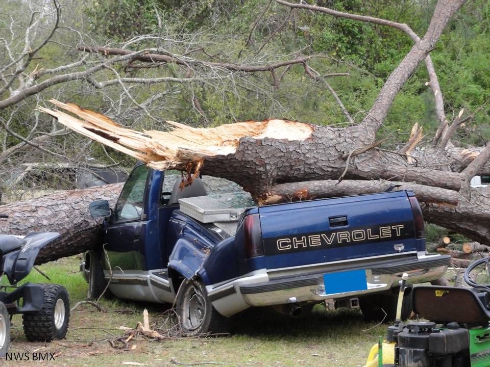
Tree destroys a truck in Autauga County
|
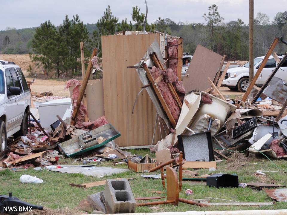
Mobile home destroyed in Autauga County
|
|

|
|
|
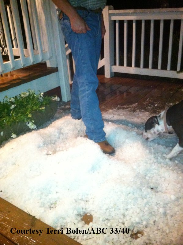
2+ Inch Hail in Tallapoosa County 3/26
|
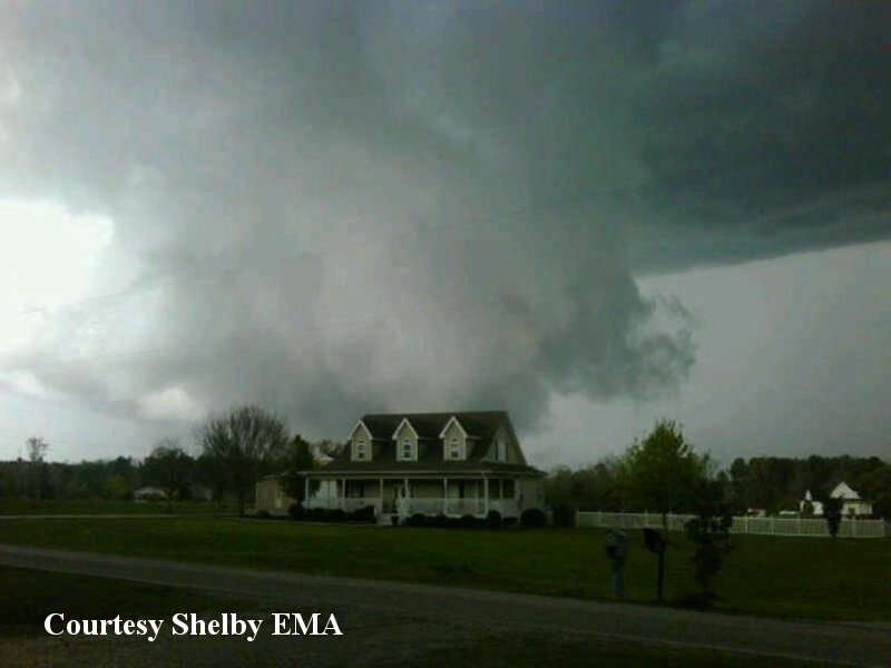
Funnel Cloud near Co Rd 99 Shelby Alabama 3/26
|
|
|
|
|
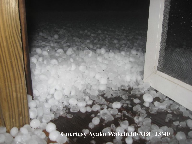
Large Hail Drift near Jasper 3/26
|
Large Hail near Jasper 3/26
|
|
|
|
|
Funnel Cloud near Lay Lake 3/26
|
Funnel Cloud near Calera 3/26
|
| |
|
| If you have any pictures from this event you would like to share with us, please email them to sr-bmx.pix@noaa.gov. Images can be submitted in any format, but please try to keep the file sizes below 500 Kb. Please include a date and location the image was taken, and a brief description. Although not every detail is needed, be as specific as you can. For proper credit for the image, also include your name and location. |
|


