|
Event Summary
|
|
EF-2
|
|
Estimated Maximum Wind:
|
130 mph
|
|
Injuries/Fatalities:
|
None |
|
Damage Path Length:
|
7.85 miles
|
|
Maximum Path Width:
|
350 yards
|
|
Approximate Start Point/Time:
|
3 ENE Baker Hill
31.8016/-85.2636
at 1134 am
|
|
Approximate End Point/Time:
|
5 S Eufaula
31.8173/-85.1313
at 1146 am
|
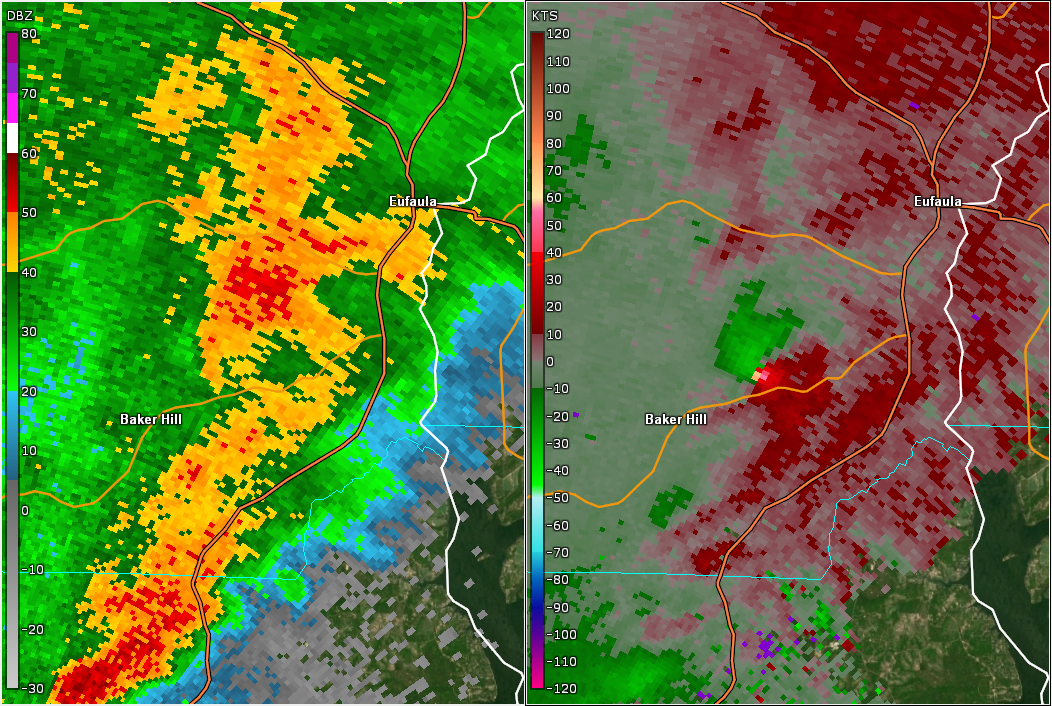
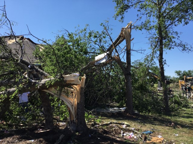
NWS meteorologists assessed damage near Eufaula and determined it was the result of an EF-2 tornado.
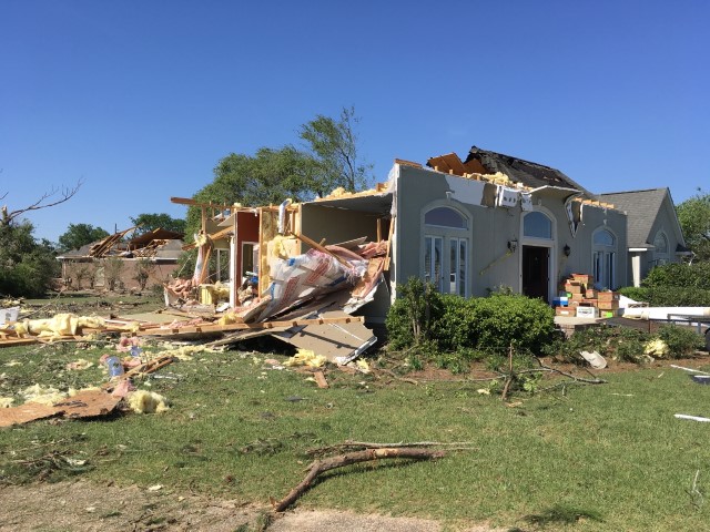
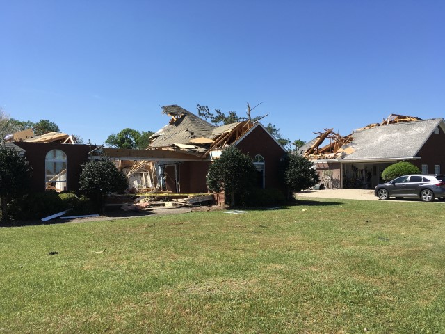
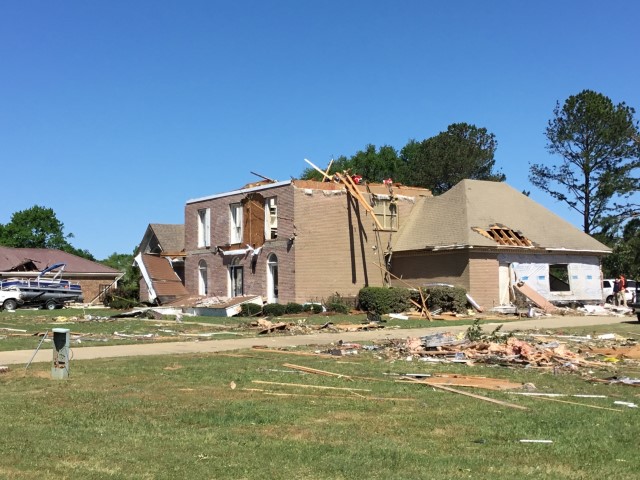
The tornado formed in a wooded area west of Lee Parker Lane, just north of Highway 131 and to the northeast of Baker Hill. It moved northeastward downing trees and causing minor roof damage to two residences along Five Mile Road and removing the roof from an outbuilding. It continued to snap numerous trees as it moved through a wooded area. It crossed Highway 131 near Leroy Road where two residences and a mobile home suffered minor damage as the tornado turned eastward. The tornado intensified as it crossed Highway 431 and was captured on video, with the most significant damage occurring in the Country Club of Alabama neighborhood along the south side of Pebble Beach Drive. Large sections of roofs were removed from a few well built residences with collapse of some exterior walls. The tornado crossed the Walter F. George Reservoir along the Chattahoochee River and continued into Quitman County in Georgia.
|