Tuscaloosa County - April 3, 2000
| Storm Survey | ||||||
|---|---|---|---|---|---|---|
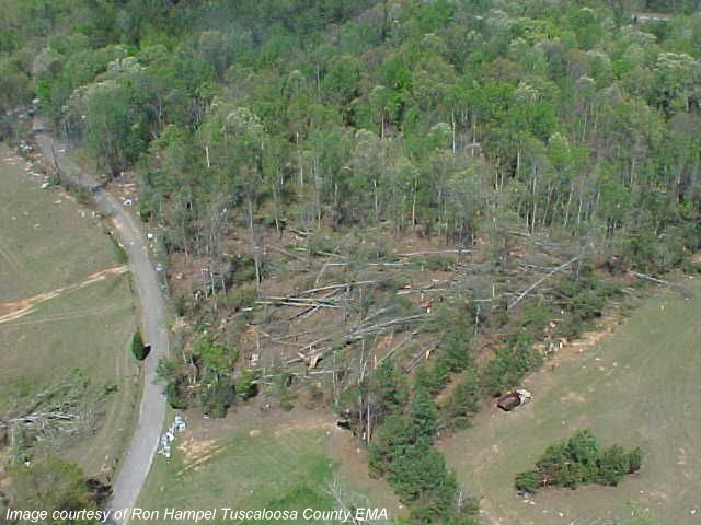
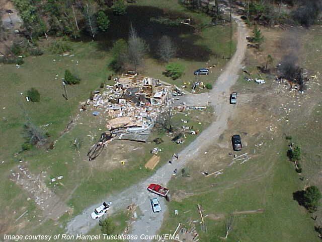
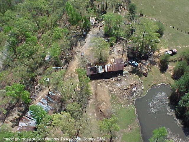
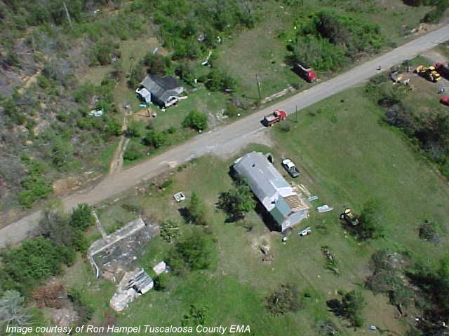
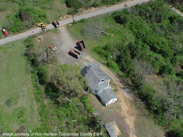
| The National Weather Service and Tuscaloosa EMA did an aerial survey of storm damage in northeast Tuscaloosa County and determined it was caused by a tornado. The survey was conducted on Thursday, April 6th, 2000.
The tornado began at the intersection of County Road 59 and 54 near the town of Kellerman. The tornado traveled in a northeast direction for approximately 11.1 miles. The tornado crossed the Tuscaloosa and Jefferson county line about 2 miles southeast of County Road 59, near Bull City, and dissipated about 2 miles southwest of Oak Grove. The damage path was about 300 yards wide at its widest point. One frame house and a church received mainly roof damage in the town of Kellerman. The path was very rural, and most of the damage was from downed and snapped trees. The terrain was hilly, with most of the downed trees located in the valleys. About one mile inside Jefferson County, a brick house sustained major damage, and one or possibly two mobile homes were overturned. A review of radar data with the known damage coordinates showed that the tornado began at 12:20 pm CDT and ended at 12:37 pm CDT. The tornado was classified as an F2 on the Fujita scale for tornado classification. Tuscaloosa County was placed in Tornado Watch number 155 valid from 10:30 am CDT to 4:00 pm CDT. A Tornado Warning was issued for Tuscaloosa County at 12:11 pm CDT valid until 12:45 pm CDT. Special thanks are extended to the Tuscaloosa Police Department and Tuscaloosa Emergency Management Agency for providing a helicopter for the aerial survey. All digital images were taken by Ron Hampel, Director of Emergency Management for Tuscaloosa County.
|
|
|||||