|
Event Summary
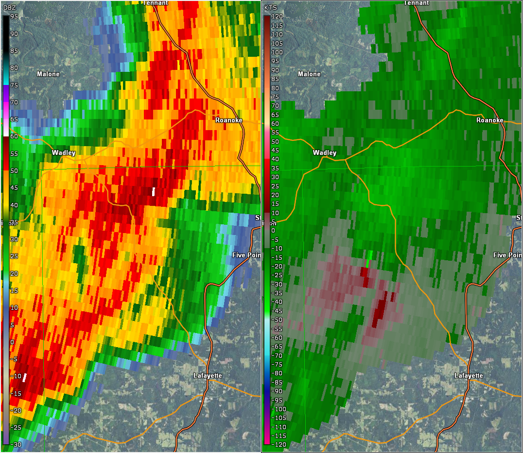
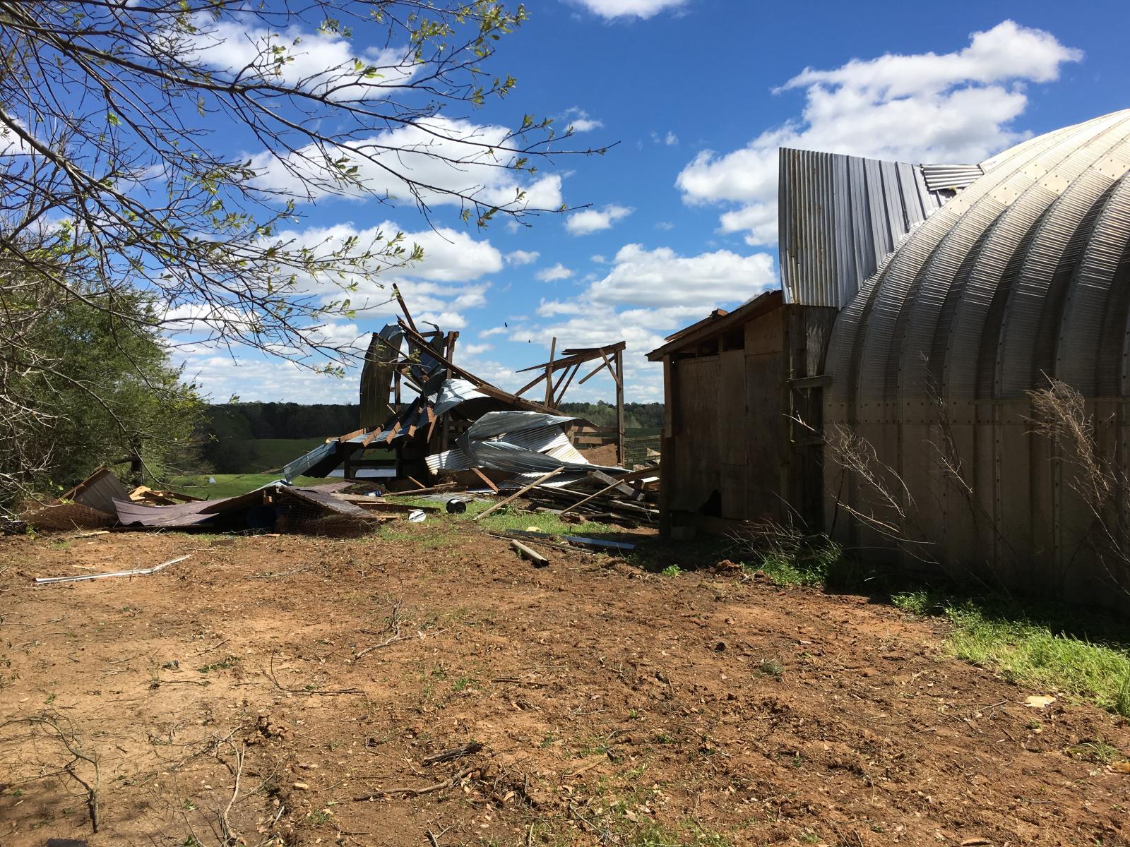
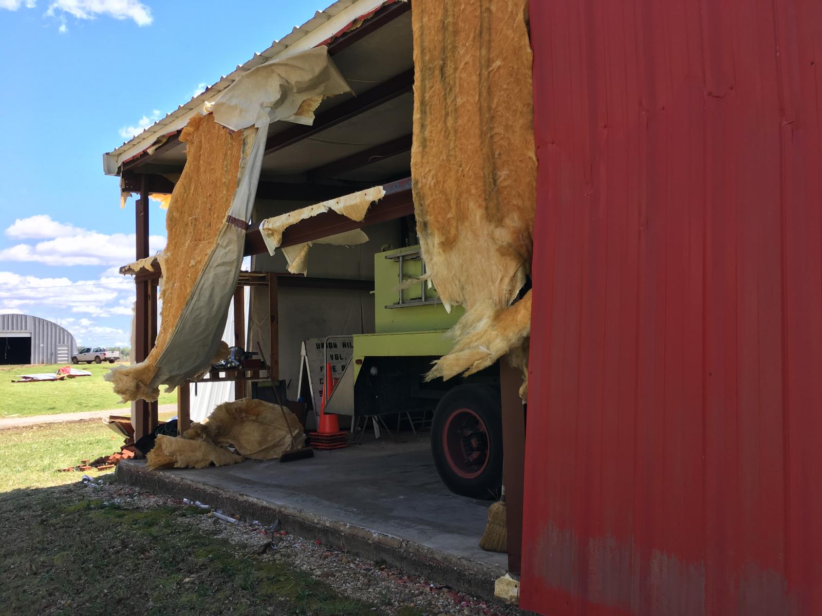
National Weather Service meteorologists surveyed damage in northwestern Chambers County and determined that the damage was consistent with a tornado. The tornado touched down along CR 116 just west of the Union Hill Community where several trees were uprooted and large branches were snapped. The tornado continued east, crossing CR 123, where a barn sustained minor damage and several additional trees were snapped. Adjacent to CR 123 and CR 53, a small fire station, barn and additional trees sustained significant damage. The tornado lifted just beyond CR 53, east of Union Hill where more trees were observed to have minor damage.
|