|
Event Summary
|
|
EF-1
|
|
Estimated Maximum Wind:
|
90 mph
|
|
Injuries/Fatalities:
|
None |
|
Damage Path Length:
|
4.25 miles
|
|
Maximum Path Width:
|
250 yards
|
|
Approximate Start Point/Time:
|
1 NNW Franklin
32.4656/-85.8051
at 1119 AM CDT
|
|
Approximate End Point/Time:
|
4 WNW Uphapee Creek
32.5099/-85.7551
at 1124 AM CDT
|
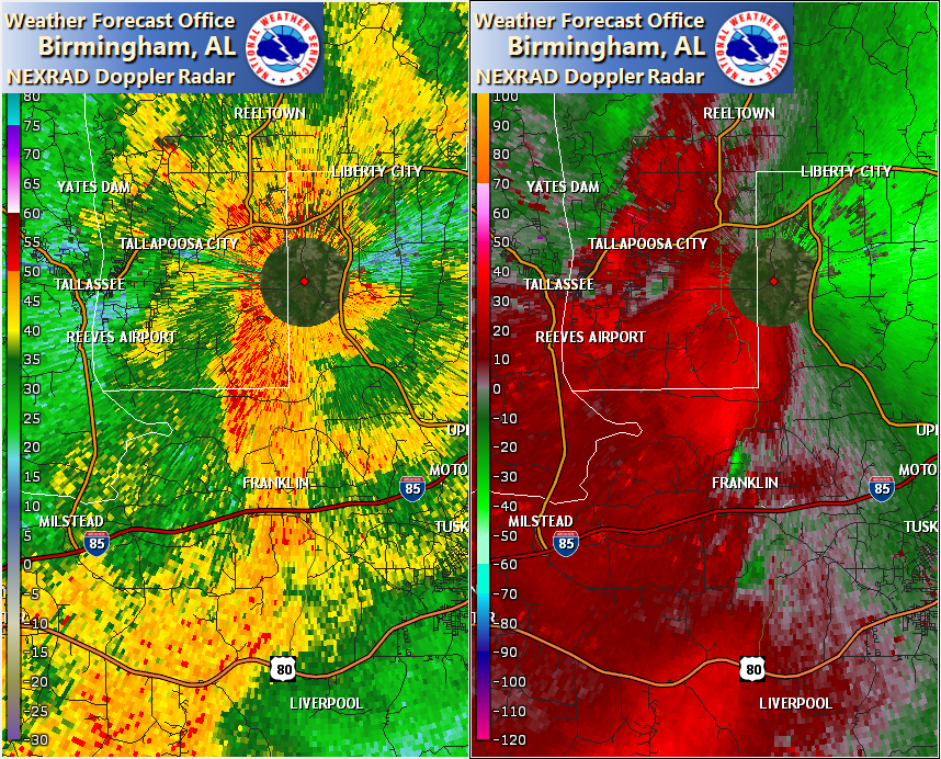
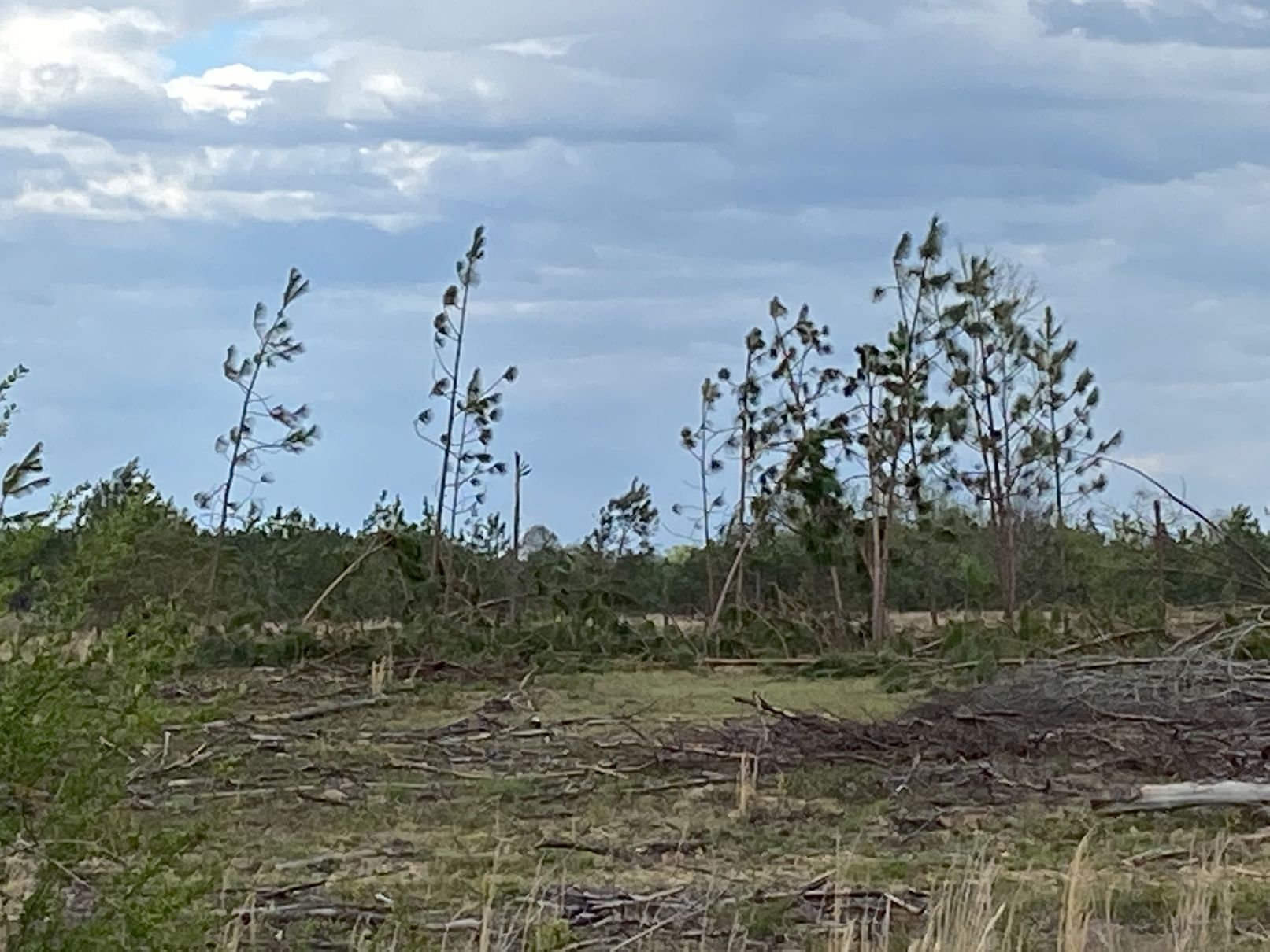
NWS Meteorologists surveyed damage in northern Macon County near Franklin and determined it was the result of an EF-1 tornado.
A small but clearly discernible tornado touched down just 4.9 miles south of the KMXX radar along Alabama Highway 49 in the Franklin community. A few small limbs were broken in trees just east of Hwy49 just east of the road. The tornado moved somewhat erratically northeastward, crossed largely harvested forest fields as it approached Macon County Road 36, breaking a few large tree limbs or causing a few trees to be left leaning into others. The narrow tornado continued across open fields before breaking large limbs on trees along Chewacla Creek. After crossing the creek, the tornado crossed the site of the historic Tuskegee Army Airfield, intermittently snapping or uprooting numerous young softwood trees, and continued across Macon County Road 56. The tornado then seemed to intensify somewhat as it approached Alabama Highway 199, where 10 to 20 mature pine trees were snapped. The tornado quickly weakened and dissipated just east of Hwy 199 in the vicinity of Bulger Creek.
|