|
Event Summary
|
|
EF-1
|
|
Estimated Maximum Wind:
|
95 mph
|
|
Injuries/Fatalities:
|
None |
|
Damage Path Length:
|
1.54 miles
|
|
Maximum Path Width:
|
200 yards
|
|
Approximate Start Point/Time:
|
2 N Beans Crossroads
32.0402/-85.8342
at 1238 PM CDT
|
|
Approximate End Point/Time:
|
3 NNE Beans Crossroads
32.0445/-85.8079
at 1240 PM CDT
|
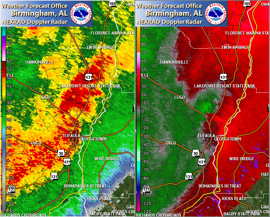
NWS Meteorologists surveyed damage in northeastern Barbour County just north of Eufaula and determined it was the result of an EF-1 tornado.
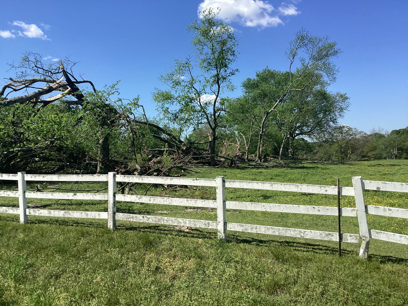
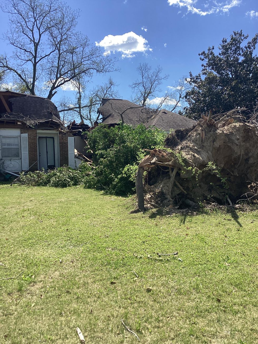
The tornado touched down in forested land just north of the end of the Yoholo Micco Trail extension, east of Chewalla Creek. It moved east-northeastward and intensified as it approached and crossed US Highway 82, where a few trees were uprooted and one tree was snapped. The tornado crossed mainly open fields as it continued in the same direction. As it crossed US Highway 431, a large pecan tree was uprooted and fell on a house, rendering it unlivable. The tornado began to weaken as it crossed more open fields, and caused damage to a few large limbs along the treeline before dissipating quickly thereafter.
|