|
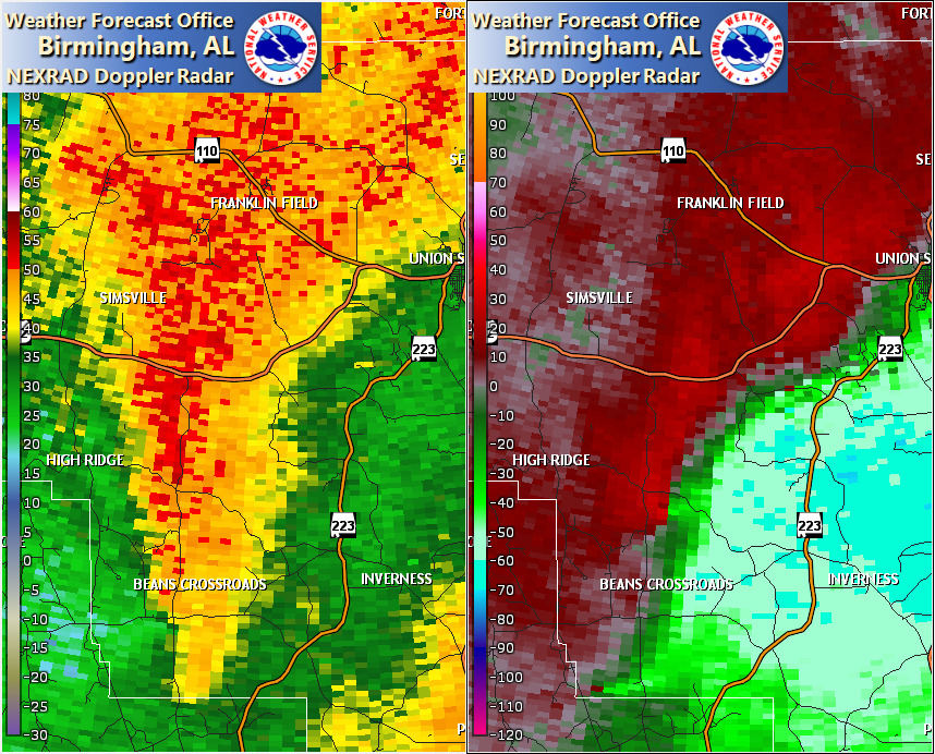
Event Summary
|
|
EF-1
|
|
Estimated Maximum Wind:
|
95 mph
|
|
Injuries/Fatalities:
|
None |
|
Damage Path Length:
|
1.58 miles
|
|
Maximum Path Width:
|
600 yards
|
|
Approximate Start Point/Time:
|
2 N Beans Crossroads
32.0402/-85.8342
at 1150 AM CDT
|
|
Approximate End Point/Time:
|
3 NNE Beans Crossroads
32.0445/-85.8079
at 1152 AM CDT
|
NWS Meteorologists surveyed damage in southwestern Bullock County southeast of Hooks Crossroads and determined it was the result of an EF-1 tornado.
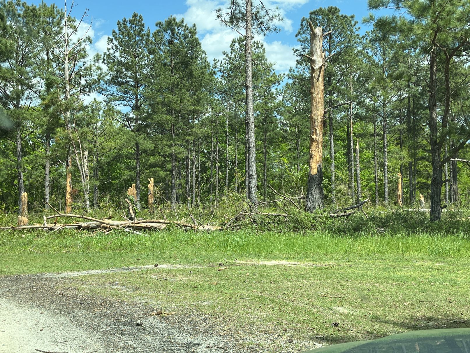
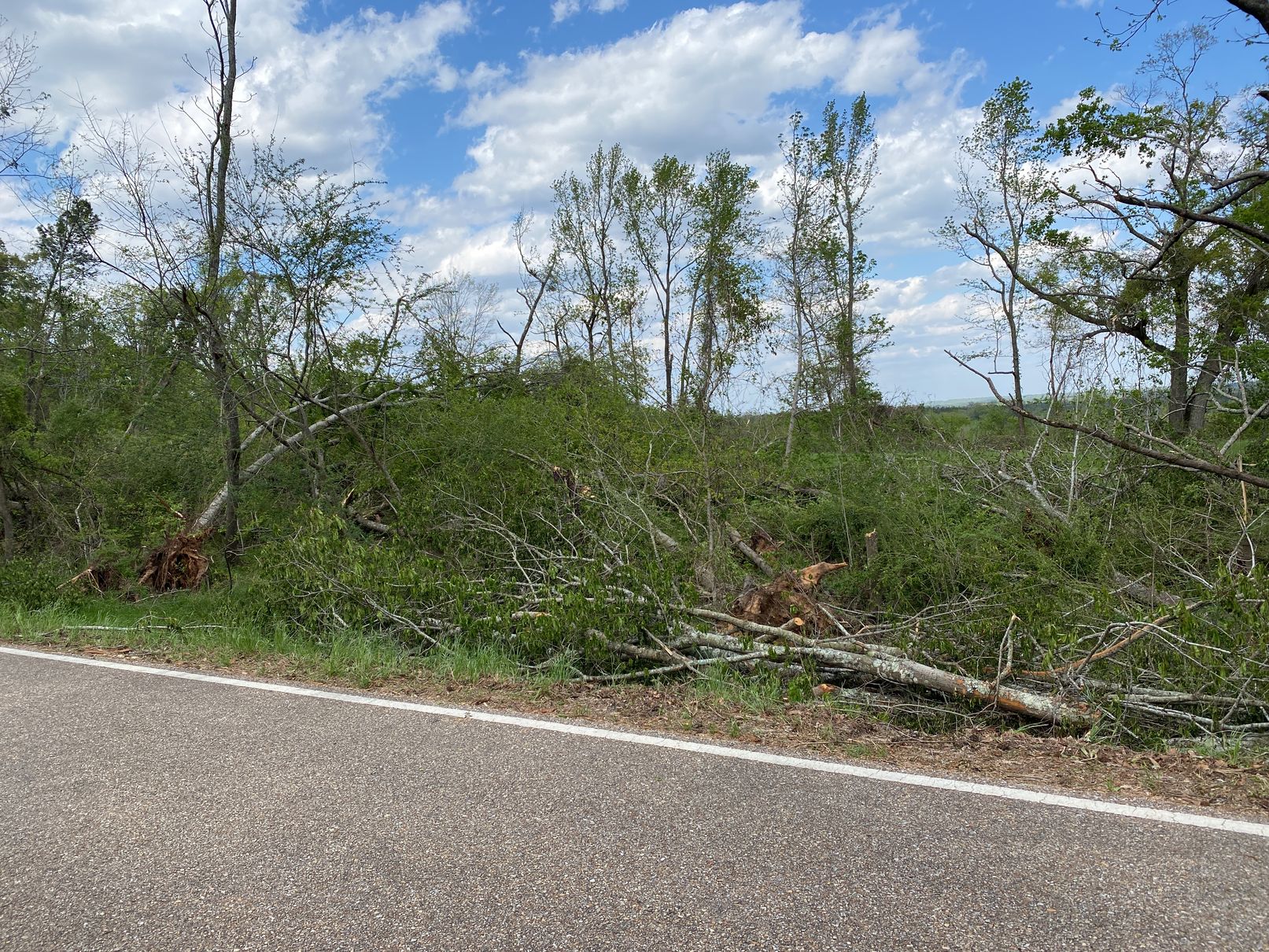
A tornado touched down and caused minor tree damage just east of Mascott Road. It moved east-northeastward across inaccessible forested land, and crossed Beaverdam Creek. As it approached Bullock County Road 14 in the High Ridge area, the tornado intensified and broadened, uprooting or snapping large limbs on numerous hardwood trees, especially alongside the road. The tornado then descended the High Ridge area into the valley to the east-northeast, and dissipated somewhere over inaccessible land west of Alabama Highway 223.
|