NWS Birmingham, Alabama
Weather Forecast Office
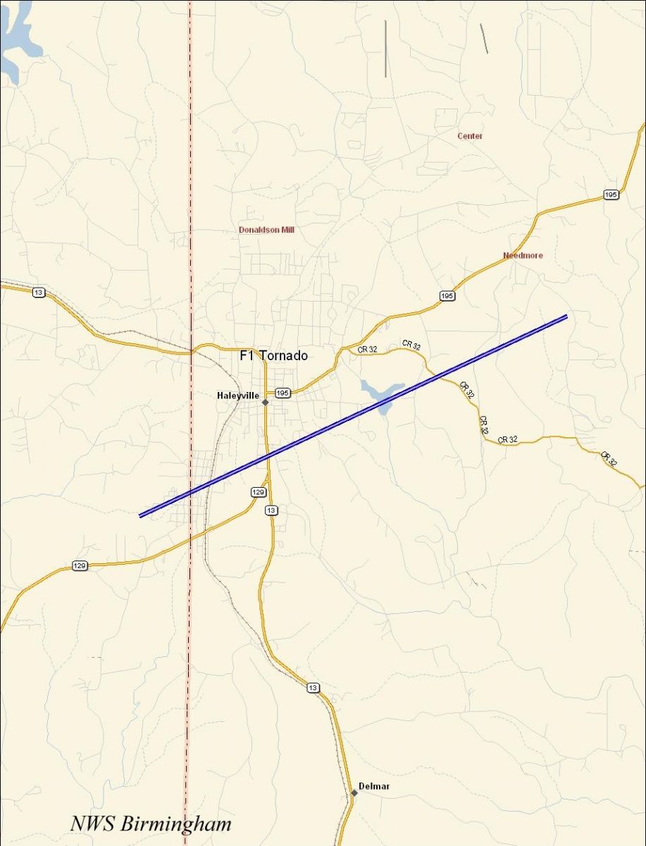
Haleyville F1 Tornado - April 7th, 2006
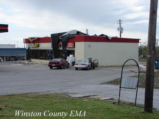
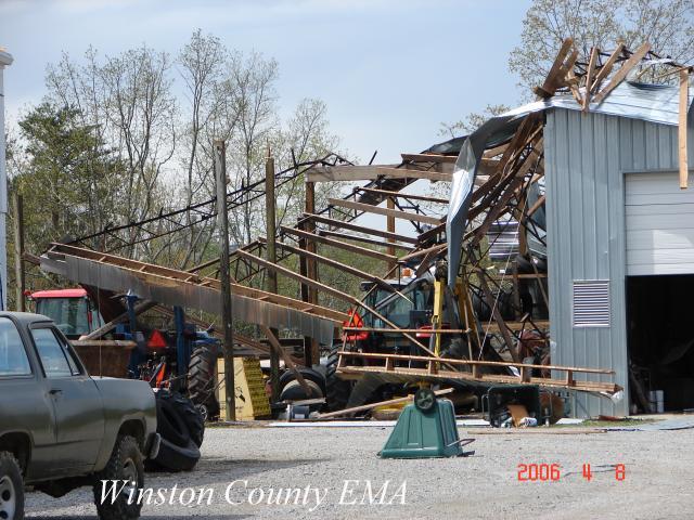
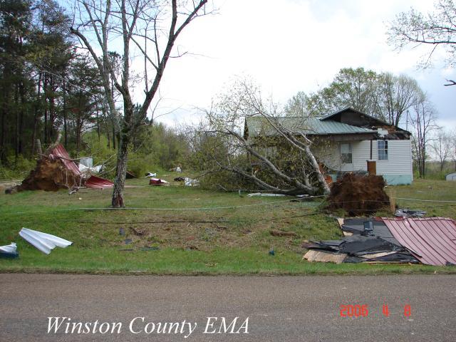
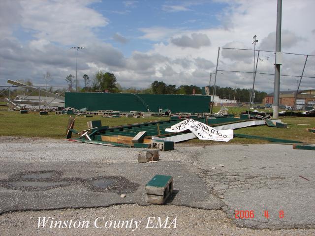
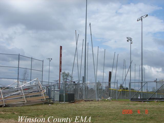
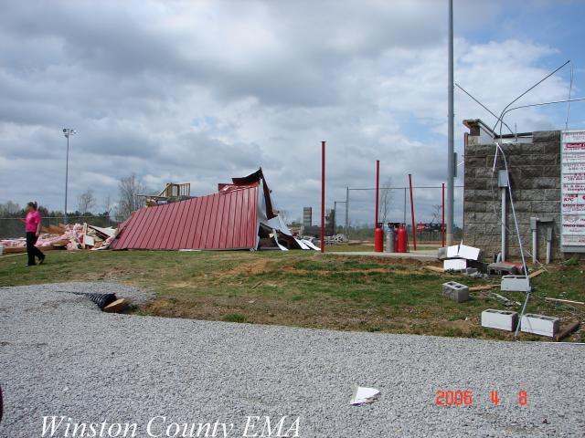
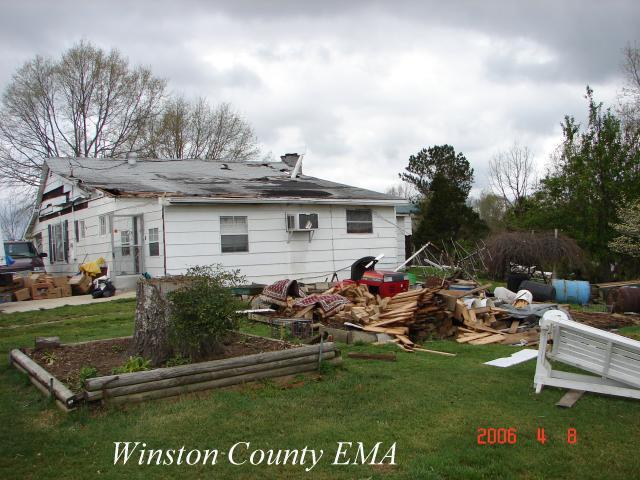
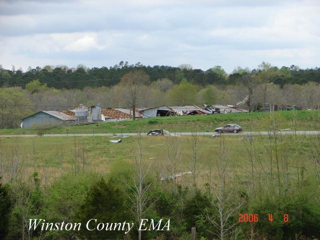
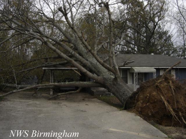
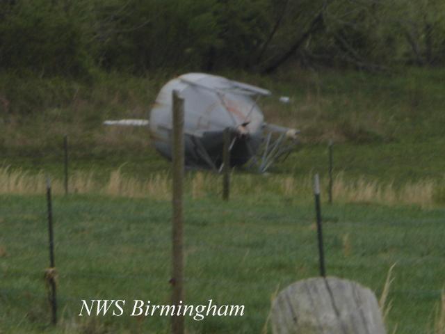
An F1 tornado touched down in far eastern Marion County, just north of State Highway 129. The tornado tracked northeastward through the southern part of Haleyville, crossed State Highway 13, crossed County Road 32 and ended just south of the Needmore community. The tornado damage path was approximately 4.7 miles long and was 150 yards wide at its widest point. The tornado was on the ground from 1000 PM CDT until 1006 PM CDT. The tornado caused significant roof damage to the Windwood Hotel. A local gas station and a vacant old textile mill building suffered roof damage near downtown Haleyville. One home had a tree fall on its carport which caused major damage to the carport and a vehicle parked beside of it. On the east side of Haleyville, Haleyville High School received damage to sections of its roof and both baseball dugouts received significant damage. A batters cage and the top floor of a press box were completely destroyed. Several trees and power lines were blown down along the path. A Tornado Warning was issued for Marion County 936 PM CDT valid until 1015 PM CDT. A Severe Thunderstorm Warning was in effect for Winston County from 955 PM CDT valid until 1100 PM CDT. The warning was upgraded to a Tornado Warning from 1007 PM CDT valid until 1045 PM CDT.
Click on the images below for larger picture.
|
|
|||||||||||||||||||||
Current Hazards
National Outlooks
Tropical
Local Storm Reports
Public Information Statement
Graphical Hazardous Weather Outlook
Current Conditions
Regional Weather Roundup
Rivers and Lakes
Drought Monitor
Forecasts
Aviation Weather
Graphical Forecasts
Forecast Discussion
Air Quality
Fire Weather
Climate and Past Weather
Past Events
Storm Data
Tornado Database
Daily Rainfall Plots
Tropical Cyclone Reports
Monthly Climate
Annual Climate
Warnings and Other Products
Tornado Warnings
Severe Thunderstorm Warnings
Flash Flood Warnings
Winter Weather Warnings
Special Weather Statements
Non-Precipitation Warnings
Flood/River Flood Warnings
Productos en Español
Conciencia y Preparación
Previsión de 7 Días
Weather Safety
NOAA Weather Radio
Severe Weather Preparedness
Severe Safety Rules
Tornado Safety Rules
Severe Safety w/ ASL
Awareness Weeks
Severe Weather
Hurricane Preparedness
Summer Safety Campaign
Winter Weather
US Dept of Commerce
National Oceanic and Atmospheric Administration
National Weather Service
NWS Birmingham, Alabama
465 Weathervane Road
Calera, AL 35040
205-664-3010
Comments? Questions? Please Contact Us.